
| Trustom Pond | |
|---|---|
 | |
 Trustom Pond | |
| Location | South Kingstown Washington County, Rhode Island |
| Coordinates | 41°22′17″N 71°34′57″W / 41.3714905°N 71.5825599°W |
| Type | saline |
| Primary inflows | precipitation, groundwater |
| Catchment area | 794 acres (321 ha)[1] |
| Basin countries | United States |
| Surface area | 180 acres (73 ha)[1] |
| Average depth | 1.3 ft (0.40 m)[1] |
| Surface elevation | 0 ft (0 m)[2] |
| Website | www |
| References | [1][2] |

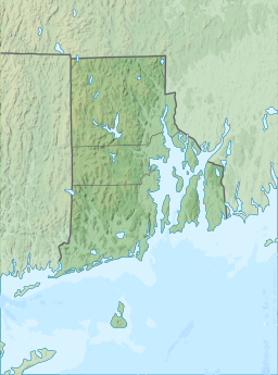
Trustom Pond is a closed lagoon in South Kingstown, Washington County, Rhode Island, United States.[3] It is one of nine coastal lagoons (referred to as "salt ponds" by locals) in southern Rhode Island.[4][5] It has a surface area of 800 acres (320 ha), and is the only undeveloped salt pond in the state.[6] The pond averages 1.3 feet (0.40 m) deep, and has a salinity level of 5 parts per thousand. It is non-tidal, except when breached by storms.[1] The water directly receives about 219,844,022 US gallons (832,200 m3) of precipitation per year, with an estimated 796,215 US gallons (3,014 m3) in daily groundwater flow.[7] No streams flow into the pond, though a nearby stream "captures water that otherwise would have flowed to Trustom Pond".[8]
Trustom Pond National Wildlife Refuge is a National Wildlife Refuge, inhabited by an estimated 300 species of birds, as well as some 40 species of mammals and 20 species of reptiles and amphibians.[9] As such, it is a popular bird-watching destination.[10] The piping plover inhabits the site.[11] In 1974, 365 acres (148 ha) of land were donated to the U.S. Fish and Wildlife Service; subsequent donations and purchases raised the protected area to 787 acres (318 ha).[9] In 2010, the wildlife refuge received approximately 70,000 visitors.[11] Trustom Pond NWR includes 3 miles (4.8 km) of nature trails.[11] Habitat areas within Trustom Pond NWR include fields, shrubland, woodland, freshwater pond, saltwater ponds, beaches, and sand dunes.[9] Wildlife managers create breachways to the Block Island Sound, lowering water levels and creating mudflats which become feeding areas for waders.[12]
YouTube Encyclopedic
-
1/2Views:839539
-
Native Plants in All Their Glory A Tour of the Kettle Pond Native Plant Garden
-
Snapping Turtle in my pond
Transcription
See also
References
- ^ a b c d e "Trustom Pond General Features Data". Rhode Island South Shore Sea Grant. Archived from the original on September 8, 2008. Retrieved 2009-05-25., quoting RIGIS 2001 (area) and Lee 1980 (salinity)
- ^ a b U.S. Geological Survey Geographic Names Information System: Trustom Pond
- ^ "Salt Ponds of Rhode Island" (PDF). Rhode Island Sea Grant. Archived from the original (PDF) on May 17, 2008. Retrieved 2009-05-25.
- ^ Donald Wyatt (1995). "Rhode Island's last execution". FAQs.org. Retrieved 2009-05-25.
- ^ S.W. Nixon and B. A. Buckley (2007). "Nitrogen Inputs to Rhode Island Coastal Salt – Too Much of a Good Thing" (PDF). Rhode Island Department of Environmental Management. Retrieved 2009-05-25.
- ^ "Trustom Pond National Wildlife Refuge". VisitRhodeIsland.com. Retrieved 2009-05-25.
- ^ "Trustom Pond Freshwater Input Data". Rhode Island South Shore Sea Grant. Archived from the original on July 16, 2011. Retrieved 2009-05-25.
- ^ John P. Masterson, Jason R. Sorenson, Janet R. Stone, S. Bradley Moran, and Andrea Hougham (2007). Hydrogeology and Simulated Groundwater Flow in the Salt Pond Region of Southern Rhode Island (PDF). United States Geological Survey. p. 30. ISBN 978-1-4223-2575-9.
{{cite book}}: CS1 maint: multiple names: authors list (link) - ^ a b c "Trustom Pond National Wildlife Refuge". U.S. Fish and Wildlife Service. Retrieved December 25, 2019.
- ^ "Bird Watching & Wildlife Refuges". South County Tourism Council. Retrieved 2009-05-25.
- ^ a b c Trustom Pond National Wildlife Refuge: Rhode Island National Wildlife Refuge Complex: Fact Sheet for Members of Congress, U.S. Fish & Wildlife Service (November 2010).
- ^ Mark Damian Duda and Robert Field (1995). Watching Wildlife. Globe Pequot. p. 80. ISBN 1-56044-315-4.
External links
- U.S. Geological Survey Geographic Names Information System: Trustom Pond
- Trustom Pond National Wildlife Refuge
- Trustom Pond map
Rhode Island's salt ponds | ||
|---|---|---|
| Authority control databases: National |
|---|