
| Charlestown Breachway State Beach | |
|---|---|
 Charlestown Breachway | |
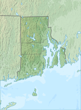 Location in Rhode Island | |
| Location | Charlestown, Rhode Island, United States |
| Coordinates | 41°21′24″N 71°38′21″W / 41.35667°N 71.63917°W[1] |
| Area | 79 acres (32 ha)[2] |
| Elevation | 0 ft (0 m)[1] |
| Established | 1952 |
| Administrator | Rhode Island Department of Environmental Management Division of Parks & Recreation |
| Website | Charlestown Breachway |
Charlestown Breachway State Beach is a seaside public recreation area on Block Island Sound in the town of Charlestown, Rhode Island. It is located on the east side of the manmade channel (the "Breachway") that connects Ninigret Pond with the Atlantic Ocean.[3]
YouTube Encyclopedic
-
1/3Views:10 7628 143449
-
Nonstop Striped Bass Blitz at Charlestown Breachway RI
-
Oceanfront Camping at the Charlestown Breachway - Aug 2017
-
Favorite Oceanside Place - Charlestown Breachway State Park
Transcription
History
The first attempt to create a breachway from Pawaget/Ninigret/Charlestown Pond to the ocean in 1897 ended in failure although $1000 had been awarded to the cause.[4]
In 1904, the General Assembly appropriated $5000 for construction of a permanent breachway that would help the pond from becoming brackish and unsuitable for cultivating oysters. Colonel Rodman of the Rhode Island Engineers Office surveyed the site and proposed building jetties on either side of the breachway. The contract was awarded to John Bristow of South Kingstown, who had built the breakwater at Point Judith. Stone for the east jetty was carried to the site by a horse-drawn narrow-gauge railroad.[4]
In 1951, the Rhode Island Division of Harbors and Rivers awarded a contract to rebuild the east wall and construct the west wall to a Westerly company, Gencarelli Inc. After four months of work in severe weather, the Charleston Beachway Beach was officially opened on April 7, 1952.[4]

Activities and amenities
The area offers 75 camping sites for self-contained RVs, ocean swimming, beach activities, salt-water fishing, and a boat launch. It is open seasonally.[4][5][6]
References
- ^ a b "Charlestown Breachway". Geographic Names Information System. United States Geological Survey, United States Department of the Interior.
- ^ "Charlestown Breachway". Charlestown Citizens Alliance. March 2015. Retrieved January 8, 2018.
- ^ "Charlestown Breachway". Rhode Island Department of Environmental Management. Retrieved January 30, 2023.
- ^ a b c d "Charlestown Breachway History". Rhode Island Department of Environmental Management. Retrieved January 30, 2023.
- ^ "Charlestown Breachway: Campground Details". Welcome to RI State Parks. Rhode Island State. Retrieved August 28, 2014.
- ^ "Rhode Island State Beaches: Parking Passes". Rhode Island Department of Environmental Management. Retrieved January 30, 2023.
External links
- Charlestown Breachway Rhode Island Department of Environmental Management Division of Parks & Recreation