
| Ninigret Pond | |
|---|---|
 Seen in August 2009 | |
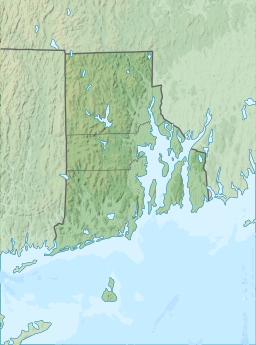 Ninigret Pond | |
| Location | Charlestown, Washington County, Rhode Island |
| Coordinates | 41°22′45″N 71°38′43″W / 41.3792677°N 71.6453401°W |
| Type | coastal lagoon, saline |
| Primary inflows | Precipitation, groundwater |
| Primary outflows | Block Island Sound |
| Catchment area | 7,645.65 acres (30.9408 km2) |
| Basin countries | United States |
| Max. length | 3.91 mi (6.29 km) |
| Max. width | 1.83 mi (2.95 km) |
| Surface area | 1,580.38 acres (6.3956 km2) |
| Average depth | 4.3 ft (1.3 m) |
| Surface elevation | 0 ft (0 m) |
| Islands | 8 |
Ninigret is a coastal lagoon in Charlestown, Rhode Island, in the United States, located at 41°22′45″N 71°38′43″W / 41.3792677°N 71.6453401°W.[1][2] It is the largest of the nine lagoons, or "salt ponds", in southern Rhode Island.[3][4] It is utilized for recreational activities, as well as oyster and quahog harvesting. Found along its shores are "extensive" archaeological remains.[1] Ninigret Pond, like others in the region, was "formed after the recession of the glaciers 12,000 years ago".[5] The pond is situated on low-lying ground, and as such, it is considered particularly vulnerable to storm surge flooding.[4] It is connected to Green Hill Pond via a small channel.[6]
The pond is located within the Ninigret National Wildlife Refuge. Both are named for Ninigret, a 17th-century sachem of the eastern Niantic aboriginal American tribe.
YouTube Encyclopedic
-
1/1Views:934
-
Fort Ninigret site in Charlestown Rhode Island RI
Transcription
Watershed and restoration
According to information compiled by the Rhode Island Sea Grant program, Ninigret Pond's watershed covers 7,645.65 acres (3,094.08 ha), of which 5,820.79 acres (2,355.59 ha) is occupied by water; Ninigret Pond itself has a surface area of 1,580.38 acres (639.56 ha), while other, smaller bodies of water account for the other 244.48 acres (98.94 ha). Averaging 4.3 ft (1.3 m) deep, Ninigret Pond has a salinity level of 24 parts per thousand.[7] The pond receives: about 1,927,399,642 gallons of precipitation per year; 8,974,614–12,376,282 gallons of groundwater flow per day; and 1,881,774–4,849,186 of river and stream flow per day.[8] It is permanently connected to the Block Island Sound by a constructed breachway.[9]
As a result of heavy development along the eastern shore, there are indications that water quality is degrading; however, restoration efforts are in place.[10] Eelgrass population has also been significantly declining.[4] Dredging and cleanup projects have additionally been established. In the past, breakwaters were established, allowing inflows of sand to "choke" the pond. The Coastal Resources Management Council and the Army Corps of Engineers spent in excess of $4.1 million to remove harmful sand accumulations. Despite this, Ninigret was assessed as being the cleanest of the nine salt ponds. In contrast, Winnapaug Pond contains high levels of pollution.[11] During the 1960s, Ninigret Pond was included as part of one of the first "integrated multidisciplinary studies of a coastal marine ecosystem".[3]
See also
References
- ^ a b "Salt Ponds of Rhode Island" (PDF). Rhode Island Sea Grant. Archived from the original (PDF) on May 17, 2008. Retrieved June 12, 2009.
- ^ Peter Lord (January 9, 2005). "Shifting sands". The Providence Journal. Retrieved June 11, 2009.
- ^ a b S.W. Nixon and B. A. Buckley (2007). "Nitrogen Inputs to Rhode Island Coastal Salt – Too Much of a Good Thing" (PDF). Rhode Island Department of Environmental Management. Retrieved May 25, 2009.
- ^ a b c "Rhode Island's Salt Pond Region: A Special Area Management Plan" (PDF). Rhode Island Coastal Resources Management Council. Retrieved June 12, 2009.
- ^ "What is a Salt Pond?". Salt Ponds Coalition. Archived from the original on October 9, 2010. Retrieved June 11, 2009.
- ^ Arthur Ganz. "Daytripper's Guide: Ninigret Pond". Rhode Island Sea Grant. Retrieved June 12, 2009.
- ^ "Ninigret Pond General Features Data". Rhode Island South Shore Sea Grant. Archived from the original on July 16, 2011. Retrieved June 12, 2009.
- ^ "Ninigret Pond Freshwater Input Data". Rhode Island South Shore Sea Grant. Archived from the original on October 13, 2008. Retrieved June 12, 2009.
- ^ "Activities within Ninigret National Wildlife Refuge". Wildernet. Retrieved June 12, 2009.
- ^ "Ninigret Pond". Salt Ponds Coalition. Retrieved June 12, 2009.
- ^ Peter Lord (January 9, 2005). "Shifting sands". The Providence Journal. Retrieved June 12, 2009.
External links
- U.S. Geological Survey Geographic Names Information System: Ninigret Pond
- U.S. Environmental Protection Agency: National Assessment Database 2004 Waterbody Report for Ninigret Pond 2002 Waterbody Report for Ninigret Pond
- Ninigret Pond map
Rhode Island's salt ponds | ||
|---|---|---|