
Tavros | |
|---|---|
| Ταύρος (Greek) Pamuklu (Turkish) | |
 Ayios Sergios | |
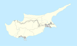 Tavros Location in Cyprus | |
| Coordinates: 35°23′49″N 34°4′34″E / 35.39694°N 34.07611°E | |
| Country (de jure) | |
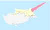
| • District | Famagusta District |
| Country (de facto) | |
| • District | İskele District |
| Government | |
| • Mukhtar | Hasan Çelik |
| Population (2011)[2] | |
| • Total | 280 |
| Time zone | UTC+2 (EET) |
| • Summer (DST) | UTC+3 (EEST) |
Tavros (Greek: Ταύρος, literally 'Bull', Turkish: Pamuklu) is a village in the Famagusta District of Cyprus, located on the Karpass Peninsula. It is in the southern part of the peninsula between Bogaz and Koma Yialou (Kumyali), 1½ miles from the peninsula's south coast.[3] It is under the de facto control of Northern Cyprus.

Until the invasion, Tavros was inhabited by Greek Cypriots. In 1891, the village population was 138 Greek Cypriots.[4] Ten years later there were 167 Greek Cypriots.[5] By 1960 there were 311 Greek Cypriots and 1 Turkish Cypriot.[6]
During the invasion, in August 1974, most of the population fled southwards. 47 people attempted to remain and they were enclaved in Tavros until they were forced to move out of the Turkish sector of Cyprus in August 1976. Meanwhile, the village was given in 1975 the new Turkish name of Pamuklu, which means “place with cotton” or “made of cotton.”.[3] Then in 1976–77, the village was settled with people from Giresun and Ordu in the Pontus region of Turkey and also from Yozgat Province just east of Ankara.
This village population in 2011 was 280, an increase from 256 in 2006.

The church of Ayios Sergios is situated at the east end of the village, on the old Nicosia-Karpas road.[2][7] The new Nicosia-Karpas road bypasses the village on the north side.
References
- ^ In 1983, the Turkish Republic of Northern Cyprus unilaterally declared independence from the Republic of Cyprus. The de facto state is not recognised by any UN state except Turkey.
- ^ a b KKTC 2011 Nüfus ve Konut Sayımı [Northern Cyprus 2011 Population and Housing Census] (PDF), Northern Cyprus State Planning Organization, 6 August 2013
- ^ a b PRIO web site www.prio-cyprus-displacement.net/default.asp?id=625 retrieved Aug 2018
- ^ Census of Cyprus 1891, printed by Eyre & Spottiswoode, London, 1893
- ^ Census of Cyprus 1901, publ. Government printing office, Nicosia, Cyprus, 1901
- ^ Census of Population and Agriculture 1960, pub.Printing Office of the Republic of Cyprus, Nicosia, 1960; Vol.1, Table IV
- ^ Map "Tavros" scale 1:1250, surveyed and published by the Dept. of Lands and Surveys, Cyprus, 2018, survey updated to 1974 (publ by DLS in printed form or online)

This Cyprus location article is a stub. You can help Wikipedia by expanding it. |