

Tariq ol Eslam Rural District (Persian: دهستان طريق الاسلام) is in the Central District of Nahavand County, Hamadan province, Iran.[3] Its capital is the village of Deh Ful.[4]
YouTube Encyclopedic
-
1/3Views:1 725 5981 14341 866
-
Chinese Street Food Tour Around China | Most Unique Chinese Street Food of 2016
-
Ziaur Rahman
-
Hazrat Zinda shah madar {r.d} makanpur
Transcription
Demographics
Population
At the time of the 2006 National Census, the rural district's population was 13,956 in 3,603 households.[5] There were 13,513 inhabitants in 4,160 households at the following census of 2011.[6] The 2016 census measured the population of the rural district as 13,171 in 4,174 households. The most populous of its 24 villages was Deh Ful, with 2,416 people.[2]
See also
References
- ^ OpenStreetMap contributors (19 October 2023). "Tariq ol Eslam Rural District (Nahavand County)" (Map). OpenStreetMap (in Persian). Retrieved 19 October 2023.
- ^ a b "Census of the Islamic Republic of Iran, 1395 (2016)". AMAR (in Persian). The Statistical Center of Iran. p. 13. Archived from the original (Excel) on 21 April 2021. Retrieved 19 December 2022.
- ^ Habibi, Hassan (21 June 1369). "Approval of the organization and chain of citizenship of the elements and units of the country's divisions of Hamadan province, centered in Hamadan city". Lamtakam (in Persian). Ministry of Interior, Political Defense Commission of the Government Board. Archived from the original on 11 February 2024. Retrieved 11 February 2024.
- ^ Mousavi, Mirhossein. "Creation and establishment of seven rural districts including villages, farms and places located in Nahavand County under Hamadan province". Islamic Parliament Research Center (in Persian). Ministry of Interior, Council of Ministers. Archived from the original on 30 September 2014. Retrieved 30 January 2024.
- ^ "Census of the Islamic Republic of Iran, 1385 (2006)". AMAR (in Persian). The Statistical Center of Iran. p. 13. Archived from the original (Excel) on 20 September 2011. Retrieved 25 September 2022.
- ^ "Census of the Islamic Republic of Iran, 1390 (2011)". Syracuse University (in Persian). The Statistical Center of Iran. p. 13. Archived from the original (Excel) on 17 January 2023. Retrieved 19 December 2022.
Hamadan Province, Iran | |||||||||||||||||||||
|---|---|---|---|---|---|---|---|---|---|---|---|---|---|---|---|---|---|---|---|---|---|
| Capital | 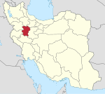 | ||||||||||||||||||||
| Counties and cities |
| ||||||||||||||||||||
| Sights |
| ||||||||||||||||||||
| populated places | |||||||||||||||||||||
This Nahavand County location article is a stub. You can help Wikipedia by expanding it. |