
Bahar County
Persian: شهرستان بهار | |
|---|---|
County | |
 Location of Bahar County in Hamadan province (center, pink) | |
 Location of Hamadan province in Iran | |
| Coordinates: 34°57′N 48°26′E / 34.950°N 48.433°E[1] | |
| Country | |
| Province | Hamadan |
| Capital | Bahar |
| Districts | Central, Lalejin, Salehabad |
| Population (2016)[2] | |
| • Total | 119,082 |
| Time zone | UTC+3:30 (IRST) |
| Bahar County can be found at GEOnet Names Server, at this link, by opening the Advanced Search box, entering "9207364" in the "Unique Feature Id" form, and clicking on "Search Database". | |
Bahar County (Persian: شهرستان بهار) is in Hamadan province, Iran. Its capital is the city of Bahar.[3]
At the 2006 census, the county's population was 121,590 in 29,345 households.[4] The following census in 2011 counted 123,869 people in 34,621 households.[5] At the 2016 census, the county's population was 119,082 in 36,844 households.[2]
YouTube Encyclopedic
-
1/1Views:542
-
Chabahar
Transcription
Administrative divisions
The population history and structural changes of Bahar County's administrative divisions over three consecutive censuses are shown in the following table. The latest census shows three districts, six rural districts, and three cities.[2]
| Administrative Divisions | 2006[4] | 2011[5] | 2016[2] |
|---|---|---|---|
| Central District | 49,138 | 50,388 | 51,837 |
| Abrumand RD | 8,624 | 8,551 | 8,506 |
| Simineh Rud RD | 13,243 | 14,192 | 14,646 |
| Bahar (city) | 27,271 | 27,645 | 28,685 |
| Lalejin District | 44,568 | 45,419 | 41,383 |
| Mohajeran RD | 19,292 | 19,355 | 10,694 |
| Sofalgaran RD | 10,587 | 10,773 | 8,442 |
| Lalejin (city) | 14,689 | 15,291 | 14,916 |
| Mohajeran (city) | 7,331 | ||
| Salehabad District | 27,884 | 28,062 | 25,862 |
| Deymkaran RD | 9,409 | 9,736 | 8,531 |
| Salehabad RD | 10,767 | 10,496 | 9,432 |
| Salehabad (city) | 7,708 | 7,830 | 7,899 |
| Total | 121,590 | 123,869 | 119,082 |
| RD: Rural District | |||
Wikimedia Commons has media related to Bahar County.
References
- ^ OpenStreetMap contributors (15 October 2023). "Bahar County" (Map). OpenStreetMap. Retrieved 15 October 2023.
- ^ a b c d "Census of the Islamic Republic of Iran, 1395 (2016)". AMAR (in Persian). The Statistical Center of Iran. p. 13. Archived from the original (Excel) on 21 April 2021. Retrieved 19 December 2022.
- ^ Habibi, Hassan (19 August 1372). "Approval letter regarding the creation and establishment of Lalejin District in Hamadan province". SOLH (in Persian). Ministry of Interior, Defense Political Commission of the Government Council. Archived from the original on 12 February 2024. Retrieved 12 February 2024.
- ^ a b "Census of the Islamic Republic of Iran, 1385 (2006)". AMAR (in Persian). The Statistical Center of Iran. p. 13. Archived from the original (Excel) on 20 September 2011. Retrieved 25 September 2022.
- ^ a b "Census of the Islamic Republic of Iran, 1390 (2011)". Syracuse University (in Persian). The Statistical Center of Iran. p. 13. Archived from the original (Excel) on 17 January 2023. Retrieved 19 December 2022.
Hamadan Province, Iran | |||||||||||||||||||||
|---|---|---|---|---|---|---|---|---|---|---|---|---|---|---|---|---|---|---|---|---|---|
| Capital | 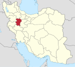 | ||||||||||||||||||||
| Counties and cities |
| ||||||||||||||||||||
| Sights |
| ||||||||||||||||||||
| populated places | |||||||||||||||||||||
| Capital | |||||||||||||||||||||||||||||||
|---|---|---|---|---|---|---|---|---|---|---|---|---|---|---|---|---|---|---|---|---|---|---|---|---|---|---|---|---|---|---|---|
| Districts |
| ||||||||||||||||||||||||||||||
This Hamadan province location article is a stub. You can help Wikipedia by expanding it. |