
Tangeh-ye Torkaman
Persian: تنگه تركمن | |
|---|---|
Village | |
 Tangeh-ye Torkaman | |
| Coordinates: 37°56′08″N 56°55′26″E / 37.93556°N 56.92389°E[1] | |
| Country | Iran |
| Province | North Khorasan |
| County | Raz and Jargalan |
| District | Central |
| Rural District | Raz |
| Population (2016)[2] | |
| • Total | 1,567 |
| Time zone | UTC+3:30 (IRST) |
Tangeh-ye Torkaman (Persian: تنگه تركمن, also Romanized as Tangeh Torkaman)[3] is a village in, and the capital of, Raz Rural District of the Central District of Raz and Jargalan County, North Khorasan province, Iran.[4] The previous capital of the rural district was the village of Tangeh-ye Raz.[5]
At the 2006 National Census, its population was 1,560 in 331 households, when it was in the former Raz and Jargalan District of Bojnord County.[6] The following census in 2011 counted 1,589 people in 370 households.[7] The latest census in 2016 showed a population of 1,567 people in 386 households, by which time the district had been separated from the county in the establishment of Raz and Jargalan County.[5] It was the most populous village in its rural district.[2]
References
- ^ OpenStreetMap contributors (19 May 2023). "Tangeh-ye Torkaman, Raz and Jargalan County" (Map). OpenStreetMap. Retrieved 19 May 2023.
- ^ a b "Census of the Islamic Republic of Iran, 1395 (2016)". AMAR (in Persian). The Statistical Center of Iran. p. 28. Archived from the original (Excel) on 27 October 2020. Retrieved 19 December 2022.
- ^ Tangeh-ye Torkaman can be found at GEOnet Names Server, at this link, by opening the Advanced Search box, entering "218334" in the "Unique Feature Id" form, and clicking on "Search Database".
- ^ Habibi, Hassan (26 February 1389). "Approval of reforms in the villages of Khorasan province". Research Center of the System of Laws of the Islamic Council of the Farabi Library of Mobile Users (in Persian). Ministry of Interior, Defense Political Commission of the Government Board. Archived from the original on 12 October 2013. Retrieved 6 January 2024.
- ^ a b Rahimi, Mohammad Reza (29 September 2013). "Distributional changes in North Khorasan province". Laws and Regulations Portal of the Islamic Republic of Iran (in Persian). Ministry of Interior, Cabinet of Ministers. Archived from the original on 8 January 2021. Retrieved 19 May 2023.
- ^ "Census of the Islamic Republic of Iran, 1385 (2006)". AMAR (in Persian). The Statistical Center of Iran. p. 28. Archived from the original (Excel) on 20 September 2011. Retrieved 25 September 2022.
- ^ "Census of the Islamic Republic of Iran, 1390 (2011)". Syracuse University (in Persian). The Statistical Center of Iran. p. 28. Archived from the original (Excel) on 19 January 2023. Retrieved 19 December 2022.
North Khorasan Province, Iran | |||||||||||||||
|---|---|---|---|---|---|---|---|---|---|---|---|---|---|---|---|
| Capital | 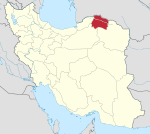 | ||||||||||||||
| Counties and cities |
| ||||||||||||||
| Sights |
| ||||||||||||||
| populated places | |||||||||||||||
This North Khorasan province location article is a stub. You can help Wikipedia by expanding it. |