
Raz Rural District
Persian: دهستان راز | |
|---|---|
 Raz Rural District | |
| Coordinates: 37°57′36″N 56°57′36″E / 37.96000°N 56.96000°E[1] | |
| Country | |
| Province | North Khorasan |
| County | Raz and Jargalan |
| District | Central |
| Capital | Tangeh-ye Torkaman |
| Population (2016)[2] | |
| • Total | 5,621 |
| Time zone | UTC+3:30 (IRST) |
Raz Rural District (Persian: دهستان راز) is in the Central District of Raz and Jargalan County, North Khorasan province, Iran.[3] Its capital is the village of Tangeh-ye Torkaman,[4] transferred from the village of Tangeh-ye Raz.[5]
At the National Census of 2006, its population (as a part of the former Raz and Jargalan District of Bojnord County) was 6,059 in 1,424 households.[6] There were 5,493 inhabitants in 1,461 households at the following census of 2011.[7] At the most recent census of 2016, the population of the rural district was 5,621 in 1,553 households, by which time the district had been separated from the county in the establishment of Raz and Jargalan County.[3] The largest of its 30 villages was Tangeh-ye Torkaman, with 1,567 people.[2]
YouTube Encyclopedic
-
1/3Views:682416 39110 899
-
Emergency Room Overcrowding
-
Geography Now! Dominican Republic
-
Working for the others // Trabajar para los demás (International version)
Transcription
References
- ^ OpenStreetMap contributors (19 May 2023). "Raz Rural District (Raz and Jargalan County)" (Map). OpenStreetMap. Retrieved 19 May 2023.
- ^ a b "Census of the Islamic Republic of Iran, 1395 (2016)". AMAR (in Persian). The Statistical Center of Iran. p. 28. Archived from the original (Excel) on 27 October 2020. Retrieved 19 December 2022.
- ^ a b Rahimi, Mohammad Reza (29 September 2013). "Distributional changes in North Khorasan province". Laws and Regulations Portal of the Islamic Republic of Iran (in Persian). Ministry of Interior, Cabinet of Ministers. Archived from the original on 8 January 2021. Retrieved 19 May 2023.
- ^ Habibi, Hassan (26 February 1389). "Approval of reforms in the villages of Khorasan province". Research Center of the System of Laws of the Islamic Council of the Farabi Library of Mobile Users (in Persian). Ministry of Interior, Defense Political Commission of the Government Board. Archived from the original on 12 October 2013. Retrieved 6 January 2024.
- ^ Mousavi, Mirhossein (18 May 1366). "Creation and formation of 14 rural districts including villages, farms and places in Bojnord County under Khorasan province". Islamic Parliament Research Center (in Persian). Ministry of Interior, Council of Ministers. Archived from the original on 14 December 2015. Retrieved 18 December 2023.
- ^ "Census of the Islamic Republic of Iran, 1385 (2006)". AMAR (in Persian). The Statistical Center of Iran. p. 28. Archived from the original (Excel) on 20 September 2011. Retrieved 25 September 2022.
- ^ "Census of the Islamic Republic of Iran, 1390 (2011)". Syracuse University (in Persian). The Statistical Center of Iran. p. 28. Archived from the original (Excel) on 19 January 2023. Retrieved 19 December 2022.
North Khorasan Province, Iran | |||||||||||||||
|---|---|---|---|---|---|---|---|---|---|---|---|---|---|---|---|
| Capital | 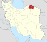 | ||||||||||||||
| Counties and cities |
| ||||||||||||||
| Sights |
| ||||||||||||||
| populated places | |||||||||||||||
This North Khorasan province location article is a stub. You can help Wikipedia by expanding it. |