
Shirvan
Persian: شيروان | |
|---|---|
City | |
 Shirvan | |
| Coordinates: 37°24′02″N 57°55′40″E / 37.40056°N 57.92778°E[1] | |
| Country | Iran |
| Province | North Khorasan |
| County | Shirvan |
| District | Central |
| Population (2016)[2] | |
| • Total | 82,689 |
| Time zone | UTC+3:30 (IRST) |
| Shirvan, Iran at GEOnet Names Server | |
Shirvan (Persian: شيروان, also Romanized as Shīrvān)[3] is a city in the Central District of Shirvan County, North Khorasan province, Iran, serving as capital of both the county and the district.[4] The city has been significant industrially with sugar beet factories.[5] It is also significant historically (Nader hill), geographically (Honameh), and anthropologically (caves around the city).[6]
At the 2006 census, its population was 82,790 in 20,878 households.[7] The following census in 2011 counted 88,254 people in 24,353 households.[8] The latest census in 2016 showed a population of 82,689 people in 24,760 households.[2]
YouTube Encyclopedic
-
1/4Views:4426 8056675 293
-
ghuchan
-
IRAN by Morshed Mehregan
-
UNESCO (Shirvan Shah´s Palace part 1)
-
Mehregan Festival 2020 Orange County
Transcription
Etymology
The name of this city branches from the old Persian word, Shīr (Persian: شیر, 'Lion').[9] It might be because of the mountain in the south of the city which looks like a big lion at rest. The history of Shirvan is more than 7000 years old, as archaeologists found some graves in Gelian and Khanlogh (Villages of Shirvan) which are related to Achaemenid Empire era. The city was fortified and strengthened as a fort city during the Safavid era to defend it against hostile raiding Turkmens.
Geography
Shirvan is located at a latitude of 37 degrees and 40 minutes and a longitude of 57 degrees and 93 minutes with an altitude of 1097 meters above sea level[10] and an area of 3789 square meters. The city of Ashgabat is bounded on the north by the capital of Turkmenistan, on the south by the city of Esfarayen, on the east by the city of Farooj and on the west by Bojnourd. The city of Shirvan is near the Atrak River. Shirvan, 22 km away, is the closest city to Ashgabat, the capital of Turkmenistan.[11]
Universities
Shirvan Higher Education Complex[12]
Shirvan Health Higher Education Complex
Islamic Azad University, Shirvan Branch[13]
Professor Hesabi Boys' Technical School
See also
References
- ^ OpenStreetMap contributors (20 May 2023). "Shirvan, Shirvan County" (Map). OpenStreetMap. Retrieved 20 May 2023.
- ^ a b "Census of the Islamic Republic of Iran, 1395 (2016)". AMAR (in Persian). The Statistical Center of Iran. p. 28. Archived from the original (Excel) on 27 October 2020. Retrieved 19 December 2022.
- ^ Shirvan, Iran can be found at GEOnet Names Server, at this link, by opening the Advanced Search box, entering "-3085108" in the "Unique Feature Id" form, and clicking on "Search Database".
- ^ Habibi, Hassan (21 June 1369). "Approval of the organization and chain of citizenship of the elements and units of the divisions of Khorasan province, centered in Mashhad". Islamic Parliament Research Center (in Persian). Ministry of Interior, Defense Political Commission of the Government Board. Archived from the original on 17 November 2015. Retrieved 6 January 2024.
- ^ "Shirvan Sugar Production Public Joint Stock Company Company Profile - Iran | Financials & Key Executives | EMIS". www.emis.com. Retrieved 18 May 2022.
- ^ "Poostindooz Cave – Shirvan - Iran Tourism". travital.com. Retrieved 18 May 2022.
- ^ "Census of the Islamic Republic of Iran, 1385 (2006)". AMAR (in Persian). The Statistical Center of Iran. p. 28. Archived from the original (Excel) on 20 September 2011. Retrieved 25 September 2022.
- ^ "Census of the Islamic Republic of Iran, 1390 (2011)" (Excel). Iran Data Portal (in Persian). The Statistical Center of Iran. p. 28. Retrieved 19 December 2022.
- ^ Heptner, V. G.; Sludskij, A. A. (1992) [1972]. "Lion". Mlekopitajuščie Sovetskogo Soiuza. Moskva: Vysšaia Škola [Mammals of the Soviet Union. Volume II, Part 2. Carnivora (Hyaenas and Cats)]. Washington DC: Smithsonian Institution and the National Science Foundation. pp. 82–95.
- ^ "Worldwide Elevation Finder". elevation.maplogs.com. Retrieved 24 March 2022.
- ^ "Shirvan - Iran Travel Destination, Guide & Tips". travital.com. Retrieved 24 March 2022.
- ^ "Higher Education Complex of Shirvan Rankings - AD Scientific Index 2022". www.adscientificindex.com. Retrieved 25 May 2022.
- ^ "[World Rankings 2021] Islamic Azad University, Shirvan". EduRank.org - Discover university rankings by location. 11 August 2021. Retrieved 22 March 2022.
| International | |
|---|---|
| National | |
North Khorasan Province, Iran | |||||||||||||||
|---|---|---|---|---|---|---|---|---|---|---|---|---|---|---|---|
| Capital | 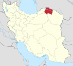 | ||||||||||||||
| Counties and cities |
| ||||||||||||||
| Sights |
| ||||||||||||||
| populated places | |||||||||||||||
| Capital | |||||||||||||||||||||||
|---|---|---|---|---|---|---|---|---|---|---|---|---|---|---|---|---|---|---|---|---|---|---|---|
| Districts |
| ||||||||||||||||||||||
Provinces of the Sasanian Empire | ||
|---|---|---|
| ||
* indicates short living provinces | ||
This Shirvan County location article is a stub. You can help Wikipedia by expanding it. |