
Superior Township, Michigan | |
|---|---|
 Community of Brimley along W. 6 Mile Road | |
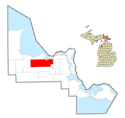 Location within Chippewa County | |
 Superior Township Location within the state of Michigan | |
| Coordinates: 46°22′40″N 84°39′28″W / 46.37778°N 84.65778°W | |
| Country | United States |
| State | Michigan |
| County | Chippewa |
| Government | |
| • Supervisor | Richard Phillips |
| Area | |
| • Total | 104.7 sq mi (271.1 km2) |
| • Land | 103.0 sq mi (266.7 km2) |
| • Water | 1.7 sq mi (4.4 km2) |
| Elevation | 810 ft (247 m) |
| Population (2020) | |
| • Total | 1,276 |
| • Density | 12/sq mi (4.7/km2) |
| Time zone | UTC-5 (Eastern (EST)) |
| • Summer (DST) | UTC-4 (EDT) |
| ZIP code | 49715 (Brimley) |
| Area code | 906 |
| FIPS code | 26-77540[1] |
| GNIS feature ID | 1627140[2] |
Superior Township is a civil township of Chippewa County in the U.S. state of Michigan. The population was 1,276 at the 2020 census.[3]
The federally recognized Bay Mills Indian Community has part of its land base reservation in Superior Township, based west of Brimley. It operates two casinos on its reservation, one of which is in Superior Township, to generate funds for education and welfare of its people. Brimley State Park is also within the township on the shores of Lake Superior.
YouTube Encyclopedic
-
1/3Views:15 0714281 106
-
Family Fun in the Soo
-
The Soo
-
Drummond Island's Part in the War of 1812
Transcription
Geography
Superior Township is located in north of the center of Chippewa County. According to the United States Census Bureau, the township has a total area of 104.7 square miles (271.1 km2), of which 103.0 square miles (266.7 km2) is land and 1.7 square miles (4.4 km2), or 1.62%, is water.[4]
The Delirium Wilderness is located several miles south of the community of Raco and extends into Kinross Township to the south.
Communities
- Brimley is an unincorporated community and census-designated place (CDP) in the north of the township.
- Raco is an unincorporated community on M-28, about 8 miles (13 km) southwest of Brimley. The name comes from the acronym of the Richardson & Avery COmpany.[5]
Demographics
As of the census[1] of 2000, there were 1,329 people, 515 households, and 384 families residing in the township. In 2010, its population then grew to 1,337.
References
- ^ a b "U.S. Census website". United States Census Bureau. Retrieved January 31, 2008.
- ^ U.S. Geological Survey Geographic Names Information System: Superior Township, Chippewa County, Michigan
- ^ "Explore Census Data". data.census.gov. Retrieved May 2, 2024.
- ^ "Geographic Identifiers: 2010 Demographic Profile Data (G001): Superior township, Chippewa County, Michigan". U.S. Census Bureau, American Factfinder. Archived from the original on February 12, 2020. Retrieved September 26, 2014.
- ^ Romig, Walter (1973). Michigan Place Names: The History of the Founding and the Naming of More Than Five Thousand Past and Present Michigan Communities. Wayne State University Press. p. 463. ISBN 9780814318386. Retrieved October 25, 2017.
External links
Municipalities and communities of Chippewa County, Michigan, United States | ||
|---|---|---|
| City |  | |
| Village | ||
| Charter township | ||
| Civil townships | ||
| CDPs | ||
| Other communities |
| |
| Indian reservations | ||
| Footnotes | ‡This populated place also has portions in an adjacent county or counties. | |