
DeTour Village, Michigan | |
|---|---|
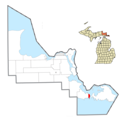 Location within Chippewa County | |
 DeTour Village Location within the state of Michigan  DeTour Village DeTour Village (the United States) | |
| Coordinates: 45°59′26″N 83°54′18″W / 45.99056°N 83.90500°W | |
| Country | United States |
| State | Michigan |
| County | Chippewa |
| Township | DeTour |
| Incorporated | 1899 |
| Government | |
| • President | Lindsey McGuire |
| Area | |
| • Total | 8.38 sq mi (21.70 km2) |
| • Land | 3.54 sq mi (9.18 km2) |
| • Water | 4.83 sq mi (12.52 km2) |
| Elevation | 600 ft (183 m) |
| Population (2020) | |
| • Total | 263 |
| • Density | 74.23/sq mi (28.66/km2) |
| Time zone | UTC-5 (Eastern (EST)) |
| • Summer (DST) | UTC-4 (EDT) |
| ZIP code(s) | 49725 |
| Area code | 906 |
| FIPS code | 26-21780[2] |
| GNIS feature ID | 0624391[3] |
| Website | Official website |
DeTour Village (/di.tuər/ DEE-tu-ər) is a village in Chippewa County in the U.S. state of Michigan. The population was 263 in 2020.
The village is at the extreme eastern tip of the Upper Peninsula of Michigan, in Detour Township, at the turning point for the shipping channel connecting the St. Mary's River with Lake Huron and the Straits of Mackinac. Drummond Island, one of the largest islands in the St. Mary's River, is only one mile across the river from DeTour. The DeTour Reef Light is nearby.
YouTube Encyclopedic
-
1/5Views:45046754737633 332
-
Goetzville, Michigan to DeTour Village, Michigan via "The North Road" Winter 2019
-
DeTour Village, Michigan in Early Spring
-
Detour Village Michigan in the Fall 2016
-
Driving with Scottman895: I-94 EB (I-69 to US 127 North) | Detour in PARMA, MICHIGAN
-
DON'T WASTE YOUR TIME IN THE UPPER PENINSULA! || 9 MUST SEE U.P. LOCATIONS
Transcription
History
The place was originally an Ojibwe settlement. It was connected with the fur trade and over time it came to have a large Metis population. Over time the Metis inhabitants were redefined as being French-Canadian.
The area was organized in 1850 as Warren Township, named after Ebenezer Warren, the first postmaster of the township. The settlement was called Warrenville on an 1848 map. The name was changed to Detour in 1856 when a new postmaster, Henry A. Williams, assumed office. It incorporated as a village in 1899. The spelling was changed to "DeTour" in 1953 and the post office was renamed "DeTour Village" in 1961.[4]
M-134 runs through the village, connecting with I-75 43 miles (69 km) to the west and with M-129 25 miles (40 km) to the west, which runs north 37 miles (60 km) to Sault Ste. Marie. M-134 also continues east to Drummond Island via the Drummond Island Ferry.
Geography
According to the United States Census Bureau, the village has a total area of 8.38 square miles (21.70 km2), of which 3.55 square miles (9.19 km2) is land and 4.83 square miles (12.51 km2) is water.[5]
Climate
| Climate data for DeTour Village, Michigan (1991–2020 normals, extremes 1900–present) | |||||||||||||
|---|---|---|---|---|---|---|---|---|---|---|---|---|---|
| Month | Jan | Feb | Mar | Apr | May | Jun | Jul | Aug | Sep | Oct | Nov | Dec | Year |
| Record high °F (°C) | 53 (12) |
52 (11) |
62 (17) |
85 (29) |
88 (31) |
96 (36) |
102 (39) |
95 (35) |
91 (33) |
88 (31) |
70 (21) |
58 (14) |
102 (39) |
| Mean daily maximum °F (°C) | 23.9 (−4.5) |
25.6 (−3.6) |
34.1 (1.2) |
45.9 (7.7) |
59.3 (15.2) |
69.9 (21.1) |
75.0 (23.9) |
74.0 (23.3) |
66.1 (18.9) |
52.9 (11.6) |
40.9 (4.9) |
30.9 (−0.6) |
49.9 (9.9) |
| Daily mean °F (°C) | 16.3 (−8.7) |
17.2 (−8.2) |
25.5 (−3.6) |
37.9 (3.3) |
50.4 (10.2) |
60.8 (16.0) |
66.3 (19.1) |
66.0 (18.9) |
58.7 (14.8) |
46.3 (7.9) |
35.2 (1.8) |
24.9 (−3.9) |
42.1 (5.6) |
| Mean daily minimum °F (°C) | 8.7 (−12.9) |
8.7 (−12.9) |
17.0 (−8.3) |
29.9 (−1.2) |
41.5 (5.3) |
51.6 (10.9) |
57.6 (14.2) |
58.0 (14.4) |
51.3 (10.7) |
39.7 (4.3) |
29.6 (−1.3) |
18.8 (−7.3) |
34.4 (1.3) |
| Record low °F (°C) | −28 (−33) |
−39 (−39) |
−32 (−36) |
1 (−17) |
11 (−12) |
32 (0) |
38 (3) |
36 (2) |
27 (−3) |
19 (−7) |
−5 (−21) |
−24 (−31) |
−39 (−39) |
| Average precipitation inches (mm) | 1.93 (49) |
1.31 (33) |
1.75 (44) |
2.44 (62) |
2.62 (67) |
3.06 (78) |
3.07 (78) |
3.35 (85) |
3.61 (92) |
3.83 (97) |
2.58 (66) |
2.32 (59) |
31.87 (809) |
| Average snowfall inches (cm) | 20.2 (51) |
13.9 (35) |
12.0 (30) |
4.6 (12) |
0.0 (0.0) |
0.0 (0.0) |
0.0 (0.0) |
0.0 (0.0) |
0.0 (0.0) |
0.3 (0.76) |
5.7 (14) |
17.9 (45) |
74.6 (189) |
| Average precipitation days (≥ 0.01 in) | 12.8 | 9.3 | 9.2 | 9.5 | 10.8 | 9.9 | 10.8 | 10.5 | 11.3 | 13.2 | 11.1 | 12.3 | 130.7 |
| Average snowy days (≥ 0.1 in) | 11.1 | 8.6 | 6.7 | 2.6 | 0.1 | 0.0 | 0.0 | 0.0 | 0.0 | 0.2 | 3.8 | 9.4 | 42.5 |
| Source: NOAA[6][7] | |||||||||||||
Demographics
| Census | Pop. | Note | %± |
|---|---|---|---|
| 1900 | 880 | — | |
| 1910 | 721 | −18.1% | |
| 1920 | 612 | −15.1% | |
| 1930 | 616 | 0.7% | |
| 1940 | 595 | −3.4% | |
| 1950 | 611 | 2.7% | |
| 1960 | 669 | 9.5% | |
| 1970 | 494 | −26.2% | |
| 1980 | 466 | −5.7% | |
| 1990 | 407 | −12.7% | |
| 2000 | 421 | 3.4% | |
| 2010 | 325 | −22.8% | |
| 2020 | 263 | −19.1% | |
| U.S. Decennial Census[8] | |||
In 2020, its population was 263.
Major highways
References
- ^ "2020 U.S. Gazetteer Files". United States Census Bureau. Retrieved May 21, 2022.
- ^ "U.S. Census website". United States Census Bureau. Retrieved January 31, 2008.
- ^ U.S. Geological Survey Geographic Names Information System: DeTour Village, Michigan
- ^ Romig, Walter (1986) [1973]. Michigan Place Names. Detroit, Michigan: Wayne State University Press. ISBN 0-8143-1838-X.
- ^ "US Gazetteer files 2010". United States Census Bureau. Archived from the original on July 2, 2012. Retrieved November 25, 2012.
- ^ "NowData – NOAA Online Weather Data". National Oceanic and Atmospheric Administration. Retrieved August 28, 2021.
- ^ "Station: DeTour Village, MI". U.S. Climate Normals 2020: U.S. Monthly Climate Normals (1991–2020). National Oceanic and Atmospheric Administration. Retrieved August 28, 2021.
- ^ "Census of Population and Housing". Census.gov. Retrieved June 4, 2015.
External links
Municipalities and communities of Chippewa County, Michigan, United States | ||
|---|---|---|
| City |  | |
| Village | ||
| Charter township | ||
| Civil townships | ||
| CDPs | ||
| Other communities | ||
| Indian reservations | ||
| Ghost towns | ||
| Footnotes | ‡This populated place also has portions in an adjacent county or counties | |
| International | |
|---|---|
| National | |
45°59′40″N 83°54′10″W / 45.99444°N 83.90278°W