
Stevens Village
Denyeet | |
|---|---|
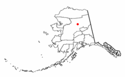 Location of Stevens Village, Alaska | |
| Coordinates: 66°0′19″N 149°6′11″W / 66.00528°N 149.10306°W | |
| Country | United States |
| State | Alaska |
| Census Area | Yukon-Koyukuk |
| Government | |
| • State senator | Click Bishop (R) |
| • State rep. | Mike Cronk (R) |
| Area | |
| • Total | 13.29 sq mi (34.43 km2) |
| • Land | 11.65 sq mi (30.17 km2) |
| • Water | 1.64 sq mi (4.25 km2) |
| Population (2020) | |
| • Total | 37 |
| • Density | 3.18/sq mi (1.23/km2) |
| Time zone | UTC-9 (Alaska (AKST)) |
| • Summer (DST) | UTC-8 (AKDT) |
| ZIP code | 99774 |
| Area code | 907 |
| FIPS code | 02-73290 |
Stevens Village (Denyeet in Koyukon) is a census-designated place (CDP) in Yukon-Koyukuk Census Area, Alaska, United States. The population was 78 at the 2010 census, down from 87 in 2000.
The village is named for its first chief, Skidedlestalk “Old Steven” Stevens (1850-d. 1912~1920).[2][3]
YouTube Encyclopedic
-
1/3Views:5301 3863 493
-
The Caribou People
-
Linking PBIS and the Values of Alaska Native Peoples
-
Alaska's Cargo Masters | INDIE ALASKA
Transcription
Geography
Stevens Village is located at 66°0′19″N 149°6′11″W / 66.00528°N 149.10306°W (66.005296, -149.103032),[4] in the middle of the Yukon Flats.
According to the United States Census Bureau, the CDP has a total area of 11.0 square miles (28 km2), of which, 10.4 square miles (27 km2) of it is land and 0.6 square miles (1.6 km2) of it (5.47%) is water.
Demographics
| Census | Pop. | Note | %± |
|---|---|---|---|
| 1910 | 100 | — | |
| 1920 | 103 | 3.0% | |
| 1930 | 48 | −53.4% | |
| 1940 | 54 | 12.5% | |
| 1950 | 84 | 55.6% | |
| 1960 | 102 | 21.4% | |
| 1970 | 74 | −27.5% | |
| 1980 | 96 | 29.7% | |
| 1990 | 102 | 6.3% | |
| 2000 | 87 | −14.7% | |
| 2010 | 78 | −10.3% | |
| 2020 | 37 | −52.6% | |
| U.S. Decennial Census[5] | |||
Stevens Village originally had been “Stevens Camp,” and was so listed in the 1900 Census.[6] It next appeared on the 1910 U.S. Census as the unincorporated village of Stevens. It returned again in 1920, and in 1930, it returned as "Stephens." From 1940–60, it returned again as "Stevens." In 1970, and in every successive census, it has returned as Stevens Village. It was made a census-designated place (CDP) in 1980.
As of the census[7] of 2000, there were 87 people, 35 households, and 15 families residing in the CDP. The population density was 8.4 inhabitants per square mile (3.2/km2). There were 43 housing units at an average density of 4.1 per square mile (1.6/km2). The racial makeup of the CDP was 3.45% White, 95.40% Native American, 1.15% from other races. 6.90% of the population were Hispanic or Latino of any race.
There were 35 households, out of which 28.6% had children under the age of 18 living with them, 2.9% were married couples living together, 31.4% had a female householder with no husband present, and 54.3% were non-families. 45.7% of all households were made up of individuals, and 11.4% had someone living alone who was 65 years of age or older. The average household size was 2.49 and the average family size was 3.63.
In the CDP, the age distribution of the population shows 29.9% under the age of 18, 8.0% from 18 to 24, 31.0% from 25 to 44, 24.1% from 45 to 64, and 6.9% who were 65 years of age or older. The median age was 35 years. For every 100 females, there were 190.0 males. For every 100 females age 18 and over, there were 190.5 males.
The median income for a household in the CDP was $12,500, and the median income for a family was $11,563. Males had a median income of $11,250 versus $0 for females. The per capita income for the CDP was $7,113. There were 60.0% of families and 61.2% of the population living below the poverty line, including 70.8% of under eighteens and 25.0% of those over 64.
References
- ^ "2020 U.S. Gazetteer Files". United States Census Bureau. Retrieved October 29, 2021.
- ^ Orth, Donald J. (1967). Dictionary of Alaska Place Names. U.S. Government Printing Office.; Phillips, James W. (1973). Alaska-Yukon Place Names. University of Washington Press. ISBN 0-295-95259-8.
- ^ 13th Census of the United States, Census of Alaska, 4th District, Stevens Village (December 25-26, 1909). Retrieved February 23, 2019.
- ^ "US Gazetteer files: 2010, 2000, and 1990". United States Census Bureau. February 12, 2011. Retrieved April 23, 2011.
- ^ "U.S. Decennial Census". Census.gov. Retrieved June 6, 2013.
- ^ 12th Census of the United States, Census of Alaska, Northern District, Stevens Camp near Dall River (April 12-13, 1900). Retrieved February 16, 2019.
- ^ "U.S. Census website". United States Census Bureau. Retrieved January 31, 2008.
![]() Media related to Yukon Flats National Wildlife Refuge at Wikimedia Commons
Media related to Yukon Flats National Wildlife Refuge at Wikimedia Commons
Municipalities and communities of Yukon–Koyukuk Census Area, Alaska, United States | ||
|---|---|---|
| Cities |  | |
| CDPs | ||
| Unincorporated communities | ||
| Ghost towns | ||
| International | |
|---|---|
| National | |