Speers, Saskatchewan | |
|---|---|
 Main Street, 2011 | |
| Coordinates: 52°25′25″N 107°19′59″W / 52.423505°N 107.332959°W | |
| Country | Canada |
| Province | Saskatchewan |
| Region | West-Central |
| Census division | 16 |
| Rural Municipality | Douglas |
| Established | 1913 |
| Incorporated (Village) | 1915 |
| Government | |
| • Governing body | Speers Village Council |
| • Mayor | Kenneth Rebeyka[1] |
| • Administrator | Dean Nicholson |
| • MP, Carlton Trail—Eagle Creek | Kelly Block (2021) |
| • MLA, Biggar-Sask Valley | Randy Weekes (2020) |
| Area | |
| • Total | 0.68 km2 (0.26 sq mi) |
| Population (2021)[2] | |
| • Total | 72 |
| • Density | 105.9/km2 (274/sq mi) |
| Time zone | CST |
| Postal code | S0M 2V0 |
| Area code | 306 |
| Highways | Highway 40 |
| Railways | Canadian National Railway |
| [3][4][5][6] | |
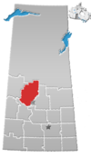
Speers (2021 population: 72) is a village in the Canadian province of Saskatchewan within the Rural Municipality of Douglas No. 436 and Census Division No. 16. The village is located approximately 50 kilometres (31 mi)} southeast of the City of North Battleford on Highway 40.
The community is named for Charles Wesley Speers, the colonization agent for Western Canada, who came from Eastern Canada to settle at Griswold, Manitoba, in 1884.
History
Speers incorporated as a village on December 24, 1915.[7]
Demographics
In the 2021 Census of Population conducted by Statistics Canada, Speers had a population of 72 living in 30 of its 37 total private dwellings, a change of 20% from its 2016 population of 60. With a land area of 0.68 km2 (0.26 sq mi), it had a population density of 105.9/km2 (274.2/sq mi) in 2021.[2]
In the 2016 Census of Population, the Village of Speers recorded a population of 60 living in 26 of its 34 total private dwellings, a -8.3% change from its 2011 population of 65. With a land area of 0.69 km2 (0.27 sq mi), it had a population density of 87.0/km2 (225.2/sq mi) in 2016.[10]
See also
References
- ^ Municipal Directory System
- ^ a b "Population and dwelling counts: Canada, provinces and territories, census divisions and census subdivisions (municipalities), Saskatchewan". Statistics Canada. February 9, 2022. Retrieved April 1, 2022.
- ^ National Archives, Archivia Net, Post Offices and Postmasters
- ^ Government of Saskatchewan, MRD Home, Municipal Directory System, archived from the original on November 21, 2008
- ^ Canadian Textiles Institute. (2005), CTI Determine your provincial constituency, archived from the original on 2007-09-11
- ^ Commissioner of Canada Elections, Chief Electoral Officer of Canada (2005), Elections Canada On-line
- ^ "Urban Municipality Incorporations". Saskatchewan Ministry of Government Relations. Archived from the original on October 15, 2014. Retrieved June 1, 2020.
- ^ "Saskatchewan Census Population" (PDF). Saskatchewan Bureau of Statistics. Archived from the original (PDF) on September 24, 2015. Retrieved May 31, 2020.
- ^ "Saskatchewan Census Population". Saskatchewan Bureau of Statistics. Retrieved May 31, 2020.
- ^ "Population and dwelling counts, for Canada, provinces and territories, and census subdivisions (municipalities), 2016 and 2011 censuses – 100% data (Saskatchewan)". Statistics Canada. February 8, 2017. Retrieved May 30, 2020.
52°42′35″N 107°33′29″W / 52.70972°N 107.55806°W


