
Sasaguri
篠栗町 | |
|---|---|
 Sasaguri Town Hall | |
 Flag  Chapter | |
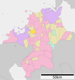
 Location of Sasaguri in Fukuoka Prefecture | |
 | |
 Sasaguri Location in Japan | |
| Coordinates: 33°37′26″N 130°31′34″E / 33.62389°N 130.52611°E | |
| Country | Japan |
| Region | Kyushu |
| Prefecture | Fukuoka |
| District | Kasuya |
| Area | |
| • Total | 38.93 km2 (15.03 sq mi) |
| Population (March 31, 2024) | |
| • Total | 31,191 |
| • Density | 800/km2 (2,100/sq mi) |
| Time zone | UTC+09:00 (JST) |
| City hall address | 1-1-1 Chuo, Sasaguri-cho, Kasuya-gun, Fukuoka-ken 811-2492 |
| Website | Official website |
| Symbols | |
| Bird | Oriental turtle dove |
| Flower | Orchidaceae |
| Tree | Cryptomeria |


Sasaguri (篠栗町, Sasaguri-machi) is a town in Kasuya District, Fukuoka Prefecture, Japan. As of 31 March 2024[update], the town had an estimated population of 31,191 in 14041 households, and a population density of 250 persons per km².[1] The total area of the town is 38.93 km2 (15.03 sq mi)
YouTube Encyclopedic
-
1/3Views:1 22544 256587
-
VOYAGE AU JAPON 2016 - 05 Sasaguri
-
まるで「もののけ姫」 九大の森、SNS映えで人気 福岡県篠栗町
-
Templo Nanzoin
Transcription
Geography
Sasaguri is located 12 kilometers east of Fukuoka city. Sasaguri Station is located slightly west of the geographic center of the town, and the area surrounding the station forms the central urban area. The city center and the area to the west of it are relatively flat, on the eastern edge of the Fukuoka Plain. To the east of the city center is a mountainous region that separates the Fukuoka metropolitan area from Chikuho. The Tatara River flows east-west through the town. The town jointly manages the 17-hectare Sasaguri Kyudai Forest with Kyushu University.[2]
Neighboring municipalities
Fukuoka Prefecture
Climate
Sasaguri has a humid subtropical climate (Köppen Cfa) characterized by warm summers and cool winters with light to no snowfall. The average annual temperature in Sasaguri is 15.2 °C. The average annual rainfall is 1766 mm with September as the wettest month. The temperatures are highest on average in August, at around 26.5 °C, and lowest in January, at around 4.4 °C.[3]
Demographics
Per Japanese census data, the population of Sasaguri is as shown below.
| Year | Pop. | ±% |
|---|---|---|
| 1940 | 12,422 | — |
| 1950 | 14,903 | +20.0% |
| 1960 | 14,039 | −5.8% |
| 1970 | 14,855 | +5.8% |
| 1980 | 19,662 | +32.4% |
| 1990 | 23,267 | +18.3% |
| 2000 | 29,389 | +26.3% |
| 2010 | 31,327 | +6.6% |
| 2020 | 31,209 | −0.4% |
History
The area of Sasaguri was part of ancient Chikuzen Province. During the Edo Period, the area was under the control of Fukuoka Domain. After the Meiji restoration, the villages of Sasaguri and Seto were established with the creation of the modern municipalities system on April 1, 1889. The Sasaguri was raised to town status on January 1, 1927, and annexed Seto on April 1, 1955.
Government
Sasaguri has a mayor-council form of government with a directly elected mayor and a unicameral town council of 12 members. Sasaguri, together with the other municipalities in Kasuya District contributes three members to the Fukuoka Prefectural Assembly. In terms of national politics, the town is part of the Fukuoka 4th district of the lower house of the Diet of Japan.
Economy
There used to be a coal mine in the northwestern part of town, but it closed in the 1960s. After that, an industrial park (Totetsu Kogyo Danchi) was established; however, the main focus of the local economy is on agriculture and tourism.
Education
Sasaguri has three public elementary schools and two public junior high schools operated by the town government. The town does not have a high school.
Transportation
Railways
Highways
Local attractions
- Nanzo-in, temple known for its 41 metres (135 ft) reclining Buddha statue, considered one of the largest bronze statues in the world.[4][5] Nanzo-in is the initial temple on the 88-temple Sasaguri pilgrimage route.
- Narufuchi Dam.
References
- ^ "Sasaguri Town official statistics" (in Japanese). Japan.
- ^ "「まるでジブリ」SNSで話題の森、人出急増で困惑 踏み荒らされ渋滞が頻発 福岡県篠栗町". 西日本新聞me (in Japanese). Retrieved 2022-10-22.
- ^ Sasaguri climate: Average Temperature, weather by month
- ^ MATCHA. "Nanzoin Temple, Fukuoka - Visit The 41m Long Reclining Buddha!". MATCHA - JAPAN TRAVEL WEB MAGAZINE. Retrieved 2022-10-22.
- ^ "Sasaguri Pilgrimage | Japan Experience". www.japan-experience.com. Retrieved 2022-10-22.
External links
- Official website
 (in Japanese)
| International | |
|---|---|
| National | |
| Fukuoka |
| |||
|---|---|---|---|---|
| Kitakyushu |
| |||
| Core city | ||||
| Cities | ||||
| Districts | ||||
This Fukuoka Prefecture location article is a stub. You can help Wikipedia by expanding it. |