
Ōtō
大任町 | |
|---|---|
 Miyako Town hall | |
 Flag  Seal | |
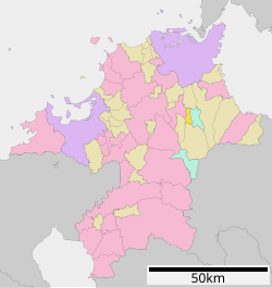
 Location of Ōtō in Fukuoka Prefecture | |
 | |
 Ōtō Location in Japan | |
| Coordinates: 33°36′44″N 130°51′13″E / 33.61222°N 130.85361°E | |
| Country | Japan |
| Region | Kyushu |
| Prefecture | Fukuoka |
| District | Tagawa |
| Area | |
| • Total | 14.26 km2 (5.51 sq mi) |
| Population (November 30, 2023) | |
| • Total | 5,066 |
| • Density | 360/km2 (920/sq mi) |
| Time zone | UTC+09:00 (JST) |
| City hall address | 3067 Daijichi, Oto-cho, Tagawa-gun, Fukuoka-ken 824-0512 |
| Website | Official website |
| Symbols | |
| Bird | Warbling white-eye |
| Flower | Brassica rapa, Camellia japonica |
| Tree | Pine |
Ōtō (大任町, Ōtō-machi) is a town located in Tagawa District, Fukuoka Prefecture, Japan.[1] As of 30 November 2023[update], the town had an estimated population of 5,066 in 2615 households, and a population density of 360 persons per km2. [2] The total area of the town is 151.34 km2 (58.43 sq mi). The town is known for its small, palm-sized mangoes.[3]
Geography
Ōtō is located in the Chikuho region of northeastern of Fukuoka Prefecture. The Hikoyama River flowing from north to south through the center of the town, and much of the town belongs to the Tagawa Basin.
Neighboring municipalities
Fukuoka Prefecture
Climate
Ōtō has a humid subtropical climate (Köppen Cfa) characterized by warm summers and cool winters with light to no snowfall.
Demographics
Per Japanese census data, the population of Ōtō is as shown below
| Year | Pop. | ±% |
|---|---|---|
| 1940 | 7,149 | — |
| 1950 | 8,596 | +20.2% |
| 1960 | 8,940 | +4.0% |
| 1970 | 6,256 | −30.0% |
| 1980 | 6,653 | +6.3% |
| 1990 | 6,628 | −0.4% |
| 2000 | 5,943 | −10.3% |
| 2010 | 5,176 | −12.9% |
| 2020 | 5,008 | −3.2% |
History
The area of Ōtō was part of ancient Buzen Province and part of the holdings of Kokura Domain in the Edo Period. The village of Ōtō was established on May 1, 1889 with the creation of the modern municipalities system. It was raised to town status on January 1, 1960.
Government
Ōtō has a mayor-council form of government with a directly elected mayor and a unicameral town council of 11 members. Ōtō, collectively with the other municipalities of Tagawa District contributes two members to the Fukuoka Prefectural Assembly. In terms of national politics, the town is part of the Fukuoka 11th district of the lower house of the Diet of Japan. The town mayor and government has frequently been involved in scandals involving corruption, fraud, and violent crime with frequent accusations of ties with organized crime.
Economy
During the Meiji period, Ōtō, along with the other municipalities of the Chikuho area, developed with the Kitakyushu industrial zone through coal mining, and is still considered part of to the Greater Kitakyushu Metropolitan Area. However, as the demand for coal decreased due to the energy revolution, the coal mines that had sponsored prosperity have all closed, leading to depopulation. Ōtō
Education
Ōtō has two public elementary schools and one public junior high school operated by the town government. The town does not have a high school.
Transportation
Railways
Ōtō has had no passenger railway service since the closure of the Soeda Line in 1985. The nearest train station is Tagawa-Ita Station in neighboring Tagawa.
Highways
There are no expressways or national highways in the town.
References
- ^ "「労働問題相談会」のお知らせ - 福岡県庁ホームページ". www.pref.fukuoka.lg.jp. Retrieved 2022-10-21.
- ^ "Ōtō Town official statistics" (in Japanese). Japan.
- ^ 日本放送協会. "福岡でマンゴー栽培!? 道の駅ではスイーツも! 大任町 | NHK". NHK北九州放送局 (in Japanese). Retrieved 2022-10-21.
External links
 Media related to Ōtō, Fukuoka at Wikimedia Commons
- Ōtō official website (in Japanese)
| Fukuoka |
| |||
|---|---|---|---|---|
| Kitakyushu |
| |||
| Core city | ||||
| Cities | ||||
| Districts | ||||
| International | |
|---|---|
| National | |
This Fukuoka Prefecture location article is a stub. You can help Wikipedia by expanding it. |