
Sankhuwasabha District
सङ्खुवासभा जिल्ला | |
|---|---|
 Yangle Kharka, a place in Sankhuwasabha | |
 Location of Sankhuwasabha in province | |
| Coordinates: 27°06′N 86°57′E / 27.100°N 86.950°E to 27°55′N 87°40′E / 27.917°N 87.667°E | |
| Country | |
| Province | Koshi Province |
| Established | 1962 |
| Admin HQ. | Khandbari |
| Municipality | |
| Government | |
| • Type | Coordination committee |
| • Body | DCC, Sankhuwasabha |
| • Head | Mahesh Thapaliya |
| • Parliamentary constituencies | 1 |
| • Provincial constituencies | 2 |
| Area | |
| • Total | 3,480 km2 (1,340 sq mi) |
| Highest elevation | 8,463 m (27,766 ft) |
| Lowest elevation | 457 m (1,499 ft) |
| Population (2011) | |
| • Total | 158,742 |
| • Density | 46/km2 (120/sq mi) |
| • Households | 34,615 |
| Demographics | |
| • Ethnic groups (2011) [1] | 18%Chhetri 11%Rai 10%Tamang 6%Kulung 6%Sherpa 5%Yakkha 5% Limbu 5%Gurung 34%Others |
| • Female ♀ | 53% |
| Human Development Index | |
| • Income per capita (US dollars) | $1,193 |
| • Poverty rate | 21% |
| • Literacy | 69% |
| • Life Expectancy | 68.4 |
| Time zone | UTC+05:45 (NPT) |
| Postal Codes | 56900..., 56913 |
| Telephone Code | 029 |
| Main Language(s) | Nepali, Yakkha, Kulung, Limbu |
| Website | ddcsankhuwasabha |
Sankhuwasabha District (Nepali: सङ्खुवासभा जिल्ला ⓘ) is one of 14 districts of Koshi Province of eastern Nepal. The district's area is 3,480 km2 with a population of 159,203 in 2001 and 158,742 in 2011. The administrative center is Khandbari.
Bordering districts are Bhojpur, Tehrathum, Dhankuta, Solukhumbu and Taplejung in Koshi Province. Tingri County of Shigatse Prefecture in the Tibet Autonomous Region of China borders to the north.
YouTube Encyclopedic
-
1/5Views:9 14739 4133 134437594
-
Tumlingtar Airport || Flight Movement || Sankhuwasabha || 2021
-
Crossing the Arun River on a ferry in Sankhuwasabha, Nepal
-
Breathtaking Barun Valley || Way to MBC|| Shivadhara(remake with little additional Story)| part-2|
-
East Nepal | Tehrathum | Bhojpur | Sankhuwasabha | Makalu Barun National Park | Travel Nepal
-
Baneshwar Danda |Sankhuwasabha| Khandbari Motorcycle Trip
Transcription
Geography and climate
| Climate Zone[2] | Elevation Range | % of Area |
|---|---|---|
| Lower Tropical | below 300 meters (1,000 ft) | 0.4% |
| Upper Tropical | 300 to 1,000 meters 1,000 to 3,300 ft. |
10.0% |
| Subtropical | 1,000 to 2,000 meters 3,300 to 6,600 ft. |
24.8% |
| Temperate | 2,000 to 3,000 meters 6,400 to 9,800 ft. |
23.3% |
| Subalpine | 3,000 to 4,000 meters 9,800 to 13,100 ft. |
12.8% |
| Alpine | 4,000 to 5,000 meters 13,100 to 16,400 ft. |
8.4% |
| Nival | above 5,000 meters | 20.4% |
The Arun River enters from Tibet at an elevation of about 3,500 meters (11,500 feet) and flows south across the district, forming one of the world's deepest valleys relative to 8,481 meter Makalu to the west and 8,586 meter Kangchenjunga to the east.
Demographics
| Year | Pop. | ±% p.a. |
|---|---|---|
| 1981 | 129,414 | — |
| 1991 | 141,903 | +0.93% |
| 2001 | 159,203 | +1.16% |
| 2011 | 158,742 | −0.03% |
| 2021 | 159,046 | +0.02% |
| Sources:[3] | ||
At the time of the 2011 Nepal census, Sankhuwasabha District had a population of 158,742.
As their first language, 46.1% spoke Nepali, 8.8% Tamang, 8.0% Sherpa, 6.6% Kulung, 5.0% Limbu, 4.3% Yakkha, 3.2% Yamphu, 2.9% Gurung, 2.3% Magar, 2.2% Rai, 1.9% Newar, 1.8% Lohorung, 1.6% Mewahang, 1.1% Khaling, 0.9% Chamling, 0.6% Thulung, 0.4% Lhomi, 0.3% Maithili, 0.2% Bantawa, 0.2% Nachhiring, 0.1% Bahing, 0.1% Bhujel, 0.1% Dumi, 0.1% Jerung, 0.1% Koi, 0.1% Sampang, 0.1% Sindhi and 0.5% other languages.[5]
Ethnicity/caste: 18.3% were Chhetri, 10.7% Rai, 10.5% Tamang, 6.2% Kulung, 5.8% Sherpa, 5.5% Limbu, 5.4% Gurung, 5.3% Hill Brahmin, 4.8% Kami, 4.7% Newar, 4.5% Yakkha, 3.3% Magar, 2.7% Yamphu, 2.2% Bhote, 2.2% Damai/Dholi, 1.4% Mewahang Bala, 1.3% Sarki, 0.7% Sanyasi/Dasnami, 0.6% Kumal, 0.6% Lohorung, 0.5% Gharti/Bhujel, 0.5% Lhomi, 0.4% Thulung, 0.3% Khaling, 0.2% Chamling, 0.1% Kayastha, 0.1% Majhi, 0.1% Marwadi, 0.1% Nachhiring, 0.1% Thakuri and 0.5% others.[6]
Religion: 42.7% were Hindu, 28.8% Kirati, 26.6% Buddhist, 1.5% Christian, 0.1% Prakriti and 0.3% others.[8]
Literacy: 69.3% could read and write, 2.8% could only read, and 27.8% could neither read nor write.[9]
Divisions
Sankhuwasabha District is divided into the following subdivisions:[10]
| Local Body | Nepali | Type | Population (2021) |
|---|---|---|---|
| Bhotkhola | भोटखोला | Rural municipality | 6,438 |
| Chainpur | चैनपुर | Municipality | 26,799 |
| Chichila | चिचिला | Rural municipality | 6,477 |
| Dharmadevi | धर्मदेवी | Municipality | 16,053 |
| Khandbari | खाँदबारी | Municipality | 35,565 |
| Madi | मादी | Municipality | 13,273 |
| Makalu | मकालु | Rural municipality | 13,424 |
| Panchkhapan | पाँचखपन | Municipality | 16,348 |
| Savapokhari | सभापोखरी | Rural municipality | 9,970 |
| Silichong | सिलीचोङ | Rural municipality | 10,296 |
See also
- Arun Valley
- Tumlingtar Airport
- khadbari
- Panchkhapan
- Chainpur
References
- ^ "Sankhuwasabha District Profilecbs.gov.np" (PDF).
- ^ The Map of Potential Vegetation of Nepal - a forestry/agroecological/biodiversity classification system (PDF), Forest & Landscape Development and Environment Series 2-2005 and CFC-TIS Document Series No.110., 2005, ISBN 87-7903-210-9, retrieved Nov 22, 2013
- ^ "Nepal: Provinces and Districts". www.citypopulation.de.
- ^ "NepalMap profile: Sankhuwasabha". NepalMap. Retrieved 17 July 2022.
- ^ NepalMap Language [1]
- ^ NepalMap Caste [2]
- ^ "NepalMap profile: Sankhuwasabha". NepalMap. Retrieved 17 July 2022.
- ^ NepalMap Religion [3]
- ^ NepalMap Literacy [4]
- ^ "Nepal: Municipal Division (Districts and Local Units) - Population Statistics, Charts and Map". www.citypopulation.de. Retrieved 2023-03-28.
External links
- "Districts of Nepal". Statoids.
- "Sankhuwasabha District". Sankhuwasabha.com. Retrieved 4 January 2013.
Places adjacent to Sankhuwasabha District | |
|---|---|
Headquarters: Khandbari Municipality | ||
| Rural municipalities | 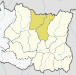 | |
| Municipalities | ||
| International | |
|---|---|
| National | |
27°22′N 87°13′E / 27.367°N 87.217°E
This article about a location in the Sankhuwasabha District of Nepal is a stub. You can help Wikipedia by expanding it. |