
Chainpur
चैनपुर नगरपालिका | |
|---|---|
 Chainpur Location in Nepal | |
| Coordinates: 27°18′N 87°19′E / 27.30°N 87.32°E | |
| Country | |
| Province | Koshi Province |
| District | Sankhuwasabha District |
| Government | |
| • Mayor | Krishna Kumar Tamang (NCP) |
| • Deputy Mayor | Alina Shrestha (NCP) |
| Area | |
| • Total | 223.69 km2 (86.37 sq mi) |
| • Rank | 10th (Province No. 1) |
| Population (2011) | |
| • Total | 27,308 |
| • Density | 120/km2 (320/sq mi) |
| Time zone | UTC+5:45 (NST) |
| Postal code | 56913 |
| Area code | 029 |
| Website | www.chainpurmun.gov.np |
Chainpur is a municipality in Sankhuwasabha District in the Koshi Province of north-eastern Nepal. It was formed by merging five villages i.e. Chainpur, Siddhakali, Siddhapokhari, Baneshwar and Kharang. The municipality was implemented on 18 May 2014.[1][2] At the time of the 1991 Nepal census it had a population of 4933 people in 948 households.[3]
Chainpur is an ancient market place of the eastern region of Nepal. It has been famous for hundreds of years for Karuwa, a special kind of water mug with pipe tap sculptured with artistic carving on exterior of it.
It used to be district headquarters of Sankhuwasabha before it was shifted to Khandbari.
Chainpur is famous for making Khukuri.
Demographics
At the time of the 2011 Nepal census, Chainpur Municipality had a population of 27,462. Of these, 48.4% spoke Nepali, 13.6% Tamang, 10.4% Sherpa, 9.6% Limbu, 3.3% Yakkha, 2.8% Newar, 2.0% Chamling, 1.8% Magar, 1.7% Khaling, 1.6% Rai, 1.4% Thulung, 0.9% Kulung, 0.8% Gurung, 0.4% Jerung, 0.2% Dumi, 0.2% Maithili, 0.1% Bantawa, 0.1% Nachhiring, 0.1% Puma, 0.1% Rajasthani and 0.3% other languages as their first language.[4]
In terms of ethnicity/caste, 24.7% were Chhetri, 15.1% Tamang, 10.5% Sherpa, 10.2% Limbu, 7.8% Rai, 6.1% Hill Brahmin, 6.1% Newar, 4.0% Kami, 3.7% Yakkha, 2.3% Magar, 2.0% Damai/Dholi, 2.0% Sarki, 1.0% Gurung, 0.8% Chamling, 0.8% Thulung, 0.7% Khaling, 0.6% Kulung, 0.3% Gharti/Bhujel, 0.3% Sanyasi/Dasnami, 0.1% Bantawa, 0.1% other Dalit, 0.1% Dhandi, 0.1% Majhi, 0.1% Marwadi, 0.1% Tharu, 0.1% Yadav and 0.5% others.[5]
In terms of religion, 48.3% were Hindu, 28.3% Buddhist, 21.4% Kirati, 1.4% Christian, 0.1% Jain, 0.1% Prakriti and 0.4% others.[6]
In terms of literacy, 71.6% could read and write, 2.5% could only read and 25.9% could neither read nor write.[7]
Climate
| Climate data for Chainpur (elevation 1,329 m (4,360 ft), 1976–2005 normals) | |||||||||||||
|---|---|---|---|---|---|---|---|---|---|---|---|---|---|
| Month | Jan | Feb | Mar | Apr | May | Jun | Jul | Aug | Sep | Oct | Nov | Dec | Year |
| Mean daily maximum °C (°F) | 18.5 (65.3) |
20.6 (69.1) |
25.2 (77.4) |
27.8 (82.0) |
28.1 (82.6) |
28.6 (83.5) |
27.7 (81.9) |
28.1 (82.6) |
27.4 (81.3) |
25.8 (78.4) |
23.1 (73.6) |
19.9 (67.8) |
25.1 (77.1) |
| Mean daily minimum °C (°F) | 7.5 (45.5) |
9.1 (48.4) |
12.6 (54.7) |
15.4 (59.7) |
16.9 (62.4) |
19.1 (66.4) |
19.5 (67.1) |
19.5 (67.1) |
18.6 (65.5) |
15.5 (59.9) |
11.8 (53.2) |
8.8 (47.8) |
14.5 (58.1) |
| Average precipitation mm (inches) | 13.9 (0.55) |
16.4 (0.65) |
37.3 (1.47) |
94.6 (3.72) |
203.0 (7.99) |
223.8 (8.81) |
297.0 (11.69) |
275.3 (10.84) |
202.0 (7.95) |
57.6 (2.27) |
15.7 (0.62) |
10.8 (0.43) |
1,447.4 (56.98) |
| Source: Agricultural Extension in South Asia[8] | |||||||||||||
References
- ^ 72 new municipalities announced Archived June 18, 2014, at the Wayback Machine My Republica
- ^ Govt announces 72 new municipalities Archived 2014-10-06 at the Wayback Machine The Kathmandu Post
- ^ "Nepal Census 2001". Nepal's Village Development Committees. Digital Himalaya. Archived from the original on 12 October 2008. Retrieved 19 November 2008.
- ^ NepalMap Language [1]
- ^ NepalMap Caste [2]
- ^ NepalMap Religion [3]
- ^ NepalMap Literacy [4]
- ^ "TEMPORAL AND SPATIAL VARIABILITY OF CLIMATE CHANGE OVER NEPAL (1976-2005)" (PDF). Agricultural Extension in South Asia. Archived from the original (PDF) on 13 October 2023. Retrieved 14 October 2023.
External links
Headquarters: Khandbari Municipality | ||
| Rural municipalities | 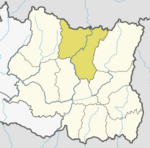 | |
| Municipalities | ||
This article about a location in the Sankhuwasabha District of Nepal is a stub. You can help Wikipedia by expanding it. |