

Ruin Rural District (Persian: دهستان روئين) is in the Central District of Esfarayen County, North Khorasan province, Iran.[3] Its capital is the village of Iraj.[4]
At the National Census of 2006, its population was 15,810 in 3,849 households.[5] There were 15,266 inhabitants in 4,313 households at the following census of 2011.[6] At the most recent census of 2016, the population of the rural district was 14,135 in 4,338 households. The most populous of its 76 villages was Sast, with 718 people.[2]
YouTube Encyclopedic
-
1/3Views:3251 8201 775
-
Iran Ruin village, Esfarayen county روستاي رويين شهرستان اسفراين ايران
-
Nepal Army Helicopter landing at Rasuwa रसुवागढी
-
Raj Bagh Ruins near Padam Talao in Ranthambore National Park
Transcription
References
- ^ OpenStreetMap contributors (18 May 2023). "Ruin Rural District (Esfarayen County)" (Map). OpenStreetMap. Retrieved 18 May 2023.
- ^ a b "Census of the Islamic Republic of Iran, 1395 (2016)". AMAR (in Persian). The Statistical Center of Iran. p. 28. Archived from the original (Excel) on 27 October 2020. Retrieved 19 December 2022.
- ^ Habibi, Hassan (21 June 1369). "Approval of the organization and chain of citizenship of the elements and units of the divisions of Khorasan province, centered in Mashhad". Islamic Parliament Research Center (in Persian). Ministry of Interior, Defense Political Commission of the Government Board. Archived from the original on 17 November 2015. Retrieved 6 January 2024.
- ^ Mousavi, Mirhossein. "Creation and formation of seven rural districts including villages, farms and places in Esfarayen County under Khorasan province". Lamtakam (in Persian). Ministry of Interior, Board of Ministers. Archived from the original on 11 January 2024. Retrieved 11 January 2024.
- ^ "Census of the Islamic Republic of Iran, 1385 (2006)". AMAR (in Persian). The Statistical Center of Iran. p. 28. Archived from the original (Excel) on 20 September 2011. Retrieved 25 September 2022.
- ^ "Census of the Islamic Republic of Iran, 1390 (2011)". Syracuse University (in Persian). The Statistical Center of Iran. p. 28. Archived from the original (Excel) on 19 January 2023. Retrieved 19 December 2022.
North Khorasan Province, Iran | |||||||||||||||
|---|---|---|---|---|---|---|---|---|---|---|---|---|---|---|---|
| Capital | 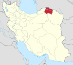 | ||||||||||||||
| Counties and cities |
| ||||||||||||||
| Sights |
| ||||||||||||||
| populated places | |||||||||||||||
This Esfarayen County location article is a stub. You can help Wikipedia by expanding it. |