
Dahaneh-ye Shirin
Persian: دهنه شيرين | |
|---|---|
Village | |
 Dahaneh-ye Shirin | |
| Coordinates: 36°39′49″N 58°01′48″E / 36.66361°N 58.03000°E[1] | |
| Country | Iran |
| Province | North Khorasan |
| County | Bam and Safiabad |
| District | Central |
| Rural District | Dahaneh-ye Shirin |
| Population (2016)[2] | |
| • Total | 551 |
| Time zone | UTC+3:30 (IRST) |
Dahaneh-ye Shirin (Persian: دهنه شيرين, also Romanized as Dahneh-ye Shīrīn)[3] is a village in, and the capital of, Dahaneh-ye Shirin Rural District of the Central District of Bam and Safiabad County, North Khorasan province, Iran.[4]
At the 2006 National Census, its population was 559 in 151 households, when it was in Safiabad Rural District of the former Bam and Safiabad District, Esfarayen County.[5] The following census in 2011 counted 613 people in 173 households.[6] The latest census in 2016 showed a population of 551 people in 175 households.[2]
In February 2023, the district was separated from the county in the establishment of Bam and Safiabad County, which was divided into two districts of two rural districts each, with Safiabad as its capital and only city.[4]
References
- ^ OpenStreetMap contributors (12 January 2024). "Dahaneh-ye Shirin, Bam and Safiabad County" (Map). OpenStreetMap. Retrieved 12 January 2024.
- ^ a b "Census of the Islamic Republic of Iran, 1395 (2016)". AMAR (in Persian). The Statistical Center of Iran. p. 28. Archived from the original (Excel) on 27 October 2020. Retrieved 19 December 2022.
- ^ Iranian National Committee for Standardization of Geographical Names website (in Persian)
- ^ a b "Explaining the details of changes in country divisions in North Khorasan". Mehr News (in Persian). Ministry of Interior, Board of Ministers. 12 February 2023. Archived from the original on 22 March 2023. Retrieved 12 January 2024.
- ^ "Census of the Islamic Republic of Iran, 1385 (2006)". AMAR (in Persian). The Statistical Center of Iran. p. 28. Archived from the original (Excel) on 20 September 2011. Retrieved 25 September 2022.
- ^ "Census of the Islamic Republic of Iran, 1390 (2011)". Syracuse University (in Persian). The Statistical Center of Iran. p. 28. Archived from the original (Excel) on 19 January 2023. Retrieved 19 December 2022.
North Khorasan Province, Iran | |||||||||||||||
|---|---|---|---|---|---|---|---|---|---|---|---|---|---|---|---|
| Capital | 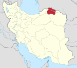 | ||||||||||||||
| Counties and cities |
| ||||||||||||||
| Sights |
| ||||||||||||||
| populated places | |||||||||||||||
This North Khorasan province location article is a stub. You can help Wikipedia by expanding it. |