
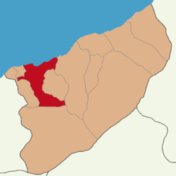

Rize District (also: Merkez, meaning "central") is a district of the Rize Province of Turkey. Its seat is the city of Rize.[1] Its area is 253 km2,[2] and its population is 150,414 (2021).[3]
Composition
There are four municipalities in Rize District:[1][4]
There are 60 villages in Rize District:[5]
- Akarsu
- Akpınar
- Aktaş
- Ambarlık
- Ayane
- Azaklıhoca
- Balıkçılar
- Beştepe
- Bıldırcınköy
- Boğaz
- Camidağı
- Çaybaşı
- Çaycılar
- Çimenli
- Derebaşı
- Dörtyol
- Düzköy
- Elmalı
- Erenköy
- Gölgeli
- Güzelköy
- Güzelyurt
- Karasu
- Karayemiş
- Ketenli
- Kırklartepesi
- Kocatepe
- Köprülü
- Küçükçayır
- Küçükköy
- Kurtuluş
- Melek
- Ortapazar
- Örnek
- Pazarköy
- Pekmezli
- Pınarbaşı
- Selimiye
- Soğukçeşme
- Söğütlü
- Sütlüce
- Taşköprü
- Taşlık
- Taşpınar
- Tekke
- Topkaya
- Tuğlalı
- Üçkaya
- Uzunköy
- Veliköy
- Yemişlik
- Yenidoğan
- Yenigüzel
- Yenikale
- Yenikasarcılar
- Yeniselimiye
- Yeşildere
- Yolüstü
- Yolveren
- Zincirliköprü
References
- ^ a b İlçe Belediyesi, Turkey Civil Administration Departments Inventory. Retrieved 30 January 2023.
- ^ "İl ve İlçe Yüz ölçümleri". General Directorate of Mapping. Retrieved 30 January 2023.
- ^ "Address-based population registration system (ADNKS) results dated 31 December 2021" (XLS) (in Turkish). TÜİK. Retrieved 30 January 2023.
- ^ Belde Belediyesi, Turkey Civil Administration Departments Inventory. Retrieved 30 January 2023.
- ^ Köy, Turkey Civil Administration Departments Inventory. Retrieved 30 January 2023.
Rize District in Rize Province of Turkey | |||||||||||||||||||||||||||
|---|---|---|---|---|---|---|---|---|---|---|---|---|---|---|---|---|---|---|---|---|---|---|---|---|---|---|---|
| Districts |   | ||||||||||||||||||||||||||
|
Metropolitan municipalities are bolded. | |||||||||||||||||||||||||||
| Municipalities | |
|---|---|
| Villages |
|
This geographical article about a location in Rize Province, Turkey is a stub. You can help Wikipedia by expanding it. |