
Kalkandere District | |
|---|---|
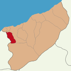 Map showing Kalkandere District in Rize Province | |
 Kalkandere District Location in Turkey | |
| Coordinates: 40°56′N 40°27′E / 40.933°N 40.450°E | |
| Country | Turkey |
| Province | Rize |
| Seat | Kalkandere |
| Government | |
| • Kaymakam | Ahmet Açıkgöz |
| Area | 107 km2 (41 sq mi) |
| Population (2021) | 13,511 |
| • Density | 130/km2 (330/sq mi) |
| Time zone | UTC+3 (TRT) |
| Website | www |
Kalkandere District is a district of the Rize Province of Turkey. Its seat is the town of Kalkandere.[1] Its area is 107 km2,[2] and its population is 13,511 (2021).[3] There is a distance of 21 km between Kalkandere and Rize city center, located in the Black Sea Region.
Formerly known as Karadere, this is a hilly, forested, rural area of scattered villages, inland from the Black Sea coast. There is little flat land and this is an impoverished area losing its population as they migrate away to jobs in other parts of Turkey or abroad. The local economy depends on growing tea on the hillsides. 90% of the agricultural land is tea plantations and there are tea processing plants in the town Kalkandere. Tea was planted in the 1950s and has brought new life to the area. Other activities include bee-keeping.
Composition
There is one municipality in Kalkandere District:[1][4]
There are 22 villages in Kalkandere District:[5]
- Çağlayan
- Çayırlı
- Dülgerli
- Esendere
- Esentepe
- Fındıklı
- Geçitli
- Hurmalık
- Hüseyinhoca
- Inciköy
- Kayabaşı
- Ormanlı
- Pınarköy
- Seyrantepe
- Soğuksu
- Ünalan
- Yenigeçitli
- Yeniköy
- Yeşilköy
- Yokuşlu
- Yolbaşı
- Yumurtatepe
References
- ^ a b İlçe Belediyesi, Turkey Civil Administration Departments Inventory. Retrieved 30 January 2023.
- ^ "İl ve İlçe Yüz ölçümleri". General Directorate of Mapping. Retrieved 30 January 2023.
- ^ "Address-based population registration system (ADNKS) results dated 31 December 2021" (XLS) (in Turkish). TÜİK. Retrieved 30 January 2023.
- ^ Belde Belediyesi, Turkey Civil Administration Departments Inventory. Retrieved 30 January 2023.
- ^ Köy, Turkey Civil Administration Departments Inventory. Retrieved 30 January 2023.
Kalkandere District in Rize Province of Turkey | |||||||||||||||||||||||||||
|---|---|---|---|---|---|---|---|---|---|---|---|---|---|---|---|---|---|---|---|---|---|---|---|---|---|---|---|
| Districts |   | ||||||||||||||||||||||||||
|
Metropolitan municipalities are bolded. | |||||||||||||||||||||||||||
This geographical article about a location in Rize Province, Turkey is a stub. You can help Wikipedia by expanding it. |