
| Rangdum Monastery | |
|---|---|
 Rangdum Monastery seen from the north | |
| Religion | |
| Affiliation | Tibetan Buddhism |
| Sect | Gelug |
| Location | |
| Location | Suru Valley, Ladakh, India |
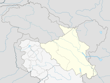 Location in Ladakh, India | |
| Geographic coordinates | 34°3′36″N 76°21′0″E / 34.06000°N 76.35000°E |

Rangdum Monastery is a Tibetan Buddhist monastery belonging to the Gelugpa sect, situated on top of a small but steep sugarloaf hill at an altitude of 4,031 m (13,225 ft) at the head of the Suru Valley, in Ladakh. It is next to the tiny village of Julidok (Zulidok), and about 25 km north of the 4,400 m (14,436 ft) Pensi La (pass), which leads into Zanskar.[1] It is on Padum-Sankoo-Kargil Road, 103 km northwest of Padum, 87 km southeast of Sankoo & 196 southeast of Kargil. The monastery was electrified using solar energy in June 2017 by Global Himalayan Expedition (GHE) [2][unreliable source?]
YouTube Encyclopedic
-
1/3Views:4326 361550
-
Rangdum Gompa from 18th century in Zanskar Valley
-
Exploring Western Ladakh - Kargil to Padum via Rangdum
-
Rangdum - village in Himalaya
Transcription
History
According to an inscription the monastery was built by Gelek Yashy Takpa during the reign of King Tsewang Namgyal II (1753-1782) of Ladakh.
Although it is physically in the Suru Valley, it is culturally part of Zanskar.[1]
Because the summer's brevity sometimes interferes with crop harvests, to supplement the locally produced dairy products, both the village and the monastery depend on outside supplies brought up the largely barren Suru Valley, or over the 4,400 metre (14,436 ft) Pensi La pass from Zanskar. The monastery was electrified using solar energy in June 2017 by Global Himalayan Expedition, along with the nearby village of Shakma Karpo. The first two female engineers of the region trained by Barefoot College and GHE executed the project.
The monastery is home to about 30 monks and almost as many donkeys.[1][3] To ensure income for the nearby local communities, GHE has set up homestays in the villages, allowing travelers to visit the monastery while experiencing an authentic culture in the homestays.

See also
Footnotes
References
- Janet Rizvi. (1996). Ladakh: Crossroads of High Asia. Second Edition. Oxford University Press, Delhi. ISBN 0-19-564546-4.
- Schettler, Margaret & Rolf (1981). Kashmir, Ladakh & Zanskar. Lonely Planet Publications. South Yarra, Victoria, Australia. ISBN 0-908086-21-0.
External links
| Part of a series on |
| Tibetan Buddhism |
|---|
 |
| State symbols | |||||||||||||||||||
|---|---|---|---|---|---|---|---|---|---|---|---|---|---|---|---|---|---|---|---|
| History |
| ||||||||||||||||||
| Administration | |||||||||||||||||||
| Geography |
| ||||||||||||||||||
| Human settlements | |||||||||||||||||||
| Culture |
| ||||||||||||||||||
| Tourism and wildlife |
| ||||||||||||||||||
| Transport |
| ||||||||||||||||||
| Infrastructure |
| ||||||||||||||||||
| See also |
| ||||||||||||||||||