
Queen, New Mexico | |
|---|---|
 Queen Location within the state of New Mexico  Queen Queen (the United States) | |
| Coordinates: 32°11′27″N 104°44′45″W / 32.19083°N 104.74583°W | |
| Country | United States |
| State | New Mexico |
| County | Eddy |
| Elevation | 5,843 ft (1,781 m) |
| Time zone | UTC-7 (Mountain (MST)) |
| • Summer (DST) | UTC-6 (MDT) |
| ZIP codes | 88220 |
| Area code | 575 |
| GNIS feature ID | 909922 |
Queen is an unincorporated community in Eddy County in southeastern New Mexico, in the southwestern United States. Although it currently has a population of around 50, it was formerly considered a ghost town.[2][3] Located in the foothills on the east side of the Guadalupe Mountains, in the southern Lincoln National Forest, it flourished in the early 20th century as a ranching center. Queen is located alongside NM Route 137, about 27 mi (50 mi by road) southwest of Carlsbad.
YouTube Encyclopedic
-
1/3Views:5371 89861 579
-
New Mexico BDR: Queen to Cloudcroft May 23, 2020
-
SITTING BULL FALLS RECREATION AREA QUEEN, NM
-
The History of Albuquerque, New Mexico
Transcription
History
The area was originally settled by the agricultural and hunter gatherer Jornada Mogollon people about 200 CE whose suzerainty ended with the influx of the Apache and other plains raiders around 1450. Two Mogollon archaeological sites are located in Queen, Archeological Site No. AR 03-08-03-195 and Archeological Site No. AR-03-08-03-232.[4]
The recent community was founded in 1905 by entrepreneur J. W. Tulk who contracted with the local Queen Ranch (now Womack ranch) for water and land, and built a store and negotiated for a post office.[2] As part of the bargain, the town was named Queen.[2] The post office lasted from 1905 until 1920,[2] when ranching in the area had declined. For a while the only landmark was a single chimney,[3] but the community began to repopulate in the late 20th century.[3]
Attractions
Near the center of the community is the ten foot stone memorial to Frank A. Kindel, The Flying Paper Boy Of The Guadalupes, a pilot who crashed here in 1964.[5] Nearby is the Last Chance Canyon Apache/Cavalry Battle Site,[6] a New Mexico Registered Cultural Property.[7] Sitting Bull Falls is a popular day hike and an attractive picnic spot.[8]
Dog Canyon Campground, a part of Guadalupe Mountains National Park, is 20 miles southwest at the end of NM Highway 137.
Economy
As of 2008[update] there is no gas station in Queen.[9]
References
- ^ U.S. Geological Survey Geographic Names Information System: Queen, New Mexico
- ^ a b c d Pearce, T. M. (1965) "Queen" New Mexico place names; a geographical dictionary University of New Mexico Press, Albuquerque, New Mexico, p. 128, OCLC 420847
- ^ a b c Julyan, Robert (1998) "Queen" The Place Names of New Mexico (revised edition) University of New Mexico Press, Albuquerque, New Mexico, pages 280-281, ISBN 0-8263-1689-1
- ^ "New Mexico - Eddy County - Vacant / Not In Use" National Register of Historic Places
- ^ "Flying Paper Boy of the Guadalupes" Roadside America
- ^ Adams, Christopher D. (2000) Last Chance Canyon 1869 Apache/Cavalry Battle Site, Lincoln National Forest, New Mexico Lincoln National Forest Heritage Program, Alamogordo, New Mexico, OCLC 43945169
- ^ "NM Registered Cultural Properties By County: Eddy" page 3, New Mexico Historic Preservation Division, Department of Cultural Affairs
- ^ Martin, Craig (2010) "87: Sitting Bull Falls" 100 hike in New Mexico (third edition) Mountaineers Books, Seattle, Washington, pages 241-244, ISBN 978-1-59485-078-3
- ^ Shoup, Steve (June 9, 2008). "High Food and Gas Prices Force the Only Store in Weed To Close". Albuquerque Journal. Retrieved July 30, 2021. - Clipping of first and of second page from Newspapers.com (showing illustrations)
External links
Municipalities and communities of Eddy County, New Mexico, United States | ||
|---|---|---|
| Cities | 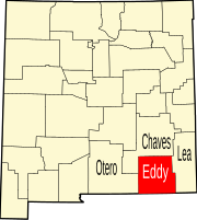 | |
| Villages | ||
| CDPs | ||
| Unincorporated communities | ||
| International | |
|---|---|
| National | |