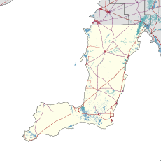
| Pine Point South Australia | |||||||||||||||
|---|---|---|---|---|---|---|---|---|---|---|---|---|---|---|---|
 Beachside shacks at Pine Point | |||||||||||||||
| Coordinates | 34°34′05″S 137°52′56″E / 34.5681°S 137.8822°E | ||||||||||||||
| Population | 88 (SAL 2021)[1] | ||||||||||||||
| Established | 24 January 1884 (town) May 1999 (locality)[2][3] | ||||||||||||||
| Postcode(s) | 5571 | ||||||||||||||
| LGA(s) | Yorke Peninsula Council | ||||||||||||||
| Region | Yorke and Mid North[4] | ||||||||||||||
| County | Fergusson[3] | ||||||||||||||
| State electorate(s) | Narungga[5] | ||||||||||||||
| Federal division(s) | Grey[6] | ||||||||||||||
| |||||||||||||||
| Footnotes | Adjoining localities[3] | ||||||||||||||
Pine Point (formerly Muloowurtie) is a locality in the Australian state of South Australia on the east side of Yorke Peninsula adjacent to Gulf St Vincent. It was surveyed as a government town in 1883 and proclaimed under the name of Muloowurtie on 24 January 1884.[2] The name was changed to Pine Point in 1940. The boundaries of the locality were created in May 1999 in respect to the "long established name" and includes both "the Pine Point Shack Site" and " the Government Town of Pine Point."[3][7]
YouTube Encyclopedic
-
1/3Views:9428791 162
-
Opening of the Corny Point Memorial Hall, Yorke Peninsula, South Australia
-
Black Point Getaway
-
Lower Yorke Peninsula SA
Transcription
See also
References
- ^ Australian Bureau of Statistics (28 June 2022). "Pine Point (suburb and locality)". Australian Census 2021 QuickStats. Retrieved 28 June 2022.
- ^ a b Bray, J.C. (24 January 1884). "Unnamed proclamation re Town of Muloowurtie" (PDF). The South Australian Government Gazette. Government of South Australia. p. 293. Retrieved 7 May 2019.
- ^ a b c d "Search result for " Pine Point (LOCB)" (Record no SA0055369) with the following layers selected – "Suburbs and Localities", "Counties" and " Place names (gazetteer)"". Property Location Browser. Government of South Australia. Archived from the original on 12 October 2016. Retrieved 7 November 2016.
- ^ "Yorke and Mid North SA Government region" (PDF). The Government of South Australia. Retrieved 28 April 2017.
- ^ Narungga (Map). Electoral District Boundaries Commission. 2016. Retrieved 1 March 2018.
- ^ "Federal electoral division of Grey" (PDF). Australian Electoral Commission. Retrieved 24 July 2015.
- ^ "NEW TOWN NAMES APPROVED". The Chronicle. Vol. LXXXIII, no. 4, 728. Adelaide. 1 August 1940. p. 13. Retrieved 31 August 2016 – via National Library of Australia.
External links
![]() Media related to Pine Point, South Australia at Wikimedia Commons
Media related to Pine Point, South Australia at Wikimedia Commons

