| Arthurton South Australia | |||||||||||||||
|---|---|---|---|---|---|---|---|---|---|---|---|---|---|---|---|
| Coordinates | 34°15′38″S 137°45′15″E / 34.26062°S 137.754196°E[1] | ||||||||||||||
| Population | 157 (SAL 2021)[2] | ||||||||||||||
| Established | 25 January 1877 (town) 27 May 1999 (locality)[3][1] | ||||||||||||||
| Time zone | ACST (UTC+9:30) | ||||||||||||||
| • Summer (DST) | ACDT (UTC+10:30) | ||||||||||||||
| LGA(s) | Yorke Peninsula Council | ||||||||||||||
| Region | Yorke and Mid North[4] | ||||||||||||||
| County | Daly[1] | ||||||||||||||
| State electorate(s) | Narungga[5] | ||||||||||||||
| Federal division(s) | Grey[6] | ||||||||||||||
| |||||||||||||||
| Footnotes | Adjoining localities[1] | ||||||||||||||
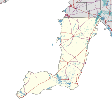
Arthurton is a town and locality in the Australian state of South Australia.
Arthurton was established on 25 January 1877.[3][1] It was named after Arthur, the son of South Australian Governor Anthony Musgrave,[1] who insisted on this name after it had already been named "Kalkabury".[8]
See also
References
- ^ a b c d e f "Search results for "Arthurton, LOCB" with the following datasets selected – 'Suburbs and localities', 'Counties', 'Government Towns', 'Hundreds', 'Local Government Areas', 'SA Government Regions' and 'Gazetteer'". Location SA Map Viewer. Government of South Australia. Retrieved 7 May 2019.
- ^ Australian Bureau of Statistics (28 June 2022). "Arthurton (suburb and locality)". Australian Census 2021 QuickStats. Retrieved 28 June 2022.
- ^ a b Musgrave Jun., A. (25 January 1877). "Untitled proclamation re the Township of Arthurton" (PDF). The South Australian Government Gazette. Government of South Australia. p. 168. Retrieved 7 May 2019.
- ^ "Yorke and Mid North SA Government region" (PDF). The Government of South Australia. Retrieved 17 April 2017.
- ^ Narungga (Map). Electoral District Boundaries Commission. 2016. Retrieved 1 March 2018.
- ^ "Federal electoral division of Grey" (PDF). Australian Electoral Commission. Retrieved 24 July 2015.
- ^ a b c Bureau of Meteorology max
- ^ "Manning index of place names". State Library of South Australia. Retrieved 22 June 2015.

