| Honiton South Australia | |||||||||||||||
|---|---|---|---|---|---|---|---|---|---|---|---|---|---|---|---|
| Coordinates | 35°06′13″S 137°38′51″E / 35.10357528°S 137.64753204°E | ||||||||||||||
| Population | 46 (SAL 2021)[1] | ||||||||||||||
| Established | 1999[2] | ||||||||||||||
| Postcode(s) | 5576 [3] | ||||||||||||||
| Time zone | ACST (UTC+9:30) | ||||||||||||||
| • Summer (DST) | ACST (UTC+10:30) | ||||||||||||||
| Location |
| ||||||||||||||
| LGA(s) | Yorke Peninsula Council | ||||||||||||||
| Region | Yorke and Mid North[4] | ||||||||||||||
| County | Fergusson[2] | ||||||||||||||
| State electorate(s) | Narungga[5] | ||||||||||||||
| Federal division(s) | Grey[6] | ||||||||||||||
| |||||||||||||||
| |||||||||||||||
| Footnotes | Distances[3] Coordinates[2] Climate[7] Adjoining localities[2] | ||||||||||||||
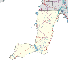
Honiton is a locality in the Australian state of South Australia located on the south coast of Yorke Peninsula immediately adjoining Investigator Strait about 89 kilometres (55 miles) west of the state capital of Adelaide and about 5 kilometres (3.1 miles) west of the Edithburgh town centre.[3][2]
Its boundaries were created in May 1999. The name derives from the former government town of Honiton which was proclaimed on 27 April 1876, which ceased on 26 September 1982 and whose site is within the locality’s extent. The former government town’s name itself is reported as being derived from Honiton, a town located in Devonshire, England.[2][8]
Honiton’s coastal boundary with Investigator Strait includes coastal features such as Troubridge Hill and Troubridge Point.[2] The area was known as Troubridge in 1871 when the land was first released for farming before the town of Honiton was surveyed in August 1874.[9]
The former government town was located in section 376 in the Hundred of Melville which was sub-divided by the surveyor, James W. Jones in 1874. A school was opened in 1874 under the name "Diamond Lake" which was the informal name used for part of the locality. The school was renamed as “Honiton” in 1891 and was closed in 1942.[8] The locality contains two sites listed on the South Australian Heritage Register - the Lake Fowler Salt Works on Lake Fowler Road and a length of dry stone walling that is located to one side of New Honiton Road, Goldsmith Beach Road and two other roads.[10][11]
As of 2014, the majority land use within the locality is “primary production."[2][12]
Honiton is located within the federal division of Grey, the state electoral district of Narungga and the local government area of the Yorke Peninsula Council.[2][5][6] The current federal representative is Liberal MP Rowan Ramsey.
YouTube Encyclopedic
-
1/3Views:61 573541922
-
Devon whirlwind
-
Willochra Creek
-
Turf Suppliers in Devon
Transcription
See also
References
- ^ Australian Bureau of Statistics (28 June 2022). "Honiton (suburb and locality)". Australian Census 2021 QuickStats. Retrieved 28 June 2022.
- ^ a b c d e f g h i "Search result for "Honiton (Locality Bounded)" (Record no SA0030994) with the following layers selected - "Suburbs and Localities", "County", "Hundred", "Place names (gazetteer)", "Road Labels" and "Development Plan Layers"". Department of Planning, Transport and Infrastructure. Archived from the original on 12 October 2016. Retrieved 19 February 2016.
- ^ a b c "Honiton, South Australia (Postcode)". postcodes-australia.com. Retrieved 19 February 2016.
- ^ "Yorke and Mid North SA Government region" (PDF). The Government of South Australia. Retrieved 17 April 2017.
- ^ a b Narungga (Map). Electoral District Boundaries Commission. 2016. Retrieved 1 March 2018.
- ^ a b "Federal electoral division of Grey" (PDF). Australian Electoral Commission. Retrieved 24 July 2015.
- ^ "Summary statistics EDITHBURGH". Commonwealth of Australia , Bureau of Meteorology. Retrieved 19 February 2016.
- ^ a b Manning, G.H. "Honiton". State Library of South Australia. Retrieved 21 February 2016.
- ^ "GOVERNMENT REGULATIONS". The Irish Harp And Farmers' Herald. Vol. III, no. 97. South Australia. 1 April 1871. p. 10. Retrieved 1 July 2017 – via National Library of Australia.
- ^ "Lake Fowler Salt Works Site". Department of Environment Water and Natural Resources. 11 November 1999. Archived from the original on 4 March 2016. Retrieved 22 February 2016.
- ^ "Dry Stone Walling". Department of Environment Water and Natural Resources. 11 November 1999. Archived from the original on 4 March 2016. Retrieved 22 February 2016.
- ^ "Development Plan - Yorke Peninsula Council" (PDF). Department of Planning, Transport and Infrastructure. pp. 230, 232, 290 & 293. Archived from the original (PDF) on 4 June 2015. Retrieved 24 July 2015.

