

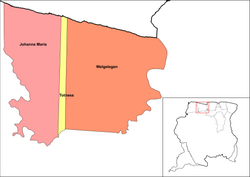
Welgelegen is a resort in Suriname, located in the Coronie District. Its population at the 2012 census was 593.[1] Welgelegen started as a cotton plantation in 1824.[2] The church of Welgelegen was consecrated on 1 November 1883, but wasn't built at the spot. It was first erected on Cardross Park, and later moved to its current location. The church is no longer in service.[3]
The villages of Jenny and Mary's Hope are also located in the Welgelegen resort.
Peruvia Nature Reserve
The Peruvia Nature Reserve was founded in 1986.[4] It is located near the mouth of the Coppename River, and covers an area of 31,000 hectares.[5] The reserve contains moriche palms, Sandbox tree forests, and is home to the Blue-and-yellow macaw.[4]
References
- ^ a b "Resorts in Suriname Census 2012" (PDF). Retrieved 19 May 2020.
- ^ "Plantage Welgelegen (Kust in Coronie)". Suriname Plantages (in Dutch). Retrieved 21 May 2020.
- ^ "Welgelegen". Coronie.nl (in Dutch). Retrieved 21 May 2020.
- ^ a b "Natuur" (in Dutch). Retrieved 22 May 2020.
- ^ "STRUCTUUR ANALYSE DISTRICTEN 2009-2013" (PDF). Planning Office Suriname (in Dutch). Retrieved 22 May 2020.
External links
This Suriname location article is a stub. You can help Wikipedia by expanding it. |
| Brokopondo District |  | |
|---|---|---|
| Commewijne District | ||
| Coronie District | ||
| Marowijne District | ||
| Nickerie District | ||
| Para District | ||
| Paramaribo District | ||
| Saramacca District | ||
| Sipaliwini District | ||
| Wanica District | ||
 | ||
5°52′36″N 56°19′50″W / 5.87659°N 56.3306°W