
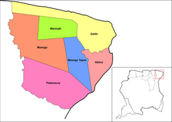
Patamacca is a resort in Suriname, located in the Marowijne District. Its population at the 2012 census was 427. Patamacca is a tribal area inhabited by Maroons[1]
In 1773, attempts were made to conquer the Patamacca territory by the Society of Suriname, but did not yield results, and the area was left in the hands of the Maroons.[2]
The main economic activity in the Patamacca area was the palm oil industry,[3] During the 1960s[4] Bruynzeel started a large-scale wood plantation in the resort.[5] There is a large granite mine in the resort which is operated by Grassalco.[6] Even though Patamacca did not bear much destruction during the Surinamese Interior War, the civil war did result in refugees, and stopped much of the industry.[4] As of 2019, attempts have been made to restart the palm oil industry with Chinese aid.[7]
The village of Ovia Olo is located in the resort.[8]
YouTube Encyclopedic
-
1/1Views:637
-
INFO ACT 4 5 2017 HERWAARDING PRES 4 KINDEREN SOMBRA HONGERSTAKING BRIBI UPDATE PATAMAKKA HD
Transcription
References
- ^ a b "Resorts in Suriname Census 2012" (PDF). Retrieved 21 May 2020.
- ^ "Geschiedenis Van Suriname" (in Dutch). 1861. Retrieved 21 May 2020.
- ^ "Suriname palm-oil industry may rise again after setbacks". The Caribbean Radio. Retrieved 21 May 2020.
- ^ a b "Distrikt Marowijne 2". Suriname.nu (in Dutch). Retrieved 21 May 2020.
- ^ "HUMAN INTERFERENCE IN THE TROPICAL RAINFOREST ECOSYSTEM". Anton de Kom University via Wageningen University. Retrieved 21 May 2020.
- ^ "Grassalco N.V. Ons bedrijf". Grassalco (in Dutch). Retrieved 21 May 2020.
- ^ "PALMOLIE OF ORDINAIRE HOUTROOF?". Dagblad De West. 8 June 2019. Retrieved 21 May 2020.
- ^ Plan Bureau (2014). "Planning Office Suriname - Districts 2009-2013" (PDF). Planning Office Suriname (in Dutch). p. 114.
| Brokopondo District |  | |
|---|---|---|
| Commewijne District | ||
| Coronie District | ||
| Marowijne District | ||
| Nickerie District | ||
| Para District | ||
| Paramaribo District | ||
| Saramacca District | ||
| Sipaliwini District | ||
| Wanica District | ||
5°25′23″N 54°30′07″W / 5.423°N 54.502°W
This Suriname location article is a stub. You can help Wikipedia by expanding it. |