
Notre-Dame-des-Prairies | |
|---|---|
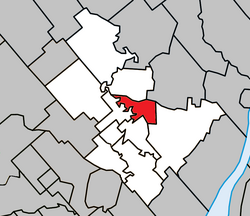 Location within Joliette RCM. | |
 Notre-Dame-des-Prairies Location in central Quebec. | |
| Coordinates: 46°03′N 73°26′W / 46.050°N 73.433°W[1] | |
| Country | |
| Province | |
| Region | Lanaudière |
| RCM | Joliette |
| Constituted | January 1, 1957 |
| Government | |
| • Mayor | Suzanne Dauphin |
| • Federal riding | Joliette |
| • Prov. riding | Joliette |
| Area | |
| • Total | 18.80 km2 (7.26 sq mi) |
| • Land | 18.20 km2 (7.03 sq mi) |
| Population (2016)[3] | |
| • Total | 9,273 |
| • Density | 509.4/km2 (1,319/sq mi) |
| • Pop 2011-2016 | |
| • Dwellings | 4,396 |
| Time zone | UTC−5 (EST) |
| • Summer (DST) | UTC−4 (EDT) |
| Postal code(s) | |
| Area code(s) | 450 and 579 |
| Highways | |
| Website | www |
Notre-Dame-des-Prairies is a town in the Lanaudière region of Quebec, Canada, part of the Joliette Regional County Municipality. It is a suburb of Joliette, located along the eastern shores of the L'Assomption River.
History
In 1950, the Parish of Notre-Dame-des-Prairies was established. The name refers to the prairies or planes of the Saint-Lawrence Lowlands that characterize the landscape. In 1957, the municipality was formed by separating from the Parish Municipality of Saint-Charles-Borromée-du-Village-d'Industrie. In 2005, the municipality changed statutes and became the City of Notre-Dame-des-Prairies.[4]
Demographics
In the 2021 Census of Population conducted by Statistics Canada, Notre-Dame-des-Prairies had a population of 9,471 living in 4,446 of its 4,547 total private dwellings, a change of 2.1% from its 2016 population of 9,273. With a land area of 18.1 km2 (7.0 sq mi), it had a population density of 523.3/km2 (1,355.2/sq mi) in 2021.[5]
Population trend:[6]
- Population in 2016: 9273 (2011 to 2016 population change: 4.6%)
- Population in 2011: 8868 (2006 to 2011 population change: 7.8%)
- Population in 2006: 8230
- Population in 2001: 7316
- Population in 1996: 6837
- Population in 1991: 6465
Mother tongue:
- English as first language: 0.6%
- French as first language: 97.6%
- English and French as first language: 0%
- Other as first language: 1.8%
Education
Commission scolaire des Samares operates francophone public schools, including:
The Sir Wilfrid Laurier School Board operates anglophone public schools, including:
- Joliette Elementary School in Saint-Charles-Borromée[9]
- Joliette High School in Joliette[10]
See also
References
- ^ "Banque de noms de lieux du Québec: Reference number 388194". toponymie.gouv.qc.ca (in French). Commission de toponymie du Québec.
- ^ a b "Répertoire des municipalités: Geographic code 61030". www.mamh.gouv.qc.ca (in French). Ministère des Affaires municipales et de l'Habitation.
- ^ a b Statistics Canada 2016 Census - Notre-Dame-des-Prairies census profile
- ^ "Notre-Dame-des-Prairies (Ville)" (in French). Commission de toponymie du Québec. Retrieved 2009-10-09.
- ^ "Population and dwelling counts: Canada, provinces and territories, and census subdivisions (municipalities), Quebec". Statistics Canada. February 9, 2022. Retrieved August 29, 2022.
- ^ Statistics Canada: 1996, 2001, 2006, 2011, 2016 census
- ^ "des Prairies (pavillon Dominique-Savio) Archived 2017-09-23 at the Wayback Machine." Commission scolaire des Samares. Retrieved on September 23, 2017.
- ^ "des Prairies (pavillon Monseigneur-Jetté) Archived 2017-09-23 at the Wayback Machine." Commission scolaire des Samares. Retrieved on September 23, 2017.
- ^ "JOLIETTE ELEMENTARY ZONE." Sir Wilfrid Laurier School Board. Retrieved on September 17, 2017.
- ^ "Joliette High School Zone Sec 1-5." Sir Wilfrid Laurier School Board. Retrieved on September 5, 2017.
Adjacent Municipal Subdivisions | ||||||||||||||||
|---|---|---|---|---|---|---|---|---|---|---|---|---|---|---|---|---|
| ||||||||||||||||
| Cities & Towns | |
|---|---|
| Municipalities | |
| Villages | |
| |
| International | |
|---|---|
| National | |