
Newton Lower Falls, Massachusetts | |
|---|---|
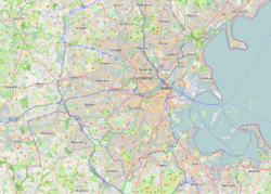
Village | |
 Lower Falls Wine Company | |
 Newton Lower Falls  Newton Lower Falls  Newton Lower Falls | |
| Coordinates: 42°20′N 71°15′W / 42.333°N 71.250°W | |
| Country | |
| State | Massachusetts |
| County | Middlesex |
| City | Newton |
| Elevation | 90 m (300 ft) |
| Time zone | UTC-5 (Eastern (EST)) |
| • Summer (DST) | UTC-4 (EDT) |
| ZIP Code |
|
| Area code | 617 |
Newton Lower Falls, Massachusetts is one of the thirteen villages within the city of Newton in Middlesex County, Massachusetts, United States. The commercial area extends across the river into Wellesley, Massachusetts, where it is known as Wellesley Lower Falls, where a majority of the retail businesses are.
The Charles River drops 18 feet over less than a quarter-mile at Lower Falls. A series of three small dams with fish ladders are located along the drop. The primary roads through the village of Lower Falls are Grove Street, Washington Street (Route 16), and Concord Street. The area is now a suburban neighborhood centered on the park at the old Hamilton elementary school (now Lower Falls Community Center), and bordered on the northwest by the Charles River and the Leo J. Martin public golf course.[1] The historic heart of the Lower Falls village, St. Mary's Episcopal Church, and the adjacent residential area on Grove Street, are listed on the National Register of Historic Places as the Newton Lower Falls Historic District.
YouTube Encyclopedic
-
1/1Views:514
-
Newton Canyon Falls 2010 Lower Falls (California, Santa Monica Mountains)
Transcription
Notable people
- Thomas Wilmer Dewing (1851–1938), a famous painter[2]
- Sarah Fuller, educator and author who taught Helen Keller[3]
- Arthur T. Gregorian, Oriental rug merchant[citation needed]
- Walter Montgomery Jackson (1863–1923), founder of encyclopedia publisher Grolier[citation needed]
- Kay Khan, Massachusetts state representative[3]
- Anne Sexton, poet[3]
- Michael Rosbash, Nobel Prize winner[3]
- Francis Blake (inventor), who worked with Alexander Graham Bell[3]
Attractions
Historic landmarks
- William Curtis House (Newton, Massachusetts), 2330 Washington St.
- Newton-Wellesley Hospital, 2014 Washington St. The hospital's campus is listed on the National Register of Historic Places as the "Newton Cottage Hospital Historic District".[4]
- Newton Lower Falls Historic District
Other
- Hamilton Playground (aka Lower Falls Community Center), 545 Grove St. The playground has two hard-surface tennis courts,[5] plus a baseball field, basketball courts, a soccer field, and a softball field.[6]
References
- ^ "Newton Lower Falls". www.newtonlowerfalls.org. Retrieved November 26, 2017.
- ^ "Thomas Wilmer Dewing". National Gallery of Art. Archived from the original on December 23, 2017. Retrieved January 26, 2024.
- ^ a b c d e "Newton Lower Falls Improvement Association - The History of Lower Falls". newtonlowerfalls.org. Archived from the original on August 10, 2020. Retrieved January 25, 2024.
- ^ Shea, Deborah; Jenkins, Candace; Abele, Susan (1988). "FORM A - AREA" (PDF). mhc-macris.net. Retrieved January 25, 2024.
- ^ "Sports: Participatory". The Boston Phoenix. June 4, 1985. p. 30. Retrieved January 25, 2024.
- ^ "Facility Directory Standard Map | City of Newton, MA". www.newtonma.gov. Retrieved January 25, 2024.
External links
| International | |
|---|---|
| National | |
Municipalities and communities of Middlesex County, Massachusetts, United States | ||
|---|---|---|
| Cities |  | |
| Towns |
| |
| CDPs | ||
| Other villages |
| |
| Footnotes | ‡This populated place also has portions in an adjacent county or counties | |
This Middlesex County, Massachusetts geography–related article is a stub. You can help Wikipedia by expanding it. |