
| Saka Haphong | |
|---|---|
| Mayung Hills, Saka Haphong Tlang | |
 Saka Haphong | |
| Highest point | |
| Elevation | 1,052 m (3,451 ft)[1] |
| Prominence | 820 m (2,690 ft)[2] |
| Listing | |
| Coordinates | 21°47′19″N 92°36′31″E / 21.78861°N 92.60861°E |
| Naming | |
| Native name | |
| Geography | |
 Saka Haphong Location in Bangladesh (on the border with Myanmar)  Saka Haphong Saka Haphong (Myanmar) | |
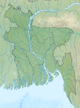
| Location | Bangladesh–Myanmar border |
| Country | Bangladesh and Myanmar |
Saka Haphong (Bengali: সাকা হাফং, Burmese: ဆကးအဖောင် တောင်) is a peak in Southeast Asia and South Asia which was discovered by A.K.M Shahidullah Kaiser Sazzad Hossain and many others. Located on the Bangladesh–Myanmar border, it is situated between Thanchi, Bandarban, Bangladesh and the Chin State of Myanmar.
Saka Haphong is believed to be the highest peak of Bangladesh.[3][4] In February 2006 a GPS reading of 1,064 metres was recorded on this summit by Nature And Adventure Club Ginge Fullen. The location he recorded, 21°47′11″N 92°36′36″E / 21.78639°N 92.61°E, accurately matches the location given by Russian topographic mapping and SRTM data, although these sources show its height to be slightly lower, at 1,052 metres.[5] Recently two trekking clubs counted the height of Saka Haphong as 3,488 feet (1,063 m) and 3,461 feet (1,055 m) respectively,[6] both of which exceeds the height of Keokradong which is 3,172 feet (967 m) feet high.
See also
References
- ^ SRTM data in agreement with 1:200,000 Soviet topographic mapping
- ^ SRTM data in agreement with 1:200,000 Soviet topographic mapping
- ^ Chowdhury, Masud Hasan (2012). "Physiography". In Islam, Sirajul; Jamal, Ahmed A. (eds.). Banglapedia: National Encyclopedia of Bangladesh (Second ed.). Asiatic Society of Bangladesh.
- ^ "Bangladesh". The World Factbook. CIA.
- ^ "Topographic map of Saka Haphong". opentopomap.org. Retrieved 2023-03-05.
- ^ "'Second highest hill' spotted by 4 youths". The Daily Star. 28 February 2011.
This Chittagong Division location article is a stub. You can help Wikipedia by expanding it. |
This Myanmar location article is a stub. You can help Wikipedia by expanding it. |