
| Keokradong | |
|---|---|
 Keokradong | |
| Highest point | |
| Elevation | 986 m (3,235 ft) |
| Prominence | 400 m (1,300 ft)[1] |
| Listing | List of mountains of Bangladesh |
| Coordinates | 21°56′59″N 92°30′51″E / 21.94972°N 92.51417°E |
| Geography | |
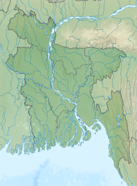 Keokradong Location in Bangladesh, near the border with Myanmar | |
| Location | Ruma Upazila, Bandarban |
| Geology | |
| Mountain type | Mountain |
Keokradong (Bengali: কেওক্রাডং) is a peak located in Bandarban, Bangladesh, with an elevation of 986 metres (3,235 ft).[2] Some sources claim it as the highest point of Bangladesh.
On the top of Keokradong there is a small shelter and a signboard put up by Bangladesh Army proclaiming the elevation to be 967 metres (3,173 ft).
Height measured by handheld GPS shows it is 986 metres (3,235 ft) with 3m accuracy.[3]
There is a controversy about the highest point of Bangladesh, and some sources indicate Saka Haphong as the most elevated peak of the country.[4] However, Tazing Dong is officially recognized as the highest point of Bangladesh.
Keokradong is a popular tourist attraction in Bangladesh for mountaineers.[5] Keokradong is one of the cloudiest places in Bangladesh.
YouTube Encyclopedic
-
1/3Views:375 36229 6845 236
-
মেঘে ঢাকা কেওক্রাডং - বাংলাদেশের সবচেয়ে সুন্দর পাহাড় চূড়া । Keokradong । Bandarban । Ruma Ep.5
-
Amazing Keokradong | Bandarban Tour | Trek to Keokradong Part 2 | Boga Lake to Keokradong |
-
Dhaka to Boga Lake । Keokradong Tour । Part-1 । Boga Lake । কেওক্রাডং ভ্রমণ সিরিজ | ১ম পর্ব
Transcription
Gallery
-
 Eastern face of Keokradong
 -
 Panorama from the top of Keokradong.
 -
 Keokradong Milestone
See also
Notes
- ^ SRTM data
- ^ Elevation extremes, CIA: the World Factbook.
- ^ Keokradong, Banglatrek Archived 2011-07-25 at the Wayback Machine, Banglatrek.org.
- ^ "Mowdok Mual, Bangladesh". Peakbagger.com.
- ^ "A Hiker's Guide to Keokradong". The Daily Star. 2016-03-17. Retrieved 2020-08-21.
This Chittagong Division location article is a stub. You can help Wikipedia by expanding it. |