
Lost Creek Township | |
|---|---|
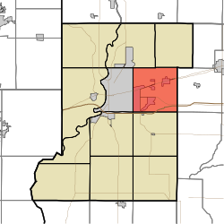 Location in Vigo County | |
| Coordinates: 39°28′38″N 87°17′40″W / 39.47722°N 87.29444°W | |
| Country | United States |
| State | Indiana |
| County | Vigo |
| Government | |
| • Type | Indiana township |
| Area | |
| • Total | 35.77 sq mi (92.6 km2) |
| • Land | 35.23 sq mi (91.2 km2) |
| • Water | 0.54 sq mi (1.4 km2) 1.51% |
| Elevation | 564 ft (172 m) |
| Population | |
| • Total | 11,199 |
| • Density | 297.9/sq mi (115.0/km2) |
| ZIP codes | 47803, 47805, 47834 |
| GNIS feature ID | 453581 |
Lost Creek Township is one of twelve townships in Vigo County, Indiana, United States. As of the 2010 census, its population was 10,497 and it contained 4,236 housing units.[2] It contains Terre Haute, Indiana's eastern, suburban end, along with the affluent Hulman family ranch and the Terre Haute International Airport originally named after the family. Seelyville, the third largest city in the county, is also located there.
YouTube Encyclopedic
-
1/1Views:1 784
-
Flooding Footage - Riley, Indiana - Honey Creek
Transcription
History
Lost creek township was founded in 1831
Vigo County Home for Dependent Children was listed on the National Register of Historic Places in 2000.[3]
Geography
According to the 2010 census, the township has a total area of 35.77 square miles (92.6 km2), of which 35.23 square miles (91.2 km2) (or 98.49%) is land and 0.54 square miles (1.4 km2) (or 1.51%) is water.[2]
Cities, towns, villages
- Seelyville
- Terre Haute (east side)
Unincorporated communities
Adjacent townships
- Nevins Township (northeast)
- Posey Township, Clay County (east)
- Perry Township, Clay County (southeast)
- Riley Township (south)
- Honey Creek Township (southwest)
- Harrison Township (west)
- Otter Creek Township (northwest)
Cemeteries
The township contains at least these sixteen named cemeteries: Baker-Coltrin, Babtist-Moses, Calvary, Chamberlain, Cheek, Dickerson, Highland Lawn, Hobmeyer-Trueblood-Ladd-Habermeyer, Hoskins, Hyde, Mewhinney, Patterson, Roberts, Swalls, Turner-Shcolfield, and Wood. As well as at least four unnamed family plots.
Airports and landing strips
- Hulman Field
Lakes/ Reservoirs
- Hulmans Lake
- Llewellyn Lake
- Maple Avenue Lake
- Dobbs Lake
- Thompson Lake
- Hulman Street Reservoir (Majority)
Housing Developments
- Terre Vista
- Lincolnshire/ Woodshire
- Village Quarter
- Watertree
- Wyndham
- Phoenix Hills
- Robinwood
- Hawthorn Woods
- Deming Estates
- Eastland
- Chamberlain Heights
- Huntington Estates
- Sycamore Terrace
- Woodridge
Demographics
According to the census[4] of 2000, there were 9,907 people and 3,968 households residing in the township. In the 2020 census, a recorded 11,199 people lived in Lost Creek township, showing a 13% increase from 2000. The population density was 281/mi2. The racial makeup of the township is 86.91% White, 2.61% Black or African American, 0.19% Native American, 4.42% Asian, less than 0.1% Pacific Islander, 0.91% from other races, and 4.97% from two or more races. 2.96% of the population were Hispanic or Latino of any race.
The average household size was 2.44 and the average family size was 2.98. The median age was 34.3 years. For every 100 females, there were 113 males.
The median income for a household in the township was $81,198, and the median income for a family was $109,358. The per capita income for the township was $43,000. 12.2% of the population was below the poverty line.
43.2% of the population has a bachelor's degree or higher, with 19% of the population having a graduate degree and 20.7% having no college education and 22.5% having some form of college education but no degree.
4.9% of the school-enrolled population is enrolled in Nursery School/ Preschool, 38.9% is enrolled in kindergarten to 12th Grade,5.8% is enrolled in graduate degree courses, and 50.4% of the school population is enrolled in undergraduate college courses.
57.4% of the population is employed, and the most common employment is Educational Services, Healthcare, and Social Services.
School districts
Political districts
- Indiana's 8th congressional district
- State House District 43
- State Senate District 38
Notable people
- Al Barker, baseball player
References
- United States Census Bureau 2007 TIGER/Line Shapefiles
- United States Board on Geographic Names (GNIS)
- IndianaMap
- ^ "Census Bureau profile: Lost Creek Township, Vigo County, Indiana". United States Census Bureau. May 2023. Retrieved March 21, 2024.
- ^ a b "Population, Housing Units, Area, and Density: 2010 - County -- County Subdivision and Place -- 2010 Census Summary File 1". United States Census. Archived from the original on February 10, 2020. Retrieved May 10, 2013.
- ^ "National Register Information System". National Register of Historic Places. National Park Service. July 9, 2010.
- ^ "U.S. Census website". United States Census Bureau. Retrieved January 31, 2008.
External links
Municipalities and communities of Vigo County, Indiana, United States | ||
|---|---|---|
| City |  | |
| Towns | ||
| Townships | ||
| CDPs | ||
| Other communities |
| |
| Footnotes | ‡This populated place also has portions in an adjacent county or counties | |