
Toad Hop, Indiana | |
|---|---|
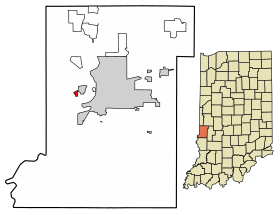 Location of Toad Hop in Vigo County, Indiana. | |
| Coordinates: 39°27′32″N 87°27′49″W / 39.45889°N 87.46361°W | |
| Country | United States |
| State | Indiana |
| County | Vigo |
| Township | Sugar Creek |
| Area | |
| • Total | 0.21 sq mi (0.55 km2) |
| • Land | 0.21 sq mi (0.55 km2) |
| • Water | 0.00 sq mi (0.00 km2) |
| Elevation | 469 ft (143 m) |
| Population (2020) | |
| • Total | 104 |
| • Density | 490.57/sq mi (189.46/km2) |
| Time zone | UTC-5 (Eastern (EST)) |
| • Summer (DST) | UTC-4 (EDT) |
| ZIP code | 47885 |
| Area code(s) | 812, 930 |
| GNIS feature ID | 444789 |
Toad Hop is an unincorporated census-designated place in Sugar Creek Township, Vigo County, in the U.S. state of Indiana.[3] It is officially part of West Terre Haute. In 2010, Toad Hop was a census designated place.[4] It is part of the Terre Haute metropolitan area.
YouTube Encyclopedic
-
1/3Views:135 1176 16197 108
-
Top 10 TV Sitcoms That Go To Walt Disney World & Disneyland
-
David Paulides 2017 - Missing 411 November 15, 2017 | New
-
Disney's Wilderness Lodge Resort, an Undercover Tourist Photo Album
Transcription
Name origin
The origin of the name Toad Hop is deeply rooted in legend. One explanation is that the town was laid out on a swampy field, and the abundance of toads and frogs hopping around inspired the name.[5]
Geography
Toad Hop is located at 39°27′32″N 87°27′49″W / 39.45889°N 87.46361°W at an elevation of 476 feet. This is the mostly wooded area between the I-70 exit (Darwin Road) and US 40.
Demographics
| Census | Pop. | Note | %± |
|---|---|---|---|
| 2010 | 108 | — | |
| 2020 | 104 | −3.7% | |
| U.S. Decennial Census[6] | |||
As of the 2010 Census, 108 people lived in Toad Hop. 107 residents were White and 1 was of two or more races. The median age was 40 years old.[7]
References
- ^ "2020 U.S. Gazetteer Files". United States Census Bureau. Retrieved March 16, 2022.
- ^ "US Board on Geographic Names". United States Geological Survey. October 25, 2007. Retrieved July 13, 2016.
- ^ "Toad Hop, Indiana". Geographic Names Information System. United States Geological Survey, United States Department of the Interior. Retrieved June 24, 2010.
- ^ "Toad Hop Census Designated Place". Geographic Names Information System. United States Geological Survey, United States Department of the Interior. Retrieved June 24, 2010.
- ^ Baker, Ronald L. (October 1995). From Needmore to Prosperity: Hoosier Place Names in Folklore and History. Indiana University Press. p. 325. ISBN 978-0-253-32866-3.
...toads hopping and frogs jumping, and hence the name Toad Hop.
- ^ "Census of Population and Housing". Census.gov. Retrieved June 4, 2016.
- ^ "U.S. Census website". census.gov. United States Census Bureau. Retrieved January 26, 2020.
Municipalities and communities of Vigo County, Indiana, United States | ||
|---|---|---|
| City |  | |
| Towns | ||
| Townships | ||
| CDPs | ||
| Other communities |
| |
| Footnotes | ‡This populated place also has portions in an adjacent county or counties | |
This Vigo County, Indiana location article is a stub. You can help Wikipedia by expanding it. |