
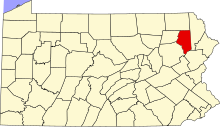
This is a list of the Pennsylvania state historical markers in Lackawanna County.
This is intended to be a complete list of the official state historical markers placed in Lackawanna County, Pennsylvania by the Pennsylvania Historical and Museum Commission (PHMC). The locations of the historical markers, as well as the latitude and longitude coordinates as provided by the PHMC's database, are included below when available. There are 32 historical markers located in Lackawanna County.[1]
Historical markers
| Marker title | Image | Date dedicated | Location | Marker type | Topics |
|---|---|---|---|---|---|
| Pioneer, The | July 15, 1948 | Nay Aug Park at railroad car (on "road" across from Vine St., near Arthur Ave., behind Everhart Mus.), Scranton 41°24′03″N 75°38′37″W / 41.40078°N 75.6435°W |
Roadside | Railroads, Transportation | |
| 1902 Anthracite Coal Strike | October 25, 2002 | Courthouse Square, Scranton |
Roadside | Coal, Government & Politics 20th Century, Labor | |
| Anthracite Mine Disaster | October 23, 1994 | In front of Throop Borough Bldg., Charles St. & Sanderson Ave., Throop 41°26′46″N 75°37′13″W / 41.44598°N 75.62039°W |
Roadside | Business & Industry, Coal, Government & Politics 20th Century, Labor | |
| Capoose | December 2, 1947 | 1030 Providence Rd., at Diamond St., West Scranton 41°25′32″N 75°39′59″W / 41.42548°N 75.66625°W |
Roadside | Early Settlement, Native American | |
| Carbondale | June 19, 1947 | 60 S Main St. (Bus. 6), at Housing Authority, Carbondale 41°34′11″N 75°30′12″W / 41.56963°N 75.50335°W |
Roadside | Cities & Towns, Coal | |
| Carbondale | June 19, 1947 | #5 6th Ave., at City Hall (6th Ave. side), Carbondale 41°34′20″N 75°30′11″W / 41.57225°N 75.50316°W |
Roadside | Cities & Towns, Coal | |
| Carbondale | November 12, 1947 | 208 Fallbrook St. (PA 106), next to guard rail, N end of Carbondale 41°34′59″N 75°30′46″W / 41.58317°N 75.51279°W |
Roadside | Cities & Towns, Coal | |
| Coal Miners' and Laborers' Strike | 
|
August 3, 2008 | SW corner of Lackawanna & Washington Aves., downtown Scranton |
City | Coal, Government & Politics 19th Century, Labor |
| Elder Miller | September 14, 1948 | 1214 N Abington Rd. (PA 407), at PA 632, Waverly 41°31′41″N 75°42′18″W / 41.52798°N 75.7051°W |
Roadside | Early Settlement, Education, Religion | |
| First Aid Pioneer | November 8, 1947 | Bus. US 6 & PA 107, near bridge next to guardrail, Jermyn 41°32′03″N 75°33′07″W / 41.53406°N 75.55189°W |
Roadside | Business & Industry, Coal, Medicine & Science, Professions & Vocations | |
| First Electric Cars | September 15, 1948 | 235 Adams Ave. at Spruce St. (Courthouse Square), Scranton 41°24′27″N 75°39′43″W / 41.40754°N 75.66196°W |
Roadside | Business & Industry, Electricity, Railroads | |
| Gravity Railroad | January 3, 1999 | 97 N Main St. (Rt. 6), at entrance to Gravity Park, Carbondale 41°34′32″N 75°29′55″W / 41.57549°N 75.49854°W |
Roadside | Coal, Railroads, Transportation | |
| Hickory Grove Cemetery | May 3, 2003 | 273 Miller Rd., just south of Carbondale Road (Rt. 632), Waverly 41°31′32″N 75°41′34″W / 41.52546°N 75.69275°W |
Roadside | African American, Underground Railroad | |
| Jay Gould | June 18, 1947 | Bear Lake Rd. (SR 2016), just N of River Rd., Thornhurst 41°10′44″N 75°34′51″W / 41.17881°N 75.58084°W |
Roadside | Business & Industry, Professions & Vocations, Railroads | |
| Jay Gould | June 19, 1947 | River & Locust Ridge (Hwy. 2015) Rds., just S of Thornhurst 41°10′29″N 75°35′19″W / 41.17486°N 75.58849°W |
Roadside | Business & Industry, Professions & Vocations, Railroads | |
| Keyser Creek | September 2, 1948 | 331 N Main St. (SR 3013), 200 yds from Taylor Profess. Plaza, near guardrail, Taylor 41°23′15″N 75°42′17″W / 41.3876°N 75.70477°W |
Roadside | Early Settlement, Government & Politics, Government & Politics 18th Century, Native American | |
| Lackawanna County | 
|
May 25, 1982 | 512 Spruce St., (betw. N Washington Ave. & Dix Ct.) Courthouse Sq., Scranton 41°24′28″N 75°39′48″W / 41.40768°N 75.66341°W |
City | Coal, Government & Politics, Government & Politics 19th Century, Native American |
| Lackawanna Iron | 
|
December 4, 1947 | at Scranton Iron Furnace, Cedar Ave. near Lackawanna Ave., (across from Gen. Dynamics) Scranton 41°24′13″N 75°39′50″W / 41.40373°N 75.66382°W |
Roadside | Business & Industry, Iron, Railroads, Steel |
| Loretta Perfectus Walsh | November 11, 1995 | 108 Willow Ave. at Lackawanna Ave. (Hwy. 347), at Am. Legion Post, Olyphant 41°28′12″N 75°36′19″W / 41.46987°N 75.60516°W |
City | Military, Military Post-Civil War, Women | |
| Munsee Indian Village - PLAQUE | May 1, 1916 | 843 Providence Rd., on wall near stadium entrance, West Scranton 41°25′11″N 75°39′55″W / 41.41975°N 75.66541°W |
Plaque | Early Settlement, Native American | |
| Old Forge | July 24, 1947 | S. Main St. (SR 3013) at Lonesome Rd., near metal bridge, Old Forge 41°21′33″N 75°44′46″W / 41.35925°N 75.74621°W |
Roadside | Business & Industry, Cities & Towns | |
| Pennsylvania Gravity | May 7, 1999 | Tigue St., near I-84 overpass (across from hotel), Dunmore 41°24′51″N 75°35′59″W / 41.4141°N 75.59976°W |
Roadside | Railroads, Transportation | |
| Rev. Jacob M. Koehler (1860-1932) | June 10, 1999 | 1800 N. Washington Ave., betw. Electric & Columbia, at Scranton State Schl. for Deaf, Scranton 41°25′48″N 75°38′30″W / 41.4299°N 75.64159°W |
Roadside | Education, Government & Politics, Professions & Vocations, Religion | |
| Rev. William Bishop | July 14, 1948 | 1124 Price St., at Main Ave., West Scranton 41°24′49″N 75°40′45″W / 41.41363°N 75.67928°W |
Roadside | Religion | |
| Rocky Glen Park | August 9, 2008 | Rocky Glen Rd., 1/4 mile off Rt. 502, at old park entrance, Moosic |
Roadside | Ethnic & Immigration, Railroads | |
| Scranton | 
|
September 7, 1948 | PA 307 E of Scranton, (Missing) |
Roadside | Cities & Towns, Government & Politics 19th Century, Iron, Steel |
| Scranton | 
|
September 7, 1948 | US 6 / I-81 northbound, at mile marker 189, just north of exit 187, N of Scranton 41°26′17″N 75°37′45″W / 41.43808°N 75.62914°W |
Roadside | Cities & Towns, Government & Politics 19th Century, Iron, Steel |
| Scranton | March 28, 1951 | US 6 / I-81 southbound, near exit 191B, next to guardrail, NE of Scranton 41°27′41″N 75°40′00″W / 41.46125°N 75.6668°W |
Roadside | Cities & Towns, Government & Politics 19th Century, Iron, Steel | |
| Scranton | 
|
September 7, 1948 | S Main & Rundle Ave., by Taylor Shopping Ctr. sign, West Scranton 41°23′48″N 75°41′20″W / 41.3967°N 75.68893°W |
Roadside | Cities & Towns |
| Terence V. Powderly | November 18, 1947 | N. Main Ave. & Mears St., West Scranton 41°25′10″N 75°40′28″W / 41.41935°N 75.67445°W |
Roadside | Government & Politics, Labor | |
| Thomas J. Foster | October 5, 1948 | Wyoming Ave. near Ash St., Scranton (Missing) |
Roadside | Education, Government & Politics 19th Century, Labor, Professions & Vocations, Publishing | |
| Tripp House, The | n/a | 1011 N. Main Ave. near Scranton Expy., Scranton 41°25′35″N 75°40′11″W / 41.42638°N 75.66969°W |
Roadside | Government & Politics, Government & Politics 18th Century |
See also
- List of Pennsylvania state historical markers
- National Register of Historic Places listings in Lackawanna County, Pennsylvania
References
- ^ "PHMC Historical Markers Search" (Searchable database). Pennsylvania Historical and Museum Commission. Commonwealth of Pennsylvania. Retrieved July 19, 2010.
External links
Municipalities and communities of Lackawanna County, Pennsylvania, United States | ||
|---|---|---|
| Cities |  | |
| Boroughs | ||
| Townships | ||
| CDPs | ||
| Other communities | ||
| Footnotes | ‡This populated place also has portions in an adjacent county or counties. | |
