
Kulkani Rural District
Persian: دهستان كولكني | |
|---|---|
 Kulkani Rural District  Kulkani Rural District | |
| Coordinates: 32°59′13″N 47°35′57″E / 32.98694°N 47.59917°E[1] | |
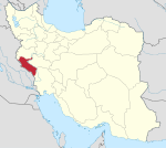
| Country | Iran |
| Province | Ilam |
| County | Darreh Shahr |
| District | Mazhin |
| Capital | Godar-e Namak |
| Population (2016)[2] | |
| • Total | 1,384 |
| Time zone | UTC+3:30 (IRST) |
Kulkani Rural District (Persian: دهستان كولكني) is in Mazhin District of Darreh Shahr County, Ilam province, Iran. Its capital is the village of Godar-e Namak.[3]
At the National Census of 2006, its population was 1,719 in 310 households.[4] There were 1,610 inhabitants in 382 households at the following census of 2011.[5] At the most recent census of 2016, the population of the rural district was 1,384 in 368 households. The most populous of its eight villages was Godar-e Namak, with 427 people.[2]
YouTube Encyclopedic
-
1/1Views:329
-
Balbhavan - science center deglur. Nanded district.
Transcription
References
- ^ OpenStreetMap contributors (28 March 2024). "Kulkani Rural District (Darreh Shahr County)" (Map). OpenStreetMap. Retrieved 28 March 2024.
- ^ a b "Census of the Islamic Republic of Iran, 1395 (2016)". AMAR (in Persian). The Statistical Center of Iran. p. 16. Archived from the original (Excel) on 1 November 2020. Retrieved 19 December 2022.
- ^ Aref, Mohammad Reza (27 November 1383). "Divisional reforms in Ilam province". Lamtakam (in Persian). Ministry of Interior, Political-Defense Commission of the Government Board. Archived from the original on 8 February 2024. Retrieved 8 February 2024.
- ^ "Census of the Islamic Republic of Iran, 1385 (2006)". AMAR (in Persian). The Statistical Center of Iran. p. 16. Archived from the original (Excel) on 20 September 2011. Retrieved 25 September 2022.
- ^ "Census of the Islamic Republic of Iran, 1390 (2011)". Syracuse University (in Persian). The Statistical Center of Iran. p. 16. Archived from the original (Excel) on 17 January 2023. Retrieved 19 December 2022.
Ilam province, Iran | ||||||||||||||||||||||||
|---|---|---|---|---|---|---|---|---|---|---|---|---|---|---|---|---|---|---|---|---|---|---|---|---|
Capital: Ilam | ||||||||||||||||||||||||
| Counties and cities |
|  | ||||||||||||||||||||||
| Sights |
| |||||||||||||||||||||||
| Populated places | ||||||||||||||||||||||||
This Darreh Shahr County location article is a stub. You can help Wikipedia by expanding it. |