
Johannesburg, California | |
|---|---|
 Rand District Cemetery | |
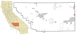 Location in Kern County and California | |
 Johannesburg, California Location in the United States | |
| Coordinates: 35°22′22″N 117°38′05″W / 35.37278°N 117.63472°W | |
| Country | United States |
| State | California |
| County | Kern |
| Government | |
| • State senator | Melissa Hurtado (D)[1] |
| • Assemblymember | Tom Lackey (R)[1] |
| • U.S. rep. | Jay Obernolte (R)[2] |
| Area | |
| • Total | 2.415 sq mi (6.255 km2) |
| • Land | 2.415 sq mi (6.255 km2) |
| • Water | 0 sq mi (0 km2) 0% |
| Elevation | 3,517 ft (1,072 m) |
| Population (2010) | |
| • Total | 172 |
| • Density | 71/sq mi (27/km2) |
| Time zone | UTC-8 (PST) |
| • Summer (DST) | UTC-7 (PDT) |
| ZIP codes | 93528, 93554 |
| Area codes | 442/760 |
| FIPS code | 06-37400 |
| GNIS feature ID | 0244074 |
Johannesburg is a census-designated place (CDP) in Kern County, California, in a mining district of the Rand Mountains. Johannesburg is located 1 mile (1.6 km) east-northeast of Randsburg,[5] at an elevation of 3,517 feet (1,072 m).[4] The terminus of the Randsburg Railway was here from 1897 to 1933. The population was 172 at the 2010 census, down from 176 at the 2000 census. Johannesburg is divided from the neighboring community of Randsburg by a ridge. The town is frequently referred to as "Jo-burg" by locals and frequent visitors to the northwest Mojave.
YouTube Encyclopedic
-
1/5Views:128 656345 3722 714 64544 3491 505 413
-
How China Constructed 36,000 km of High-Speed Railways (in less than 12 Years)
-
High speed Bombardier train in Johannesburg, South Africa - Gautrain
-
Rovos Rail, the most luxurious train in the world: Pretoria to Cape Town trip report
-
Why Monorails Are A Terrible Idea
-
The Country Where All Public Transit Is Free
Transcription
History
Johannesburg was founded to support mining operations at Randsburg. In addition to providing rail access, the region's first wells were operated by companies located in Johannesburg. During the first half of the 20th century, the Rand Mining District was the principal gold producing region of California. Activity centered on the Yellow Aster Mine, discovered in 1894. In 1919, the Rand Silver Mine was discovered east of town on Red Mountain. The Rand Mine produced more silver than any mine in California.
Johannesburg was named by miners who had previously worked in the gold-producing region of South Africa. Containing the city of Johannesburg, South Africa, this region is in the Witwatersrand, and is frequently referred to as "the Rand."
The first post office at Johannesburg opened in 1897.[5]
Transportation
Transportation to Johannesburg is provided by Ridgecrest Transit as a lifeline service once a week.[6]
Geography
Johannesburg is located at 35°22′22″N 117°38′05″W / 35.37278°N 117.63472°W.[4]
According to the United States Census Bureau, the CDP has a total area of 2.4 square miles (6.2 km2), all of it land.
Demographics
2010
At the 2010 census Johannesburg had a population of 172. The population density was 71.2 inhabitants per square mile (27.5/km2). The racial makeup of Johannesburg was 152 (88.4%) White, 2 (1.2%) African American, 2 (1.2%) Native American, 8 (4.7%) Asian, 0 (0.0%) Pacific Islander, 0 (0.0%) from other races, and 8 (4.7%) from two or more races. Hispanic or Latino of any race were 8 people (4.7%).[7]
The whole population lived in households, no one lived in non-institutionalized group quarters and no one was institutionalized.
There were 95 households, 10 (10.5%) had children under the age of 18 living in them, 32 (33.7%) were opposite-sex married couples living together, 2 (2.1%) had a female householder with no husband present, 3 (3.2%) had a male householder with no wife present. There were 7 (7.4%) unmarried opposite-sex partnerships, and 1 (1.1%) same-sex married couples or partnerships. 47 households (49.5%) were one person and 21 (22.1%) had someone living alone who was 65 or older. The average household size was 1.81. There were 37 families (38.9% of households); the average family size was 2.76.
The age distribution was 21 people (12.2%) under the age of 18, 4 people (2.3%) aged 18 to 24, 26 people (15.1%) aged 25 to 44, 75 people (43.6%) aged 45 to 64, and 46 people (26.7%) who were 65 or older. The median age was 55.0 years. For every 100 females, there were 109.8 males. For every 100 females age 18 and over, there were 109.7 males.
There were 139 housing units at an average density of 57.6 per square mile, of the occupied units 73 (76.8%) were owner-occupied and 22 (23.2%) were rented. The homeowner vacancy rate was 2.7%; the rental vacancy rate was 14.8%. 137 people (79.7% of the population) lived in owner-occupied housing units and 35 people (20.3%) lived in rental housing units.
2000
At the 2000 census there were 176 people, 85 households, and 45 families in the CDP. The population density was 72.0 inhabitants per square mile (27.8/km2). There were 133 housing units at an average density of 54.4 per square mile (21.0/km2). The racial makeup of the CDP was 91.48% White, 0.57% Black or African American, 1.14% Native American and 2.84% from other races, and 3.98% from two or more races. 5.68% of the population were Hispanic or Latino of any race.[8] Of the 85 households 21.2% had children under the age of 18 living with them, 36.5% were married couples living together, 11.8% had a female householder with no husband present, and 45.9% were non-families. 35.3% of households were one person and 21.2% were one person aged 65 or older. The average household size was 2.07 and the average family size was 2.70.
The age distribution was 20.5% under the age of 18, 4.0% from 18 to 24, 22.2% from 25 to 44, 31.8% from 45 to 64, and 21.6% 65 or older. The median age was 48 years. For every 100 females, there were 95.6 males. For every 100 females age 18 and over, there were 97.2 males.
The median household income was $63,611 and the median family income was $72,222. Males had a median income of $51,250 versus $31,250 for females. The per capita income for the CDP was $21,478. None of the families and 7.6% of the population were below the poverty line. None are under the age of 18 or over 65.
References
- ^ a b "Statewide Database". Regents of the University of California. Archived from the original on February 1, 2015. Retrieved April 6, 2015.
- ^ "California's 23rd Congressional District - Representatives & District Map". Civic Impulse, LLC.
- ^ U.S. Census Archived 2012-07-02 at the Wayback Machine
- ^ a b c U.S. Geological Survey Geographic Names Information System: Johannesburg, California
- ^ a b Durham, David L. (1998). California's Geographic Names: A Gazetteer of Historic and Modern Names of the State. Clovis, Calif.: Word Dancer Press. p. 1052. ISBN 1-884995-14-4.
- ^ "Transit Division | Ridgecrest, CA". www.ridgecrest-ca.gov. Retrieved July 21, 2023.
- ^ "2010 Census Interactive Population Search: CA - Johannesburg CDP". U.S. Census Bureau. Archived from the original on July 15, 2014. Retrieved July 12, 2014.
- ^ "U.S. Census website". United States Census Bureau. Retrieved January 31, 2008.
- Nunn, Cynthia Ackley (2019). Abandoned California: King Solomon Mine. Arcadia Publishing.
- Wynn, Marcia Rittenhouse (1963). Desert Bonanza. Glendale, CA., A. H. Clark Co.

| International | |
|---|---|
| National | |