
Holprijp
Holpryp (West Frisian) | |
|---|---|
 Holprijp Location in the province of Friesland in the Netherlands  Holprijp Holprijp (Netherlands) | |
| Coordinates: 53°09′46″N 5°32′43″E / 53.16270°N 5.54521°E | |
| Country | Netherlands |
| Province | Friesland |
| Municipality | Waadhoeke |
| Village | Tzum |
| Elevation | 0.4 m (1.3 ft) |
| Time zone | UTC+1 (CET) |
| • Summer (DST) | UTC+2 (CEST) |
| Postcode | 8804 |
| Area code | 0517 |
Holprijp (Dutch pronunciation: [ˈɦɔlp.rɛi̯p]; West Frisian: Holpryp) is a hamlet in the Dutch municipality of Waadhoeke in the province of Friesland. It is located south of Franeker and northwest of Tzum, of which it is a part administratively. The settlement of the hamlet is located on the country road of the same name that runs from the Lollumerweg to Tzum. At Tzum it connects to the hamlet of Laakwerd.
History

The name Holprijp first appeared on a map in 1433.[2] In 1414 the medieval jurisdiction was still referred to as Ripera fiarndel or Rijperda fiarndel.[3] The hamlet has grown and shrunk over the centuries.
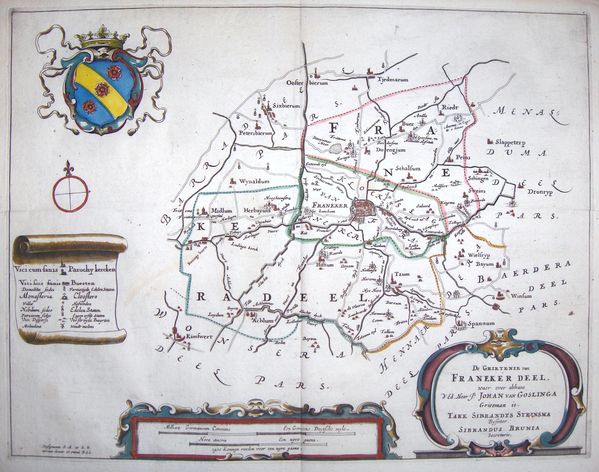
This hamlet used to be home to a significant stins, the Hottinga State, which is also clearly depicted on a map from 1664.[4] Another stins, the Sybranda State, also used to be located in the hamlet, belonging to the same broad family.[5] Hottinga State has been demolished and only the farm remains. The so-called huiseiland ('home island') is still very much visible by a moat and planted trees.[6]
References
- ^ "Postcodetool for 8804RZ". Actueel Hoogtebestand Nederland (in Dutch). Het Waterschapshuis. Retrieved 9 October 2023.
- ^ Kreger, Henk (2006). Beeld van Oud Tzum, een beschrijving met illustraties en kaarten van het dorp Tzum vanaf halverwege de negentiende eeuw (in Dutch). Franeker: Kaldadel. p. 219.
- ^ Miedema, H.T.J. (1975). "Typen van terpnamen vooral in de oude kern van Westergo". Naamkunde. 7 (3–4): 176. Retrieved 9 October 2023.
- ^ Schotanus, Bernardus (1664). "Friese grietenij landkaarten van Bernardus Schotanus 1664 / Friesland 'county' maps 1664 - FranekerDeel". Schotanus.us. Retrieved 9 October 2023.
- ^ "Sybranda State Tzum". Stinsen in Friesland (in Dutch). Retrieved 9 October 2023.
- ^ "Hottinga State Tzum". Stinsen in Friesland (in Dutch). Retrieved 9 October 2023.