
| Hollywell Gold Coast, Queensland | |||||||||||||||
|---|---|---|---|---|---|---|---|---|---|---|---|---|---|---|---|
 Hollywell | |||||||||||||||
 | |||||||||||||||
| Coordinates | 27°53′44″S 153°23′58″E / 27.8955°S 153.3994°E | ||||||||||||||
| Population | 2,865 (2016 census)[1] | ||||||||||||||
| • Density | 988/km2 (2,560/sq mi) | ||||||||||||||
| Postcode(s) | 4216 | ||||||||||||||
| Area | 2.9 km2 (1.1 sq mi) | ||||||||||||||
| Time zone | AEST (UTC+10:00) | ||||||||||||||
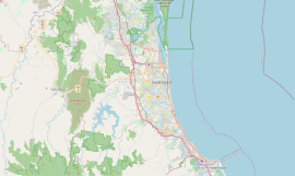
| Location |
| ||||||||||||||
| LGA(s) | City of Gold Coast | ||||||||||||||
| State electorate(s) | Broadwater | ||||||||||||||
| Federal division(s) | Fadden | ||||||||||||||
| |||||||||||||||
Hollywell is a coastal suburb in the City of Gold Coast, Queensland, Australia.[2] In the 2016 census, Hollywell had a population of 2,865 people.[1]
Geography
In the east, the suburb's boundaries extend into the Gold Coast Broadwater. Of the actual land surface, the land use is residential with the exception of the south-western quarter of the suburb which is part of the Pine Ridge Conservation Park (27°54′00″S 153°23′34″E / 27.9000°S 153.3928°E) which extends south into Runaway Bay.[3][4]
The Runaway Bay Marina is located in the south-east corner of the locality (27°54′02″S 153°24′09″E / 27.9006°S 153.4024°E).[5]
History
A 1926 map shows the area named as Pine Ridge.[6] That name is no longer official but persists in Park Ridge Road and in the Park Ridge Conservation Park.[4] Park Ridge Road as shown on a 1978 map extended north of the present road roughly along the current Oxley Drive through Holleywell and the current Paradise Road at Pardise Point (27°53′13″S 153°23′29″E / 27.8870°S 153.3913°E).[7]
The suburb takes its name from the residence of Joseph Wood Proud who was Mayor of Southport from 1934 to 1948. Proud named it after his home in England.[2]
In the 2011 census, Hollywell recorded a population of 2,679 people, 49.9% female and 50.1% male.[8] The median age of the Hollywell population was 47 years, 10 years above the national median of 37. 70.7% of people living in Hollywell were born in Australia. The other top responses for country of birth were New Zealand 9.4%, England 5.7%, South Africa 0.8%, Scotland 0.7%, Germany 0.7%. 91.8% of people spoke only English at home; the next most common languages were 0.7% Japanese, 0.6% German, 0.4% French, 0.4% Italian, 0.3% Russian.[8]
In the 2016 census, Hollywell had a population of 2,865 people.[1]
Education
There are no schools in Hollywell. The nearest schools are Coombabah State School (primary) and Coombabah State High School (secondary), both in neighbouring Coombabah.[3]
Amenities
Hollywell Fire Station is at 318 Bayview Street (27°53′43″S 153°23′56″E / 27.8954°S 153.3988°E).[9]
There are two boat ramps on Centenary Drive into the Gold Coast Broadwater. One is at the junction with Jasmine Avenue (27°53′46″S 153°24′09″E / 27.8962°S 153.4026°E) and the other at the junction with Holly Avenue (27°53′52″S 153°24′12″E / 27.8979°S 153.4032°E). They are managed by the Gold Coast City Council.[10]
References
- ^ a b c Australian Bureau of Statistics (27 June 2017). "Hollywell (SSC)". 2016 Census QuickStats. Retrieved 20 October 2018.
- ^ a b "Hollywell – suburb in City of Gold Coast (entry 46053)". Queensland Place Names. Queensland Government. Retrieved 26 January 2020.
- ^ a b "Queensland Globe". State of Queensland. Retrieved 28 March 2020.
- ^ a b "Pine Ridge Conservation Park – conservation park in Gold Coast City (entry 39603)". Queensland Place Names. Queensland Government. Retrieved 28 March 2020.
- ^ Google (28 March 2020). "Runaway Bay Marina" (Map). Google Maps. Google. Retrieved 28 March 2020.
- ^ "Tambourine" (Map). Queensland Government. Archived from the original on 5 April 2020. Retrieved 28 March 2020.
- ^ "Hollywell" (Map). Queensland Government. 1978. Archived from the original on 28 March 2020. Retrieved 28 March 2020.
- ^ a b Australian Bureau of Statistics (31 October 2012). "Hollywell (SSC)". 2011 Census QuickStats. Retrieved 28 March 2020.
- ^ "Emergency services facilities - Queensland". Queensland Open Data. Queensland Government. 12 November 2020. Archived from the original on 15 November 2020. Retrieved 12 November 2020.
- ^ "Recreational Boating Facilities Queensland". Queensland Open Data. Queensland Government. 12 November 2020. Archived from the original on 22 November 2020. Retrieved 22 November 2020.
External links
- "Hollywell". Queensland Places. Centre for the Government of Queensland, University of Queensland.