
| Gilston City of Gold Coast, Queensland | |||||||||||||||
|---|---|---|---|---|---|---|---|---|---|---|---|---|---|---|---|
 Gilston Public Hall, 2016 | |||||||||||||||
 Gilston | |||||||||||||||
 | |||||||||||||||
| Coordinates | 28°01′48″S 153°18′35″E / 28.03°S 153.3097°E | ||||||||||||||
| Population | 2,459 (2016 census)[1] | ||||||||||||||
| • Density | 258.8/km2 (670/sq mi) | ||||||||||||||
| Postcode(s) | 4211 | ||||||||||||||
| Area | 9.5 km2 (3.7 sq mi) | ||||||||||||||
| Time zone | AEST (UTC+10:00) | ||||||||||||||
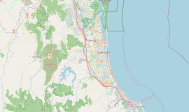
| Location |
| ||||||||||||||
| LGA(s) | City of Gold Coast | ||||||||||||||
| State electorate(s) | |||||||||||||||
| Federal division(s) | Wright | ||||||||||||||
| |||||||||||||||
Gilston is a rural residential locality in the City of Gold Coast, Queensland, Australia.[2] In the 2016 census, Gilston had a population of 2,459 people.[1]
Geography
The western boundary of the suburb is marked by the Nerang River.[3]
History
Settlement began in the 1860s with dairying and timber being the main industries. Mr Bryant, a local storekeeper, named the district Gilston after Gilston in England.[4]
Nerang Upper Provisional School opened on 1 June 1881. In 1903, it became Gilston Provisional School. In 1908 it became Gilston State School.[5][6] The school was at 636 Gilston Road (28°02′00″S 153°18′21″E / 28.0334°S 153.3057°E) until 1985 when increasing enrolments resulted in a new school campus being constructed in Worongary Street. In 1996, funds were raised to relocate the original school building onto the new campus.[7]
The first telephone office opened in March 1923.[8]
After engaged in fundraising since March 1930, the Gilson Hall was finally opened on Friday 16 June 1933 by Thomas Plunkett, junior, Member of the Queensland Legislative Assembly for the Albert. The hall was erected on the site of the old Lutheran church at 471 Gilston Road and was 60 by 30 feet (18.3 m × 9.1 m) with a stage and dressing rooms.[9][10][11]
In the 2006 census Gilston had a population of 575 people.[12]
In the 2011 census Gilston had a population of 1,449,[13] an increase of almost 900 since the previous census in 2006.[14]
Since 2014, Gilston residents have been subjected to one of the largest hoon crisis in Queensland. Despite best efforts from the Queensland Police Service to battle the ongoing eradicate behavior, many hoons continuously menace the roads endangering the public.[15][16]
In the 2016 census, Gilston had a population of 2,459 people.[1]
Heritage listings
Gilson has a number of heritage-listed sites, including:
- Colliston, 926 Gilston Road (28°02′37″S 153°17′16″E / 28.0437°S 153.2877°E): H2 Hinde Tree[17] [18]
Education
Gilston State School is a government primary (Prep-6) school for boys and girls at 588 Worongary Road (28°02′22″S 153°18′39″E / 28.0394°S 153.3108°E).[19][20] In 2017, the school had an enrolment of 599 students with 40 teachers (37 full-time equivalent) and 24 non-teaching staff (16 full-time equivalent).[21] It includes a special education program.[19]
There is no secondary school in Gilston. The nearest secondary school is Nerang State High School in neighbouring Nerang to the north.[3]
Amenities
Gilston Public Hall is located at 471 Gilston Road (28°01′21″S 153°18′33″E / 28.0226°S 153.3093°E) beside Gilston Hall Park. It is used by a number of community groups. The Gold Coast City Council operates a fortnightly mobile library service which visits the public hall.[22]
Sports
The Grand Golf Club has its entrance at 364 Gilston Road but most of the course is in neighbouring Advancetown, accessed by a bridge over the Nerang River (28°00′58″S 153°18′23″E / 28.0160°S 153.3065°E). This private club has a 19-hole golf course designed by Greg Norman.[23]
References
- ^ a b c Australian Bureau of Statistics (27 June 2017). "Gilston (SSC)". 2016 Census QuickStats. Retrieved 20 October 2018.
- ^ "Gilston – locality in City of Gold Coast (entry 48133)". Queensland Place Names. Queensland Government. Retrieved 18 September 2020.
- ^ a b "Queensland Globe". State of Queensland. Retrieved 8 October 2020.
- ^ "Gilston History". City of Gold Coast Council. Archived from the original on 22 May 2014. Retrieved 22 May 2014.
- ^ "Opening and closing dates of Queensland Schools". Queensland Government. Retrieved 22 May 2014.
- ^ "Agency ID 5236, Gilston State School". Queensland State Archives. Retrieved 22 May 2014.
- ^ "Gilston State School Handbook" (PDF). Gilston State School. Archived (PDF) from the original on 22 May 2014. Retrieved 22 May 2014.
- ^ "Telephone at Gilston". The Brisbane Courier. National Library of Australia. 5 March 1923. p. 9. Retrieved 22 May 2014.
- ^ "GILSTON HALL". The South Coast Bulletin. Southport, Qld.: National Library of Australia. 2 June 1933. p. 5. Archived from the original on 8 October 2020. Retrieved 22 May 2014.
- ^ "Nerang Shire Council". The South Coast Bulletin. Southport, Qld.: National Library of Australia. 3 March 1933. p. 10. Retrieved 22 May 2014.
- ^ "GILSTON PUBLIC HALL". The Brisbane Courier. National Library of Australia. 19 June 1933. p. 17. Archived from the original on 8 October 2020. Retrieved 22 May 2014.
- ^ Australian Bureau of Statistics (25 October 2007). "Gilston (SSC)". 2006 Census QuickStats. Retrieved 8 October 2020.
- ^ Australian Bureau of Statistics (31 October 2012). "Gilston (State Suburb)". 2011 Census QuickStats. Retrieved 11 January 2013.
- ^ 2006 ABS census data
- ^ Doherty, Denis (7 December 2014). "Close to 1500 vehicles have been impounded during the first year of the state's tough anti-hoon laws". Gold Coast Bulletin. Retrieved 6 November 2017.
- ^ Tozer, Glenn (23 February 2016). "50 Days and 50 Ways – #32: Complete a full Mudgeeraba parking audit and strategy". Division 9 City of Gold Coast. Archived from the original on 6 November 2017. Retrieved 6 November 2017.
- ^ "The H2 HINDE TREE (Macadamia integrifolia) on Colliston (entry 602649)". Queensland Heritage Register. Queensland Heritage Council. Retrieved 16 November 2014.
- ^ Gold Coast Local Heritage Register - A to M, pp. 51-52
- ^ a b "State and non-state school details". Queensland Government. 9 July 2018. Archived from the original on 21 November 2018. Retrieved 21 November 2018.
- ^ "Gilston State School". Archived from the original on 6 July 2011. Retrieved 21 November 2018.
- ^ "ACARA School Profile 2017". Archived from the original on 22 November 2018. Retrieved 22 November 2018.
- ^ "Mobile Library 2018 timetable" (PDF). Gold Coast City Council. Archived from the original (PDF) on 30 January 2018. Retrieved 30 January 2018.
- ^ "The Grand Golf Club". The Grand Golf Club. Archived from the original on 22 May 2014. Retrieved 22 May 2014.
Sources
- "Gold Coast Local Heritage Register - A to M" (PDF). Gold Coast City Council. Archived from the original (PDF) on 26 August 2020. Retrieved 26 August 2020.
Further reading
- Holt, R. W. (1978), A history of the Congregational, Methodist, and Presbyterian Churches in Southport and environs, leading up to the inauguration of the Southport Uniting Parish, Southport Uniting Parish
External links
- "Gold Coast Inner Hinterland". Queensland Places. Centre for the Government of Queensland, University of Queensland. — includes Gilston
- Suburb guide Archived 21 May 2012 at the Wayback Machine