
Hollis Crossroads, Alabama | |
|---|---|
 Location of Hollis Crossroads in Cleburne County, Alabama. | |
 Hollis Crossroads | |
| Coordinates: 33°31′25″N 85°38′14″W / 33.52361°N 85.63722°W | |
| Country | United States |
| State | Alabama |
| County | Cleburne |
| Area | |
| • Total | 12.47 sq mi (32.29 km2) |
| • Land | 12.46 sq mi (32.26 km2) |
| • Water | 0.01 sq mi (0.03 km2) |
| Elevation | 889 ft (271 m) |
| Population (2020) | |
| • Total | 665 |
| • Density | 53.39/sq mi (20.61/km2) |
| Time zone | UTC-6 (Central (CST)) |
| • Summer (DST) | UTC-5 (CDT) |
| Area code(s) | 256 & 938 |
| GNIS feature ID | 159791[2] |
Hollis Crossroads is a census-designated place and unincorporated community in Cleburne County, Alabama, United States. Its population was 665 as of the 2020 census. Hollis Crossroads is located along U.S. Route 431 between Anniston and Wedowee and Alabama State Route 9 between Lineville to Heflin; Routes 431 and 9 intersect here.[3] The Pleasant Grove Elementary School is located here.
Demographics
| Census | Pop. | Note | %± |
|---|---|---|---|
| 2020 | 665 | — | |
| U.S. Decennial Census[4] | |||
References
- ^ "2020 U.S. Gazetteer Files". United States Census Bureau. Retrieved October 29, 2021.
- ^ "Hollis Crossroads". Geographic Names Information System. United States Geological Survey, United States Department of the Interior.
- ^ Google (June 12, 2013). "Hollis Crossroads, Alabama" (Map). Google Maps. Google. Retrieved June 12, 2013.
- ^ "Census of Population and Housing". Census.gov. Retrieved June 4, 2016.
Municipalities and communities of Cleburne County, Alabama, United States | ||
|---|---|---|
| City | 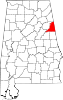 | |
| Towns | ||
| CDP | ||
| Unincorporated communities | ||
This Cleburne County, Alabama state location article is a stub. You can help Wikipedia by expanding it. |