
Fruithurst, Alabama | |
|---|---|
Town | |
 | |
 Location of Fruithurst in Cleburne County, Alabama. | |
| Coordinates: 33°43′51″N 85°25′54″W / 33.73083°N 85.43167°W | |
| Country | United States |
| State | Alabama |
| County | Cleburne |
| Area | |
| • Total | 1.00 sq mi (2.59 km2) |
| • Land | 1.00 sq mi (2.59 km2) |
| • Water | 0.00 sq mi (0.00 km2) |
| Elevation | 1,079 ft (329 m) |
| Population (2020) | |
| • Total | 235 |
| • Density | 235.00/sq mi (90.71/km2) |
| Time zone | UTC-6 (Central (CST)) |
| • Summer (DST) | UTC-5 (CDT) |
| ZIP code | 36262 |
| Area code | 256 |
| FIPS code | 01-28432 |
| GNIS feature ID | 0118739 |
Fruithurst is a town in Cleburne County, Alabama, United States. At the 2020 census, the population was 235.
YouTube Encyclopedic
-
1/3Views:4188611 113
-
NS #22E at Fruithurst, Alabama - 2/22/07
-
Fruithurst Winery
-
Southern Railfanning: Irondale, Alabama
Transcription
Geography
Fruithurst is located at 33°43'51.971" North, 85°25'54.332" West (33.731103, −85.431759).[2]
According to the U.S. Census Bureau, the city has a total area of 1.0 square mile (2.6 km2), all land.
History
Fruithurst once had a reputation for being a notorious speed trap along US Highway 78. Abuse of policing reached such an extent that in 1975 Alabama Attorney General Bill Baxley set up an office in the town, personally pledging to provide criminal defense to any person arrested or cited in the town.[3] Additionally Reason magazine reported in May 2022 that, "...one case involved a woman arrested for traveling 58 in a 55-mph zone. She was also charged with transporting untaxed liquor—a half-empty miniature bottle of liqueur in her purse..." stating this was, "...both an abuse of law enforcement powers and a mockery of the very idea of legitimate traffic safety enforcement."[4]
Demographics
| Census | Pop. | Note | %± |
|---|---|---|---|
| 1900 | 374 | — | |
| 1910 | 257 | −31.3% | |
| 1920 | 223 | −13.2% | |
| 1930 | 225 | 0.9% | |
| 1940 | 281 | 24.9% | |
| 1950 | 318 | 13.2% | |
| 1960 | 255 | −19.8% | |
| 1970 | 229 | −10.2% | |
| 1980 | 239 | 4.4% | |
| 1990 | 177 | −25.9% | |
| 2000 | 270 | 52.5% | |
| 2010 | 284 | 5.2% | |
| 2020 | 235 | −17.3% | |
| U.S. Decennial Census[5] 2013 Estimate[6] | |||
At the 2000 census there were 270 people in 107 households, including 74 families, in the city. The population density was 264.8 inhabitants per square mile (102.2/km2). There were 111 housing units at an average density of 108.9 per square mile (42.0/km2). The racial makeup of the city was 99.63% White and 0.37% Black or African American. 0.74% of the population were Hispanic or Latino of any race.[7] Of the 107 households 30.8% had children under the age of 18 living with them, 53.3% were married couples living together, 10.3% had a female householder with no husband present, and 30.8% were non-families. 28.0% of households were one person and 13.1% were one person aged 65 or older. The average household size was 2.41 and the average family size was 2.93.
The age distribution was 20.4% under the age of 18, 12.6% from 18 to 24, 24.4% from 25 to 44, 27.8% from 45 to 64, and 14.8% 65 or older. The median age was 38 years. For every 100 females, there were 98.5 males. For every 100 females age 18 and over, there were 87.0 males.
The median household income was $27,813 and the median family income was $31,667. Males had a median income of $22,188 versus $16,250 for females. The per capita income for the city was $18,130. About 17.0% of families and 17.9% of the population were below the poverty line, including 19.5% of those under the age of eighteen and 2.6% of those sixty five or over.
References
- ^ "2020 U.S. Gazetteer Files". United States Census Bureau. Retrieved October 29, 2021.
- ^ "US Gazetteer files: 2010, 2000, and 1990". United States Census Bureau. February 12, 2011. Retrieved April 23, 2011.
- ^ "'Worst Speed Trap in Nation Disbands Police Department'". The New York Times. New York, NY. May 4, 1975. p. 59. Retrieved January 28, 2022.
- ^ CIARAMELLA, C.J. "11 Insanely Corrupt Speed-Trap Towns". reason.com. Reason. Retrieved May 10, 2022.
- ^ "U.S. Decennial Census". Census.gov. Retrieved June 6, 2013.
- ^ "Annual Estimates of the Resident Population: April 1, 2010 to July 1, 2013". Archived from the original on May 22, 2014. Retrieved June 3, 2014.
- ^ "U.S. Census website". United States Census Bureau. Retrieved January 31, 2008.
33°43′52″N 85°25′54″W / 33.731103°N 85.431759°W
Municipalities and communities of Cleburne County, Alabama, United States | ||
|---|---|---|
| City | 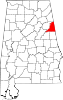 | |
| Towns | ||
| CDP | ||
| Unincorporated communities | ||