
| Halmahera Sea | |
|---|---|
| Laut Halmahera (Indonesian) | |
 Location of the Halmahera Sea within Southeast Asia | |
 Halmahera Sea | |
| Coordinates | 1°S 129°E / 1°S 129°E |
| Type | Sea |
| Basin countries | Indonesia |
| Surface area | 95,000 km2 (37,000 sq mi) |
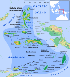
The Halmahera Sea is a regional sea located in the central eastern part of the Australasian Mediterranean Sea. It is centered at about 1°S and 129°E and is bordered by the Pacific Ocean to the north, Halmahera to the west, Waigeo and West Papua to the east, and the Seram Sea to the south. It covers about 95,000 km (59,000 mi) and its topography comprises a number of separate basins and ridges, the chief of which is the Halmahera Basin reaching a depth of 2039 m.
YouTube Encyclopedic
-
1/3Views:44 566758704
-
Raja Ampat - Halmahera - Lembeh crossing 2018 with Raja Manta Liveaboard
-
Best of Halmahera & Raja Ampat - Reef Life
-
Extra Divers: Maluku Explorer / Liveaboard Indonesia
Transcription
Extent
The International Hydrographic Organization (IHO) defines the Halmahera Sea as being one of the waters of the East Indian Archipelago. The IHO defines its limits as follows:[1]
On the North A line from Wajaboela (Morotai) to Tg. Djodjefa, the Northern point of Halmahera.
On the East. A line from Tg. Gorango, the Northeastern point of Morotai Island, through Sajang and Kawé Islands to the Western extremes of Waigeo and Batanta Islands across to the Northwest point of Samawati Island, down the coast to Tg. Menonket its Southwest point, and thence to Tg. Sele, New Guinea (1°26′S 130°56′E / 1.433°S 130.933°E).
On the South. The Northern limit of Ceram Sea between Obi Major and New Guinea [A line from ... Obi Major ... Tanjong Seranmaloleo its Eastern extreme, thence through Tobalai, Kekek, Pisang and Kofiau Islands to Tanjong Sele (1°26′S 130°55′E / 1.433°S 130.917°E), the Western point of New Guinea].
On the West. The Southern limit of Molukka Sea [sic] between Halmahera and Obi Major [A line from the Southern extreme of Halmahera to the North point of Bisa (Setile) Island, thence to the Northern extreme of Obi Major].
References
- ^ "Limits of Oceans and Seas, 3rd edition" (PDF). International Hydrographic Organization. 1953. Archived from the original (PDF) on 8 October 2011. Retrieved 28 December 2020.
External links
This article about a specific oceanic location or ocean current is a stub. You can help Wikipedia by expanding it. |
This North Maluku location article is a stub. You can help Wikipedia by expanding it. |