
Gayaza–Ziroobwe Road is a road in central Uganda, connecting the towns of Gayaza in Wakiso District and Ziroobwe in Luweero District.[1]
Location
The road starts at Gayaza and proceeds northeastwards, goes through Namulonge, Busiika, and Bugema before ending in Ziroobwe, a distance of about 33 kilometres (21 mi).[2] The coordinates of the road in Bugema, Luweero District are 0°34'14.0"N, 32°38'38.0"E (Latitude:0.570556; Longitude:32.643889).[3]
Overview
Prior to 2007, the road had a gravel surface. In 2007, the government of Uganda began to upgrade the surface to bitumen at an estimated cost of US$40 million. The work, undertaken by Serbian firm Energoprojekt, began in March 2007 and was originally expected to be completed in November 2009.[1] The construction and improvement of the road was extended to include the Kampala-Gayaza section of the road. Because of repeated delays, completion did not occur until June 2011.[4]
Points of interest
The following points of interest also lie along or near the road: (a) the town of Gayaza in Wakiso District, 3 kilometres (1.9 mi), by road, east of Kasangati, (b) Gayaza High School, an all-girls boarding high school established in 1905 (c) Kabanyolo Farm, an agricultural and livestock farm that belongs to the College of Agricultural Sciences and the College of Veterinary Medicine, both at Makerere University, (d) The National Crops Resources Research Institute, located at Namulonge, (e) Bugema University, a private university, maintains its man campus along this road, and (f) in Ziroobwe, this road joins the Ziroobwe–Wobulenzi Road.[1]
See also
References
- ^ a b c Baguma, Raymond (25 November 2008). "Gayaza road gets tarmac". New Vision. Kampala. Retrieved 14 August 2017.
- ^ Google (11 September 2022). "Road Distance Between Gayaza, Uganda And Ziroobwe, Uganda" (Map). Google Maps. Google. Retrieved 11 September 2022.
- ^ Google (11 September 2022). "Location of Gayaza-Ziroobwe Road At Bugema, Uganda" (Map). Google Maps. Google. Retrieved 11 September 2022.
- ^ Mena Report (14 July 2011). "UGANDA: Conclusion of Gayaza-Zirobwe road construction". Highbeam.com. Archived from the original on 29 March 2015. Retrieved 15 July 2015.
External links

Capital: Luweero | ||
| Towns and villages | 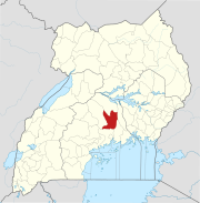 | |
| Economy | ||
| Education |
| |
| Notable landmarks | ||
| Health | ||
| Transport |
| |
| Notable people | ||
00°34′14″N 32°38′38″E / 0.57056°N 32.64389°E