
Ziroobwe | |
|---|---|
 Ziroobwe Map of Uganda showing the location of Ziroobwe | |
| Coordinates: 00°40′59″N 32°42′04″E / 0.68306°N 32.70111°E[1] | |
| Country | Uganda |
| Region | Central Region of Uganda |
| District | Luweero District |
| Elevation | 1,100 m (3,600 ft) |
| Population (2012 Estimate) | |
| • Total | 5,000 |
| Time zone | UTC+3 (EAT) |
Ziroobwe is a town in Luweero District in the Central Region of Uganda. The correct phonetic spelling in the native Luganda language is "Ziroobwe".[2]
YouTube Encyclopedic
-
1/3Views:2 644578466
-
Manya Akabugako-ZIROOBWE
-
Tomatoes "Enyanya"
-
Drive from Kubbiri via Gayaza to Zirobwe and back
Transcription
Location
Ziroobwe is approximately 52 kilometres (32 mi), by road, north of Kampala, Uganda's capital and largest city.[3] This is approximately 22 kilometres (14 mi), by road, southeast of Luweero, the site of the district headquarters.[4]
Population
In August 2012, the night-time population of the town was estimated at 5,000, swelling to an estimated 7,000 during working days.[2]
Points of interest
The following additional points of interest are found in or near the town of Ziroobwe:[1] The town hosts (a) the headquarters of Ziroobwe sub-county, an administrative until in Luweero District (b) Ziroobwe Central Market and (c) the offices of Ziroobwe Town Council.[1]
The Gayaza–Ziroobwe Road, ends here. This 37 kilometres (23 mi) road connects Gayaza in Wakiso District to Ziroobwe in Luweero District.[5] The Ziroobwe–Wobulenzi Road starts here and ends at Wobulenzi, about 22 kilometres (14 mi) to the west, on the Kampala–Gulu Highway.[6]
The main campus of Bugema University is located about 15 kilometres (9 mi), by road, south of Ziroobwe on the Gayaza-Ziroobwe Road.[7]
See also
References
- ^ a b c Google (14 July 2015). "Location of Ziroobwe At Google Maps" (Map). Google Maps. Google. Retrieved 14 July 2015.
- ^ a b Lumu, Procopios (26 August 2012). "Ziroobwe: Akabuga k'Abalimi (Ziroobwe: The Small Town of Farmers)". Bukedde.co.ug (in Ganda). Retrieved 14 July 2015.
- ^ Google (6 June 2021). "Road Distance Between Central Kampala, Uganda And Ziroobwe, Uganda With Map" (Map). Google Maps. Google. Retrieved 6 June 2021.
- ^ Google (6 June 2021). "Road Distance Between Luweero, Uganda And Ziroobwe, Uganda" (Map). Google Maps. Google. Retrieved 6 June 2021.
- ^ Raymond Baguma (25 November 2008). "Gayaza Road Gets Tarmac". New Vision. Kampala. Retrieved 14 July 2015.
- ^ Google (6 June 2021). "Road Distance Between Wobulenzi, Uganda And Ziroobwe, Uganda" (Map). Google Maps. Google. Retrieved 6 June 2021.
- ^ Newvision Notices (2 October 2013). "Bugema University Announcing Their 19th Graduation Ceremony To Take Place On Sunday, 27 October 2013 At Bugema University Main Campus". New Vision. Kampala. Retrieved 14 July 2015.
Capital: Luweero | ||
| Towns and villages | 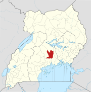 | |
| Economy | ||
| Education |
| |
| Notable landmarks | ||
| Health | ||
| Transport |
| |
| Notable people | ||