
Rush Township, Michigan | |
|---|---|
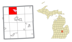 Location within Shiawassee County (red) and the administered community of Henderson (pink) | |
 Rush Township Location within the state of Michigan  Rush Township Rush Township (the United States) | |
| Coordinates: 43°04′46″N 84°13′14″W / 43.07944°N 84.22056°W | |
| Country | United States |
| State | Michigan |
| County | Shiawassee |
| Government | |
| • Supervisor | Rodney Spitler |
| • Clerk | Lois Walker |
| Area | |
| • Total | 35.24 sq mi (91.3 km2) |
| • Land | 34.90 sq mi (90.4 km2) |
| • Water | 0.34 sq mi (0.9 km2) |
| Elevation | 732 ft (223 m) |
| Population (2020) | |
| • Total | 1,268 |
| • Density | 36/sq mi (14/km2) |
| Time zone | UTC-5 (Eastern (EST)) |
| • Summer (DST) | UTC-4 (EDT) |
| ZIP code(s) | |
| Area code | 989 |
| FIPS code[1] | 26-70260 |
| GNIS ID[2] | 1627016 |
Rush Township is a civil township of Shiawassee County in the U.S. state of Michigan. The population was 1,268 at the 2020 census.[3]
YouTube Encyclopedic
-
1/3Views:375 4836 7031 604
-
Bodycam Shows Rescue Of Woman From Freezing Water in Harrison Township, Michigan
-
Shelby Township Office Mi, They Need Blinds
-
Driving with Scottman895: Commerce Township, Walled Lake, & Wixom, Michigan Driving Tour
Transcription
Communities
- Five Points North is an unincorporated community in this township and New Haven Township on North M-52 at Riley Road and Seymour Road.43°04′25″N 84°10′03″W / 43.07361°N 84.16750°W[4][5]
- Henderson, formerly Hendersonville, is a census-designated place and unincorporated community located within the township at 43°05′11″N 84°11′43″W / 43.08639°N 84.19528°W.[4][6]
Geography
According to the United States Census Bureau, the township has a total area of 35.24 square miles (91.27 km2), of which 34.90 square miles (90.39 km2) is land and 0.34 square miles (0.88 km2) (0.96%) is water.[7]
Demographics
As of the 2000 United States Census,[1] there were 1,409 people, 505 households, and 413 families residing in the township. The population density was 40.0 inhabitants per square mile (15.4/km2). There were 541 housing units at an average density of 15.4 per square mile (5.9/km2). The racial makeup of the township was 98.58% White, 0.07% African American, 0.35% Native American, 0.28% from other races, and 0.71% from two or more races. Hispanic or Latino of any race were 1.21% of the population.
There were 505 households, out of which 34.9% had children under the age of 18 living with them, 70.3% were married couples living together, 7.5% had a female householder with no husband present, and 18.2% were non-families. 15.2% of all households were made up of individuals, and 8.7% had someone living alone who was 65 years of age or older. The average household size was 2.79 and the average family size was 3.08.
In the township the population was spread out, with 26.3% under the age of 18, 6.7% from 18 to 24, 27.2% from 25 to 44, 25.8% from 45 to 64, and 14.1% who were 65 years of age or older. The median age was 39 years. For every 100 females, there were 98.2 males. For every 100 females age 18 and over, there were 93.1 males.
The median income for a household in the township was $47,232, and the median income for a family was $51,731. Males had a median income of $35,815 versus $22,400 for females. The per capita income for the township was $20,053. About 3.0% of families and 3.7% of the population were below the poverty line, including 4.4% of those under age 18 and 7.3% of those age 65 or over.
Highways
References
- ^ a b "U.S. Census website". United States Census Bureau. Retrieved January 31, 2008.
- ^ "Township of Rush". Geographic Names Information System. United States Geological Survey, United States Department of the Interior.
- ^ "Explore Census Data". data.census.gov. Retrieved April 24, 2024.
- ^ a b SHIAWASSEE County Map. J. Shively. State of Michigan Department of Information Technology Technology Center for Genographic Information. September 2007.
- ^ "Five Points North, Michigan". Geographic Names Information System. United States Geological Survey, United States Department of the Interior.
- ^ "Henderson, Michigan". Geographic Names Information System. United States Geological Survey, United States Department of the Interior.
- ^ "Michigan: 2010 Population and Housing Unit Counts 2010 Census of Population and Housing" (PDF). 2010 United States Census. United States Census Bureau. September 2012. p. 42 Michigan. Archived (PDF) from the original on October 19, 2012. Retrieved June 1, 2020.
Municipalities and communities of Shiawassee County, Michigan, United States | ||
|---|---|---|
| Cities |  | |
| Villages | ||
| Charter townships | ||
| Civil townships | ||
| CDPs | ||
| Other communities | ||
| Footnotes | ‡This populated place also has portions in an adjacent county | |