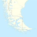
Size of this PNG preview of this SVG file: 594 × 600 pixels. Other resolutions: 238 × 240 pixels | 475 × 480 pixels | 761 × 768 pixels | 1,014 × 1,024 pixels | 2,028 × 2,048 pixels | 1,535 × 1,550 pixels.
Original file (SVG file, nominally 1,535 × 1,550 pixels, file size: 824 KB)
File history
Click on a date/time to view the file as it appeared at that time.
| Date/Time | Thumbnail | Dimensions | User | Comment | |
|---|---|---|---|---|---|
| current | 16:20, 5 March 2024 |  | 1,535 × 1,550 (824 KB) | Janitoalevic | More specific Beagle Channel |
| 01:23, 29 December 2022 |  | 1,535 × 1,550 (588 KB) | Janitoalevic | Improved borders | |
| 19:41, 3 May 2020 |  | 1,535 × 1,550 (566 KB) | Janitoalevic | Improved Isla de los Estados | |
| 18:47, 3 May 2020 |  | 1,535 × 1,550 (558 KB) | Janitoalevic | Improved | |
| 23:23, 29 August 2017 |  | 1,535 × 1,550 (441 KB) | Janitoalevic | Fixed size | |
| 11:23, 29 August 2017 |  | 1,535 × 1,550 (510 KB) | NordNordWest | Reverted to version as of 20:59, 15 March 2016 (UTC); change of size is catastrophic to some templates | |
| 22:18, 28 August 2017 |  | 1,638 × 1,653 (442 KB) | Janitoalevic | More precise borders and lakes | |
| 20:59, 15 March 2016 |  | 1,535 × 1,550 (510 KB) | Janitoalevic | Fixed limits following Google Earth/maps limits | |
| 22:12, 2 March 2016 |  | 1,535 × 1,550 (510 KB) | Janitoalevic | Updated | |
| 20:34, 11 September 2015 |  | 1,535 × 1,550 (508 KB) | Janitoalevic | Added Southern Patagonian Ice Field (Campo de hielo Patagónico Sur) undefined limits part, since 1998 For more information read: https://en.wikipedia.org/wiki/Southern_Patagonian_Ice_Field#Borderline Now with full resolution. |
File usage
The following pages on the English Wikipedia use this file (pages on other projects are not listed):
- 2022 Tierra del Fuego wildfire
- Ana Lake
- Carbajal Valley
- Cerro Murallón
- Cerro Piergiorgio
- Cerro Torre
- Circo de los Altares
- Clarence Island, Chile
- Cook Island, Tierra del Fuego
- Cordillera Darwin
- Cordillera Sarmiento
- Cueva Fell
- Dawson Island
- Deseado Lake
- Desolación Island
- Diego Ramírez Islands
- Diego Ramírez de Arellano
- Estancia Harberton
- Evangelistas Islets
- Fitz Roy
- Gallegos River
- Gordon Island
- Grey Lake
- Hermes Quijada International Airport
- Hermite Islands
- Hornos Island
- Hoste Island
- Ildefonso Islands
- Invierno mine
- Isla Bartolomé
- Isla Gonzalo
- Isla Grande de Tierra del Fuego
- Juan Guillermos Island
- Karukinka Natural Park
- Lago Escondido
- Londonderry Island
- Mount Darwin (Andes)
- Navarino Island
- Noir Island
- Pacheco Island
- Pali-Aike volcanic field
- Penitente River
- Porteño Lake
- Puerto Navarino
- Puerto Toro
- Puerto Williams
- Ramírez Island
- Riesco Island
- Rubens River
- Río Grande, Tierra del Fuego
- San Juan River (Chile)
- San Sebastián, Tierra del Fuego
- Southern Patagonian Ice Field
- Spanish colonization attempt of the Strait of Magellan
- Tierra del Fuego
- Tierra del Fuego gold rush
- Ushuaia – Malvinas Argentinas International Airport
- Viedma (volcano)
- Viedma Glacier
- Viedma Lake
- Yendegaia National Park
Global file usage
The following other wikis use this file:
- Usage on als.wikipedia.org
- Usage on ar.wikipedia.org
- Usage on az.wikipedia.org
- Usage on ba.wikipedia.org
- Usage on bn.wikipedia.org
- Usage on ceb.wikipedia.org
- Usage on cs.wikipedia.org
- Usage on da.wikipedia.org
- Usage on de.wikipedia.org
- Usage on el.wikipedia.org
- Usage on eo.wikipedia.org
- Usage on es.wikipedia.org
- Cabo de Hornos
- Archipiélago de Año Nuevo
- Campo de hielo patagónico sur
- Monte Fitz Roy
- Cerro Torre
- Bahía de Ushuaia
- Terremoto de Tierra del Fuego de 1949
- Glaciar Upsala
- Glaciar Grey
- Monte Darwin (Chile)
- Paso Fronterizo Radman
- Glaciar Spegazzini
- Cerro Agassiz
- Cabo San Pío
- Punta Dungeness
- Wikiproyecto Discusión:Chile
- Glaciar Viedma
- Bahía de San Sebastián
- Parque natural Karukinka
- Aeródromo Guardiamarina Zañartu
- Isla Magdalena (Magallanes)
View more global usage of this file.


