| Carbajal Valley | |
|---|---|
 Aerial view, east end | |
| Floor elevation | ~150 metres (490 ft) asl |
| Length | ~20 kilometres (12.4 mi) NW-SE |
| Width | 2.6 kilometres (1.6 mi) |
| Geography | |
| Coordinates | 54°41′9″S 68°20′58″W / 54.68583°S 68.34944°W |
| Rivers | Río Olivia |
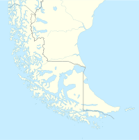
The Carbajal Valley (Spanish: Valle Carbajal) is a valley in the Fuegian Andes of southern Tierra del Fuego Province, Argentina. The Carbajal valley is approximately 20 kilometres (12 mi) long, running west to east, between the Alvear mountain range to the north and the Vinciguerra range to the south.[1][2][3] Andes peak heights in the region are generally less than 1,250 metres (4,100 ft) above sea level.[1]
Argentine Route 3 runs diagonally through Ushuaia (SW-NE) along the Río Olivia past the west base of Mount Olivia and around the northwestern and northern base of Monte Cinco Hermanos.
Topography
During the Last Glacial Maximum (LGM), approximately 20,000 years ago,[4][nb 1] a valley glacier carved the Carbajal-Tierra Mayor valley (described as the "glaciation axis of the Fuegian Andes")[7] from northwest to southeast, with an ice tongue forking south along the Valle Río Olivia into the Beagle Channel immediately to the east of Ushuaia.[8] Based on the geological study of the erosion patterns, the Carbajal glacier’s ice thickness was 600–800 metres (2,000–2,600 ft).[8] Several existing glaciers (e.g., Ojos de Albino, Vinciguerra) were tributaries of the Carbajal glacier.[9]
In the early Holocene period (11,700–8,200 years ago),[10] by 10,300 years ago, ice had receded from the valley walls and vegetation was growing.[8] By the middle Holocene period (8,200–4,200 years ago),[11] forest growth was expanding.[8]
The nearly U-shaped valley floor is covered with Sphagnum peat bogs and poorly drained mires.[4]
References
- ^ a b Menounos et al. 2013, p. 71.
- ^ Rabassa et al. 2006, p. 130.
- ^ Hennessy 1999, p. 333.
- ^ a b Borromei et al. 2007, p. 332.
- ^ Hopcroft & Valdes 2015, p. 5533.
- ^ Cook & Vizy 2006, p. 1.
- ^ Rabassa 2008, p. 183.
- ^ a b c d Borromei et al. 2007, p. 329.
- ^ Menounos et al. 2013, pp. 73–75.
- ^ Walker et al. 2012, p. 651.
- ^ Walker et al. 2012, p. 653.
Notes
Sources
- Borromei, Ana Marıa; Coronato, Andrea; Quattrocchio, Mirta; Rabassa, Jorge; Grill, Silvia; Roig, Claudio (2007), "Late Pleistocene–Holocene environments in Valle Carbajal, Tierra del Fuego, Argentina", Journal of South American Earth Sciences, 23 (4): 321–335, doi:10.1016/j.jsames.2007.02.008
- Cook, K.H.; Vizy, E.K. (2006), "South American climate during the Last Glacial Maximum: Delayed onset of the South American monsoon", Journal of Geophysical Research, 111 (D2): 1–21, Bibcode:2006JGRD..111.2110C, doi:10.1029/2005JD005980
- Hennessy, Huw (1999). Insight Guide Argentina. Insight Guides. p. 333. ISBN 978-0-88729-031-2.
- Hopcroft, Peter O.; Valdes, Paul J. (2015), "How well do simulated last glacial maximum tropical temperatures constrain equilibrium climate sensitivity?" (PDF), Geophysical Research Letters, 42 (13): 5533–5539, doi:10.1002/2015GL064903
- Menounos, Brian; Clague, John J.; Osborn, Gerald; Davis, P. Thompson; Ponce, Federico; Goehring, Brent; Maurer, Malyssa; Rabassa, Jorge; Coronato, Andrea; Marr, Rob (2013), "Latest Pleistocene and Holocene glacier fluctuations in southernmost Tierra del Fuego, Argentina", Quarterly Science Reviews, 77: 70–79, doi:10.1016/j.quascirev.2013.07.008, hdl:11336/26740
- Rabassa, Jorge (2008). "Chapter 8: Late Cenozoic Glaciations in Patagonia and Tierra del Fuego". In Rabassa, Jorge (ed.). The Late Cenozoic of Patagonia and Tierra del Fuego. Elsevier. pp. 151–xxx. ISBN 978-0-444-52954-1.
- Rabassa, J.; Coronato, A.; Heusser, C.J.; Roig Junent, F.; Borromei, A.; Roig, C.; Quattrocchio, M. (2006). Martini, I.P.; Martinez Cortizas, A.; Chesworth, W. (eds.). Peatlands: Evolution and Records of Environmental and Climate Changes. Elsevier. p. 130. ISBN 978-0-444-52883-4.
- Walker, M.J.C.; Berkelhammer, M.; Björck, S.; Cwynar, L.C.; Fisher, D.A.; Long, A.J.; Lowe, J.J.; Newnham, R.M.; Rasmussen, S.O.; Weiss, H. (2012), "Formal subdivision of the Holocene Series/Epoch: a Discussion Paper by a Working Group of INTIMATE (Integration of ice-core, marine and terrestrial records) and the Subcommission on Quaternary Stratigraphy (International Commission on Stratigraphy)", Journal of Quaternary Science, 27 (7): 649–659, doi:10.1002/jqs.2565, S2CID 41814349
External links
 Media related to Carbajal Valley at Wikimedia Commons

