
Empire City, Oklahoma | |
|---|---|
 Location of Empire City, Oklahoma | |
| Coordinates: 34°28′51″N 98°03′20″W / 34.48083°N 98.05556°W | |
| Country | United States |
| State | Oklahoma |
| County | Stephens |
| Area | |
| • Total | 9.49 sq mi (24.57 km2) |
| • Land | 9.32 sq mi (24.13 km2) |
| • Water | 0.17 sq mi (0.44 km2) |
| Elevation | 1,152 ft (351 m) |
| Population (2020) | |
| • Total | 703 |
| • Density | 75.46/sq mi (29.14/km2) |
| Time zone | UTC-6 (Central (CST)) |
| • Summer (DST) | UTC-5 (CDT) |
| FIPS code | 40-23900[3] |
| GNIS feature ID | 2412486[2] |
Empire City, or simply Empire, is a town in Stephens County, Oklahoma, United States. The population was 703 at the time of the 2020 Census.[4]
YouTube Encyclopedic
-
1/2Views:14 046 723877
-
American Empire
-
Stateline: Invisible Empire
Transcription
The United States is, shockingly, a bunch of states that are united. It was just 13 to start with, but as time marched on, the border marked west, bringing us to today and the 48 contiguous states plus Alaska and Hawaii. They're usually drawn in these little boxes, not to to scale because Hawaii is in the middle of a vast ocean of deadly nothing-ness, and Alaska is monstrous. Unlike other unions, where members can leave if they so choose, statehood is eternal. Even for you, Texas. Now, how the federal government works is a story for another time, but at the moment, all you need know is that Congress, where national laws are written is made of representatives who are sent from the states. Now, there are some non-state gaps not visible on this map. The first is Washington D.C., the nation's capital. which is a stateless limbo land between Maryland and Virginia. As D.C. is a city without a state, it puts her under the control of Congress. Meaning all the other states get the final say on how D.C. is run, while she doesn't get a vote in anything. It didn't matter when the District of Columbia was basically uninhabited, but since more people live in D.C. now than do in a couple of states it's an uncomfortable arrangement. The other gaps on this map are the American Indian reservations. which are numerous. The United States kind of administers them while sort of treating them as foreign nations which means you could draw the state boundaries to look like this because the reservations are kind of apart from those states. But the American Indian reservations are such a full of asterisks (O' so sensitive situation) it's also better as a story for another time. Gaps aside, the continent (and Hawaii) is mostly straight-forward. But there's more than just these United States. When the U.S. ran out of lands to manifest destiny, she learned from the best and teritorified a whole bunch of islands. First up: Puerto Rico - an organized, unincorporated territory of the U.S. This means she's self-governing(to some extent) and that all the U.S. constitution doesn't automatically apply on the island. Now, 3.7 million people live in Puerto Rico which is 91% of the people living on U.S. Territorial islands and more people than live in 21 of the states. And, the U.S. treats Puerto Rico as a state in almost all but name which possibly soon she will be anyway bringing the number of stars to a nice, even, 51? But Puerto Rico isn't the only organized, unincorporated territory. There's also Guam, which was acquired in the Spanish-American war, along with Puerto Rico, there's the Northern Mariana Islands, taken from Japan during World War II, and the U.S. Virgin Islands taken from nobody -- Denmark sold her. The people in these territories are American citizens. In most ways, the territories are just like D.C. Congress can override their local governments and they don't have representation because no state-tation. But otherwise, it's America. Actually, the territories and D.C. do get to elect congressional representatives who attend all of the meetings but just can't vote in any of them. which is either the worst job in the world or the best job in the world depending on the kind of person who gets it. Also, since votes for president are based on state population, citizens in the territories can't vote. Which as mentioned in a previous video leads to the weird situation that Americans who live in foreign countries can vote for president in the state where they last lived. While Americans who live in America, just in a territory, cannot. Along with these unincorporated organized territories there are also unincorporated unorganized territories. Actually, quite a few. They are Howland Island, Navassa Island, Wake Island, Jarvis Island, Johnston Atoll, Kingman Reef, Midway Reef, Serranilla Bank and Bajo Nuevo Bank. Most of these were acquired under the delightfully named Guano Islands Act when the U.S. decided she wanted a bunch of islands filled with bird poop. No, really, the U.S. just straight up wrote a law to declare those islands were now hers. Unorganized, in this system, means there's no local government on these islands because no one lives in these places. Some of them are barley above the water line. Now, the weird category is unorganized incorporated territories of which there is one: the Palmyra Atoll. claimed by the U.S. after the totally peaceful annexation of Hawaii. They're currently an uninhabited nature reserve. But, incorporated means the U.S. constitution applies here. To who? The Palmyra Atoll is like that question about a tree falling in the forest. If there are no people for the constitution to apply to, does the constitution still apply? Yes. This means if a foreigner gives birth on this uninhabited strip and doesn't die from the nature, their child would be an American citizen. Now, this category is empty. It's where territories go before they become states. When basically the Constitution fully applies and it was last occupied by Hawaii. We've gone full circle but there is one territory we've left out -- American Samoa: home to 55,000 people. Uniquely, American Samoans don't get to be citizens but instead are American Nationals. They can live in the states but can't vote in presidential elections Unless they go through the immigration process like any foreigner. Even though in all other ways, they're indistinguishable from citizens. This is unique to American Samoa and there seems to be no reason for it other than that Congress has gotten around to updating the system. American Samoa is in the no-government category, like it's lord of the flies over there, which it obviously isn't. So American Samoa with it's organized government needs to go over here and Puerto Rico, essentially a state, needs to go over here and the empty Palmyra Atoll needs to go over here. But, don't hold your breath for the paperwork to make it's way through Congress any time soon. So, that's all the territories of the United States, but there is one final thing to talk about: three tiny nations -- Palu, the Marshall Islands and the Federated States of Micronesia. The last has a convenient domain name: .fm -- first choice of quality podcasts everywhere. *hint, hint; click, click* These are separate countries with UN seats and everything but they have a "Compact of Free Association" with the United States. The deal is that the U.S. provide economic support and military defense to the compact nations in return for being allowed to build military bases there. Also, compact citizens can live and work in the United States and vice versa. The Americans wanting to live abroad: you have three easy options. So, that's America: 50 states, many reservations, one district, lots of islands territories, some even with people and three tiny associated countries.
History
A classic oil-boom town, Empire City started in the late 1910s as drilling activity in Stephens County mushroomed.[5] At its peak, its estimated population was about 3000.[5] The original post office was established in February 1921 and discontinued in December 1934.[5] With the boom long gone, the population by 1980 dwindled to just 13 persons.[5] But the town started a rebound in the mid-1980s, though no post office has been reestablished.[5]
Geography
According to the United States Census Bureau, the town has a total area of 10.9 square miles (28 km2), of which 10.8 square miles (28 km2) is land and 0.04 square miles (0.10 km2) (0.37%) is water.
Demographics
| Census | Pop. | Note | %± |
|---|---|---|---|
| 1970 | 23 | — | |
| 1980 | 13 | −43.5% | |
| 1990 | 219 | 1,584.6% | |
| 2000 | 734 | 235.2% | |
| 2010 | 955 | 30.1% | |
| 2020 | 703 | −26.4% | |
| U.S. Decennial Census[6] | |||
As of the census of 2010, there were 955 people living in the town.[7] The population density was 67.7 inhabitants per square mile (26.1/km2). There were 369 housing units at an average density of 26.8 per square mile (10.3/km2). The racial makeup of the town was 94.82% White, 0.14% African American, 3.13% Native American, 0.14% Asian, 0.68% from other races, and 1.09% from two or more races. Hispanic or Latino of any race were 2.18% of the population.
There were 266 households, out of which 41.0% had children under the age of 18 living with them, 77.8% were married couples living together, 3.8% had a female householder with no husband present, and 13.5% were non-families. 11.7% of all households were made up of individuals, and 4.5% had someone living alone who was 65 years of age or older. The average household size was 2.76 and the average family size was 2.98.
In the town, the population was spread out, with 27.1% under the age of 18, 6.8% from 18 to 24, 24.9% from 25 to 44, 30.1% from 45 to 64, and 11.0% who were 65 years of age or older. The median age was 40 years. For every 100 females, there were 107.9 males. For every 100 females age 18 and over, there were 101.9 males.
The median income for a household in the town was $39,722, and the median income for a family was $43,304. Males had a median income of $34,844 versus $23,750 for females. The per capita income for the town was $17,190. About 4.9% of families and 6.4% of the population were below the poverty line, including 5.8% of those under age 18 and 6.7% of those age 65 or over.
References
- ^ "ArcGIS REST Services Directory". United States Census Bureau. Retrieved September 20, 2022.
- ^ a b U.S. Geological Survey Geographic Names Information System: Empire City, Oklahoma
- ^ "U.S. Census website". United States Census Bureau. Retrieved January 31, 2008.
- ^ "Empire City (town), Oklahoma". United States Census Bureau. Retrieved March 23, 2024.
- ^ a b c d e "Empire City". Oklahoma Historical Society. Retrieved February 16, 2020.
- ^ "Census of Population and Housing". Census.gov. Retrieved June 4, 2015.
- ^ "2010 City Population and Housing Occupancy Status". U.S. Census Bureau. Retrieved October 18, 2013.[dead link]
External links
Municipalities and communities of Stephens County, Oklahoma, United States | ||
|---|---|---|
| Cities | 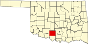 | |
| Towns | ||
| CDP | ||
| Other communities | ||
| Ghost town | ||
| Indian reservation | ||
| Footnotes | ‡This populated place also has portions in an adjacent county or counties | |