
Velma, Oklahoma | |
|---|---|
 Location of Velma, Oklahoma | |
| Coordinates: 34°27′17″N 97°39′44″W / 34.45472°N 97.66222°W | |
| Country | United States |
| State | Oklahoma |
| County | Stephens |
| Area | |
| • Total | 1.36 sq mi (3.53 km2) |
| • Land | 1.35 sq mi (3.50 km2) |
| • Water | 0.01 sq mi (0.02 km2) |
| Elevation | 1,040 ft (320 m) |
| Population (2020) | |
| • Total | 554 |
| • Density | 409.46/sq mi (158.06/km2) |
| Time zone | UTC-6 (Central (CST)) |
| • Summer (DST) | UTC-5 (CDT) |
| ZIP code | 73491 |
| Area code | 580 |
| FIPS code | 40-76900[3] |
| GNIS feature ID | 2413425[2] |
Velma is a town in Stephens County, Oklahoma, United States. The population was 620 at the 2010 census.
YouTube Encyclopedic
-
1/1Views:2 420
-
God of this City- Velma, OK
Transcription
History
A post office was established at Velma, Indian Territory on September 25, 1886. It was named for Velma Dobbins, daughter of a local merchant and longtime resident.[4]
At the time of its founding, Velma was located in Pickens County, Chickasaw Nation.[5]
Geography
According to the United States Census Bureau, the town has a total area of 1.4 square miles (3.6 km2), all land.
Velma is home of the "Annual Old Settler's Picnic and Rodeo", which, since statehood, has been held on the first weekend of August with few interruptions. The event is known for attracting the best Calf Ropers in the United States.
Demographics
| Census | Pop. | Note | %± |
|---|---|---|---|
| 1970 | 611 | — | |
| 1980 | 831 | 36.0% | |
| 1990 | 661 | −20.5% | |
| 2000 | 771 | 16.6% | |
| 2010 | 620 | −19.6% | |
| 2020 | 554 | −10.6% | |
| U.S. Decennial Census[6] | |||
As of the census[3] of 2000, there were 664 people, 247 households, and 187 families residing in the town. The population density was 470.6 inhabitants per square mile (181.7/km2). There were 290 housing units at an average density of 205.5 per square mile (79.3/km2). The racial makeup of the town was 90.96% White, 8.28% Native American, 0.30% from other races, and 0.45% from two or more races. Hispanic or Latino of any race were 1.05% of the population.
There were 247 households, out of which 40.5% had children under the age of 18 living with them, 60.3% were married couples living together, 12.1% had a female householder with no husband present, and 23.9% were non-families. 21.5% of all households were made up of individuals, and 10.1% had someone living alone who was 65 years of age or older. The average household size was 2.69 and the average family size was 3.15.
In the town, the population was spread out, with 29.1% under the age of 18, 8.0% from 18 to 24, 28.5% from 25 to 44, 22.3% from 45 to 64, and 12.2% who were 65 years of age or older. The median age was 35 years. For every 100 females, there were 97.0 males. For every 100 females age 18 and over, there were 87.6 males.
The median income for a household in the town was $30,341, and the median income for a family was $34,286. Males had a median income of $32,083 versus $16,136 for females. The per capita income for the town was $12,010. About 16.3% of families and 17.8% of the population were below the poverty line, including 21.7% of those under age 18 and 15.8% of those age 65 or over.
Notable person
Joe Diffie, country singer-songwriter
References
- ^ "ArcGIS REST Services Directory". United States Census Bureau. Retrieved September 20, 2022.
- ^ a b U.S. Geological Survey Geographic Names Information System: Velma, Oklahoma
- ^ a b "U.S. Census website". United States Census Bureau. Retrieved January 31, 2008.
- ^ George H. Shirk. Oklahoma Place Names (Norman: University of Oklahoma Press, 1965), p. 212.
- ^ Charles Goins, Historical Atlas of Oklahoma (Norman: University of Oklahoma Press, 2006), plate 105.
- ^ "Census of Population and Housing". Census.gov. Retrieved June 4, 2015.
Municipalities and communities of Stephens County, Oklahoma, United States | ||
|---|---|---|
| Cities | 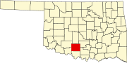 | |
| Towns | ||
| CDP | ||
| Other communities | ||
| Ghost town | ||
| Indian reservation | ||
| Footnotes | ‡This populated place also has portions in an adjacent county or counties | |